Single jet-powered Shahed (Geran-3) drone reported heading toward Kostopil, Rivne Oblast
What happened
Ukrainian air monitoring, posted on the Telegram channel @kpszsu, reported at 10:44 UTC on 20 October 2026 that one jet-powered drone, identified as a Russian Shahed (Geran-3), was on a course toward Kostopil in Rivne Oblast. The original Ukrainian post, which translates roughly as a jet UAV heading for Kostopil or Berezne, names both settlements, but the event is geolocated to Kostopil alone. The report describes a transit, not an impact. It does not mention detonation, damage, casualties, or the drone's intended target. The alert is one of several Rivne-area drone-transit notices logged earlier the same day, all attributed to the same monitoring source. The wording is brief and operational, consistent with a real-time air-threat notification rather than a post-incident account.
Context and assessment
Kostopil lies in the north of Rivne Oblast, and it appears repeatedly in this day's sequence of alerts. Related entries from 01:07 and 08:40 UTC both describe groups of two or more Geran-3 drones heading toward or departing from the Kostopil area, and the 03:10 notice tracked a single drone toward the city of Rivne. Between these, reports at 04:35 and 06:18 place groups passing Olevsk and moving from western Zhytomyr Oblast toward Rivne Oblast. Taken together, the pattern suggests drones entering from the north and west and moving through the Rivne area over several hours, with Kostopil recurring as a waypoint or an intended endpoint. The jet-powered Geran-3 variant is generally understood to be faster and harder to intercept than the piston-engined Geran-2, which may explain why monitoring channels are flagging it separately. Operationally, the sequence may indicate sustained launches along a northwestern routing or repeated probing of air defense coverage, but the data does not confirm either interpretation. A single transit alert is not evidence of a strike on the settlement, and the recurrence of Kostopil in the record should be read as a tracking pattern rather than a confirmed target.
Sources and confidence
The event rests on one Telegram channel, @kpszsu, with a source count of one and no independent corroboration listed. The assigned confidence of 8.0 reflects the channel's role as an official-style air monitoring feed, the specificity of the drone type and heading, and the consistency of this alert with a series of related notices from the same source earlier that day. It is held below the top of the scale because nothing in the record comes from a second channel, wire service, or official air force statement, and the post itself gives no independent evidence beyond the monitoring claim. Confidence would rise with corroboration from a second monitoring source, a wire report, or Ukrainian official confirmation of the track. It would fall if the channel corrected or withdrew the alert, or if later reporting showed the track was misidentified or never materialized.
Location
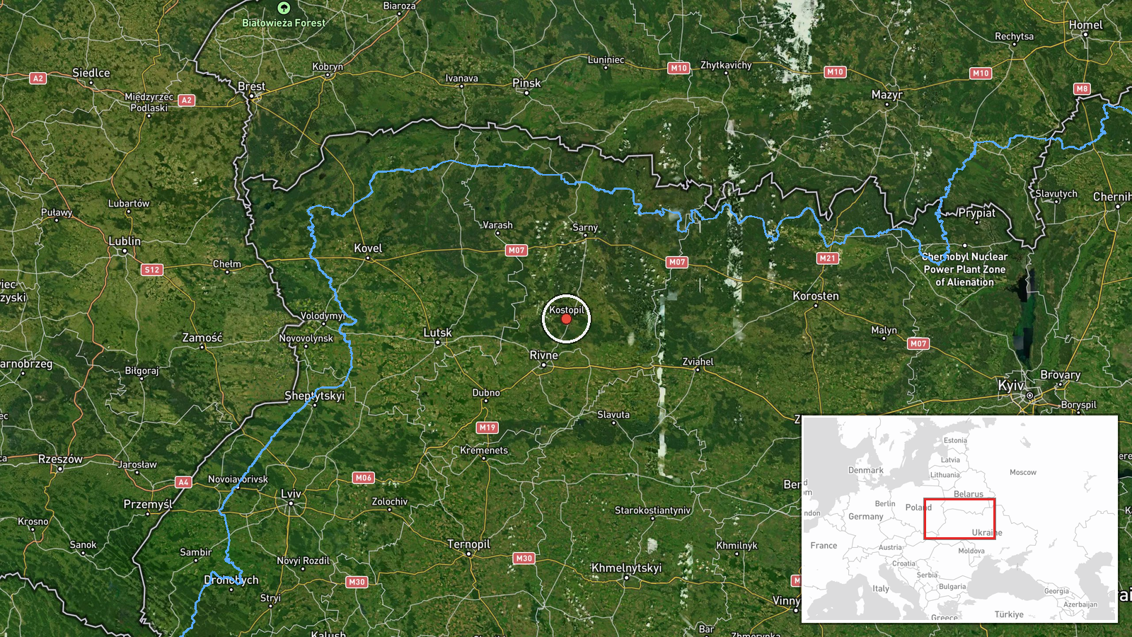
The location is recorded at settlement level, with the coordinates placed on the town of Kostopil, which is the stated location of the report. Location confidence is high because the source names the settlement directly, although the original post also mentions Berezne, which is not separately geolocated here. Kostopil sits in northern Rivne Oblast in northwestern Ukraine, in the Polissia lowlands, an area of forest, wetland, and river valleys. Its setting is rural and sparsely built compared with Rivne city to the south and east, and the surrounding terrain is largely flat.
Related events nearby
- Ukrainian air monitoring: 2+ Russian jet-powered Shahed (Geran-3) drones from Rivne Oblast toward Kostopil.2026-10-20 08:40 UTC · Drone Transit · Kostopil, Ukraine
- Ukrainian air monitoring: 2+ Russian jet-powered Shahed (Geran-3) drones heading toward Kostopil.2026-10-20 01:07 UTC · Drone Transit · Kostopil, Ukraine
- Ukrainian air monitoring: 2+ Russian jet-powered Shahed (Geran-3) drones from western Zhytomyr Oblast toward R2026-10-20 06:18 UTC · Drone Transit · Rivne Oblast, Ukraine
- Ukrainian air monitoring: 2+ Russian jet-powered Shahed (Geran-3) drones passing Olevsk, heading toward Rivne 2026-10-20 04:35 UTC · Drone Transit · Rivne Oblast, Ukraine
- Ukrainian air monitoring: 1 Russian jet-powered Shahed (Geran-3) drone heading toward Rivne.2026-10-20 03:10 UTC · Drone Transit · Rivne, Ukraine
▶ View this event on the live map

Intel Mapper aggregates open-source reports from monitored Telegram and X channels, geolocates them, cross-checks duplicates across sources and assigns a confidence score. Entries are updated as new confirmations arrive. Read how we verify events.