Single jet-powered Shahed (Geran-3) drone reported heading toward Voznesensk, Mykolaiv Oblast
What happened
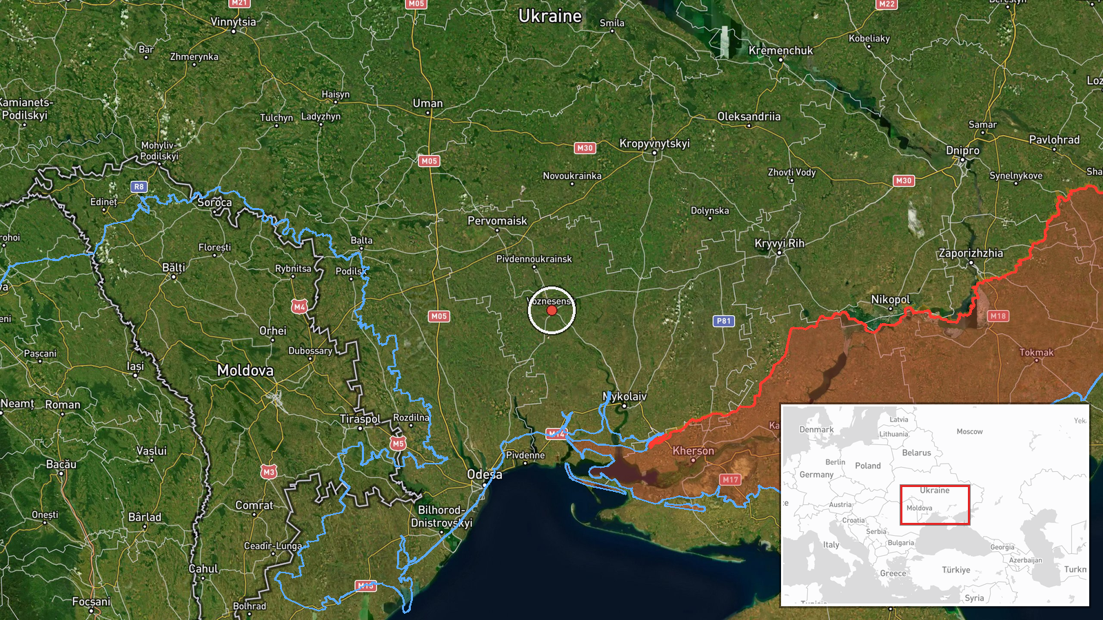
Ukrainian air monitoring reported on Telegram via the channel @kpszsu that one Russian jet-powered Shahed, identified in the source as a Geran-3, was moving on a course toward Voznesensk in Mykolaiv Oblast at about 15:20 UTC on 20 October 2026. The original Ukrainian-language post is brief and describes the object only as a jet-type unmanned aerial vehicle (реактивний БпЛА) on a course toward the town. The report does not mention impact, damage, casualties, or interception. Because the wording describes a heading rather than a strike, the event is best read as an airspace transit warning. The post comes from a single channel and has not been independently repeated in the material available here.
Context and assessment
Voznesensk sits on the Southern Bug in western Mykolaiv Oblast, a corridor that drone traffic has repeatedly crossed on routes toward Odesa, Mykolaiv, and the Dnipro region. The related events logged earlier the same day show a sustained pattern of Geran-3 transits across this area: a single drone passing Berezanka at 07:46, another at 08:44 and a third at 10:11, a group of two or more near Raukhivka at 02:10, and a group of two or more heading toward Berezivka at 14:28. Several of these reports describe drones heading northwest, which suggests a rolling sequence of single and small-group movements rather than one large raid. Repeated single-object reports spread across the morning and afternoon are consistent with launches that are staggered, that follow different approach paths, or that are being tracked as they move through air defence zones. Operationally, this kind of pattern can be used to stretch monitoring and interceptor coverage across a wide area. Any single report should be read against that broader rhythm rather than in isolation.
Sources and confidence
The event rests on one Telegram channel, @kpszsu, which is the official Ukrainian air-monitoring feed. Confidence is scored at 8.0 out of 10, reflecting the channel's institutional role and the consistency of the day's reports, but not yet independent corroboration. No second outlet, radar-based tracker, or regional military administration confirmation is attached to this entry. Confidence would rise if a regional authority or independent aviation tracker logged the same object, or if subsequent reports named a specific impact or interception. It would fall if later updates retracted the heading or if the feed was found to be a duplicate of an earlier alert.
Location
The coordinates place the event at the centre of Voznesensk, a settlement in Mykolaiv Oblast, which was assigned at settlement-level precision with high location confidence. The source names the town as the heading, not a confirmed impact site, so the pin marks the destination of the reported course rather than any observed point of impact. The town lies on the Southern Bug river in the Mykolaiv area of southern Ukraine, on relatively flat steppe terrain. Major nearby reference points include the Southern Bug floodplain and the regional road and rail links toward Mykolaiv city to the southeast.
Related events nearby
- Ukrainian air monitoring: 2+ Russian jet-powered Shahed (Geran-3) drones heading toward Berezivka.2026-10-20 14:28 UTC · Drone Transit · Berezivka, Ukraine
- Ukrainian air monitoring: 2+ Russian jet-powered Shahed (Geran-3) drones passing Raukhivka, heading northwest.2026-10-20 02:10 UTC · Drone Transit · Raukhivka, Ukraine
- Ukrainian air monitoring: 1 Russian jet-powered Shahed (Geran-3) drone passing Berezanka, heading northwest.2026-10-20 10:11 UTC · Drone Transit · Berezanka, Ukraine
- Ukrainian air monitoring: 1 Russian jet-powered Shahed (Geran-3) drone passing Berezanka, heading northwest.2026-10-20 08:44 UTC · Drone Transit · Berezanka, Ukraine
- Ukrainian air monitoring: 1 Russian jet-powered Shahed (Geran-3) drone heading toward Berezanka.2026-10-20 07:46 UTC · Drone Transit · Berezanka, Ukraine
▶ View this event on the live map

Intel Mapper aggregates open-source reports from monitored Telegram and X channels, geolocates them, cross-checks duplicates across sources and assigns a confidence score. Entries are updated as new confirmations arrive. Read how we verify events.