Air monitoring reports jet-powered Shahed drone heading toward Berezanka, Mykolaiv Oblast
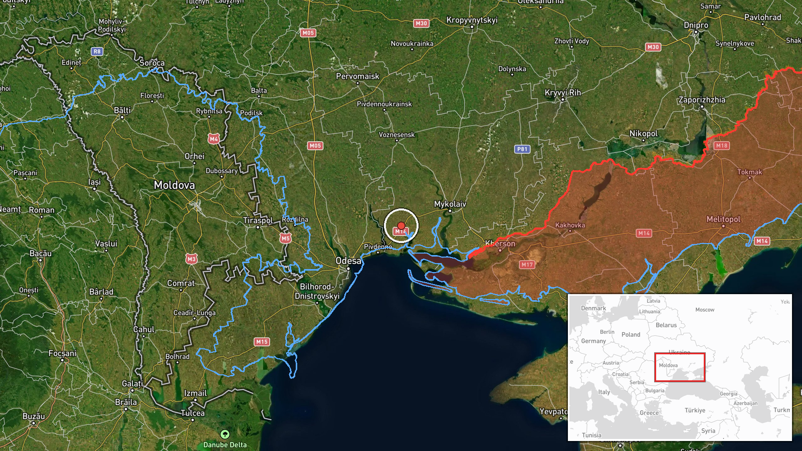
What happened
Ukrainian air monitoring, as relayed by the official Telegram channel @kpszsu, reported on 20 October 2026 at 07:46 UTC that a single Russian jet-powered Shahed-type drone, identified as a Geran-3, was moving on a course toward Berezanka in Mykolaiv Oblast. The original Ukrainian-language post is brief: a notice of a jet-type UAV heading for the settlement, with no mention of impact, casualties, or damage. The wording describes a transit rather than a confirmed strike, and it does not say whether the drone was later tracked to a target or lost. Attribution to Russia comes from the channel's own description of the drone, which fits the Geran series used against Ukraine. The item is a single-source report, and no independent confirmation appeared in the material available at compilation.
Context and assessment
The event sits within a cluster of similar reports. Earlier on 19 October, air monitoring logged jet-powered Geran-3 drones moving north along the Odesa-Mykolaiv border, and a separate drone was tracked from the Black Sea toward Ochakiv that evening. Early on 20 October, one drone passed eastern Odesa Oblast heading west, another crossed Mykolaiv district heading northwest, and reports placed a Shahed-type drone over Mykolaiv city while another was described as heading toward Kharkiv. Taken together, the sequence suggests drones entering from the Black Sea and moving through the southern oblasts along several routes, some toward the north-east and others westward. Mykolaiv and Odesa host ports, energy assets, and logistics nodes, so the corridor is significant for the wider Ukrainian southern supply network. The jet-powered variant is faster than earlier piston-engine Shaheds, which may shorten warning times. Operationally, transit notices of this kind may reflect routing, reconnaissance, saturation tactics, or decoys, but this single report does not establish the intended target.
Sources and confidence
The report comes from one Telegram channel, @kpszsu, which is associated with Ukraine's Air Force monitoring and alert reporting. No other channel in the supplied data reports the same drone, so cross-confirmation is absent. The confidence score of 8.0 reflects the official-channel origin, the specific type identification, and consistency with a dense series of similar same-day reports from the same source family. It is held below the maximum because the item rests on one brief post without imagery, impact reports, or follow-up. Confidence would rise with corroboration from other official alert feeds, local authority statements, or wreckage and impact documentation. It would fall if the channel later corrected or withdrew the notice, or if contrary reports emerged.
Location
The location is recorded at settlement level with high confidence, using coordinates placed at the approximate centre of Berezanka rather than any specific facility. Berezanka lies in Mykolaiv Oblast in southern Ukraine, close to the boundary with Odesa Oblast. The surrounding terrain is largely flat steppe and farmland typical of the northwestern Black Sea littoral. Features in the wider area include river systems and estuary channels associated with the Southern Bug basin, which can affect low-altitude flight paths. Because the coordinates describe the settlement rather than a target, they show the drone's reported direction of travel, not a confirmed impact point.
Related events nearby
- Ukrainian air monitoring reports jet-powered Shahed (Geran-3) drones on the Odesa-Mykolaiv border, heading nor2026-10-19 14:02 UTC · Drone Transit · Odesa-Mykolaiv Oblast border, Ukraine
- Ukrainian air monitoring: 1 Russian jet-powered Shahed (Geran-3) drone from Black Sea toward Ochakiv.2026-10-19 20:58 UTC · Drone Transit · Ochakiv, Ukraine
- Ukrainian air monitoring: 1 Russian jet-powered Shahed (Geran-3) drone passing eastern Odesa Oblast, heading w2026-10-20 06:30 UTC · Drone Transit · eastern Odesa Oblast, Ukraine
- Ukrainian air monitoring: 1 Russian jet-powered Shahed (Geran-3) drone passing Mykolaiv district, heading nort2026-10-20 01:36 UTC · Drone Transit · Mykolaiv district, Ukraine
- Ukrainian air monitoring: 1 Russian Shahed-type drone over Mykolaiv; 1 Russian Shahed-type drone heading towar2026-10-20 06:20 UTC · Drone Transit · Mykolaiv, Ukraine
▶ View this event on the live map

Intel Mapper aggregates open-source reports from monitored Telegram and X channels, geolocates them, cross-checks duplicates across sources and assigns a confidence score. Entries are updated as new confirmations arrive. Read how we verify events.