Single jet-powered Shahed (Geran-3) drone reported moving from Black Sea toward Ochakiv, Ukraine
What happened
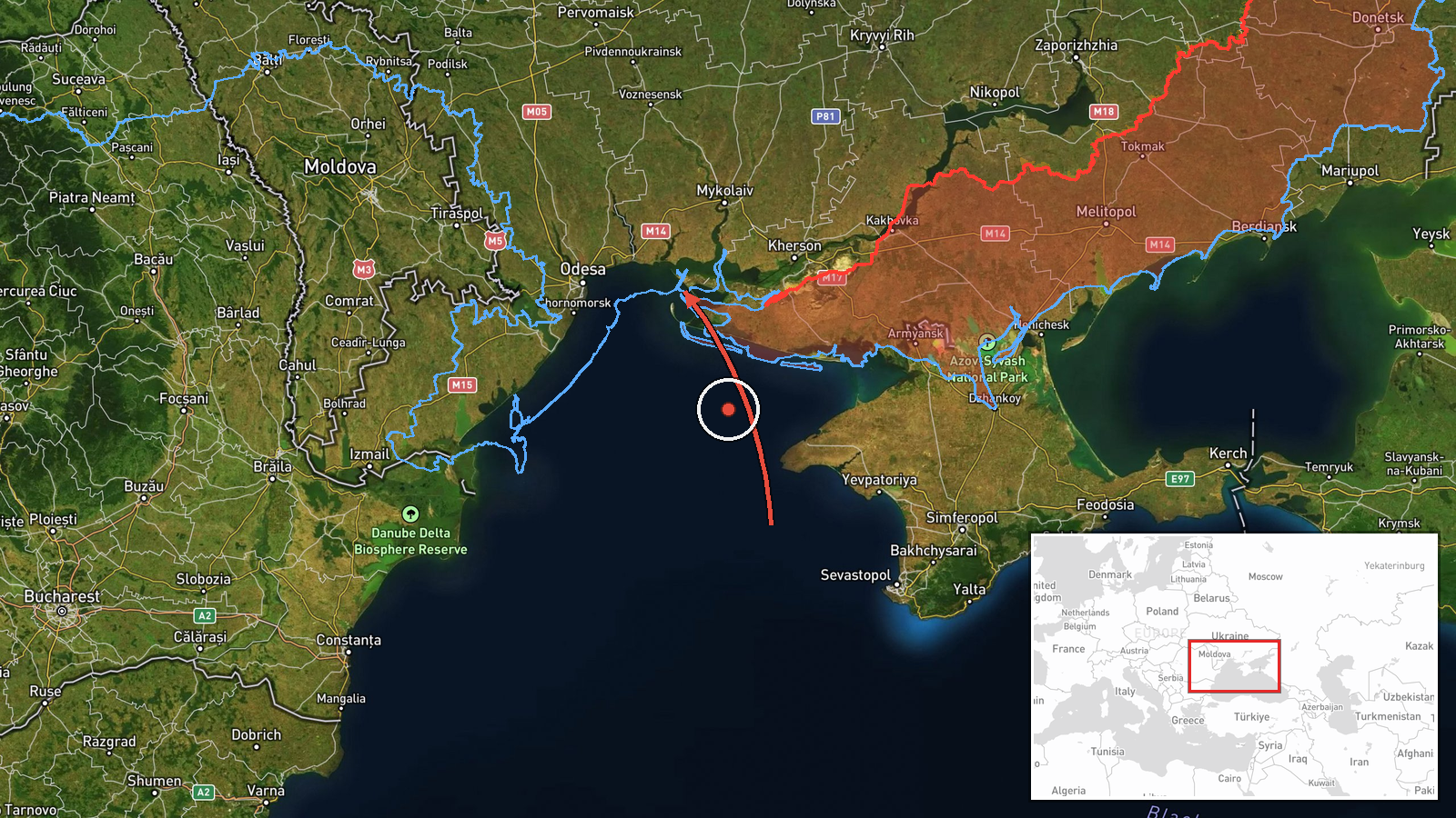
Ukrainian air monitoring channel @kpszsu reported on Telegram on 19 October 2026 at about 20:58 UTC that one Russian jet-powered Shahed, identified as a Geran-3, was flying from the Black Sea in the direction of Ochakiv, a port town in Mykolaiv Oblast on the northwestern Black Sea coast. The original post is brief, a single line with a jet-drone icon, and does not describe impact, damage, or casualties. The report is a transit warning rather than a strike report, meaning it records a drone's direction of travel and not any detonation. Because the source is one channel and no independent confirmation appears in the data, the account should be treated as an initial monitoring alert.
Context and assessment
Ochakiv sits on the Dnipro-Bug estuary approaches, a corridor that has repeatedly been used by Russian long-range drones traveling from the Black Sea toward Mykolaiv, Odesa and the lower Dnipro region. The related events for the same day show a sequence of Geran-3 transit reports: groups of two or more drones heading toward southern Mykolaiv Oblast in the early hours, further single drones from the Black Sea at 06:28 and 06:53 UTC, a report of drones crossing the Odesa-Mykolaiv border heading north at 14:02, and a drone passing Mykolaiv Oblast heading northwest at 16:10. The repetition suggests sustained, distributed launches across the southern axis rather than a single raid. Operationally, low-count jet-drone movements of this kind are often consistent with route probing, air-defense drawing, or staggered delivery to multiple targets, though the data alone cannot confirm which purpose applies here.
Sources and confidence
The report comes from one Telegram channel, @kpszsu, which is linked to Ukraine's air force monitoring reporting. No second outlet in the data corroborates the track, so cross-confirmation is absent. The confidence score of 8.0 reflects a credible official-linked source with a clear location and direction, offset by the lack of independent verification and the absence of any impact or follow-up report. Confidence would rise with corroboration from additional air-monitoring feeds, regional military administration statements, or reports of interception or impact near Ochakiv. It would fall if the track were revised, retracted, or attributed to a different drone type.
Location
The location is recorded at settlement level for Ochakiv, Ukraine, at approximately 46.61 N, 31.55 E, with high location confidence. The source names the town as the drone's destination, not a specific facility, so the point represents the settlement center rather than any target. Ochakiv lies on the Black Sea coast in Mykolaiv Oblast, near the mouth of the Southern Bug estuary and across from the Kinburn Spit. Nearby features include the estuary, low-lying wetlands, and the port and coastal waters that link the area to the wider Black Sea.
Related events nearby
- Ukrainian air monitoring: 1 Russian jet-powered Shahed (Geran-3) drone from Black Sea toward Ochakiv.2026-10-19 06:28 UTC · Drone Transit · Ochakiv, Ukraine
- Ukrainian air monitoring reports jet-powered Shahed (Geran-3) drones on the Odesa-Mykolaiv border, heading nor2026-10-19 14:02 UTC · Drone Transit · Odesa-Mykolaiv Oblast border, Ukraine
- Ukrainian air monitoring: 1 Russian jet-powered Shahed (Geran-3) drone from Black Sea toward southern Mykolaiv2026-10-19 06:53 UTC · Drone Transit · southern Mykolaiv Oblast, Ukraine
- Ukrainian air monitoring: 2+ Russian jet-powered Shahed (Geran-3) drones heading toward southern Mykolaiv Obla2026-10-19 03:07 UTC · Drone Transit · southern Mykolaiv Oblast, Ukraine
- Ukrainian air monitoring: 1 Russian jet-powered Shahed (Geran-3) drone passing Mykolaiv Oblast, heading northw2026-10-19 16:10 UTC · Drone Transit · Mykolaiv Oblast, Ukraine
▶ View this event on the live map

Intel Mapper aggregates open-source reports from monitored Telegram and X channels, geolocates them, cross-checks duplicates across sources and assigns a confidence score. Entries are updated as new confirmations arrive. Read how we verify events.