Ukraine reports 2+ Russian jet-powered Geran-3 drones heading north over southern Mykolaiv
What happened
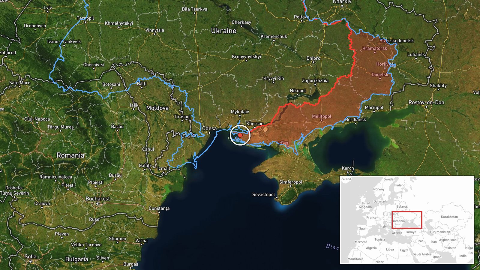
Ukrainian air monitoring, as posted on the Telegram channel @kpszsu, reported at 03:07 UTC on 19 October 2026 that two or more Russian jet-powered Shahed drones, identified in the report as Geran-3 type, were flying toward the southern part of Mykolaiv Oblast in southern Ukraine. The original Ukrainian-language post is brief and reads, in translation, as jet-powered unmanned aerial vehicles to the south of Mykolaiv region, heading north. The summary gives no precise impact point, no target and no damage, and it describes no explosion or casualties. This is a transit warning about aircraft in flight rather than a confirmed strike. The phrase 'two or more' indicates the count was not fixed, so the number may be higher than two.
Context and assessment
Southern Mykolaiv Oblast lies between Odesa Oblast to the west and Kherson Oblast to the east, on the northern Black Sea approaches. Drones moving north from the coast here pass over territory that lies on the route toward Mykolaiv city and further inland. The related entries show a sequence over roughly one day. On 18 October at 05:53 UTC a single Shahed-type drone was tracked from the Black Sea toward Odesa Oblast, and at 06:55 another single drone was reported from the sea toward the southern part of that oblast. Later that day, at 04:41 UTC, a jet-powered Geran-3 was tracked from Mykolaiv Oblast toward Novyi Buh, and at 03:00 UTC on 19 October a single jet-powered drone was reported heading toward northern Mykolaiv Oblast. The pattern is repeated single-drone transits along the coast and inland. Operationally, this may reflect routine launch and transit activity whose targets the reports do not name, and the appearance of jet-powered variants may point to a shift in the aircraft mix. These are inferences from timing and wording, not established facts. The related entries do not link the drones to one another or to any specific target.
Sources and confidence
The report came from one channel, Telegram account @kpszsu, which is generally understood to belong to Ukraine's Air Force and is used for rapid airspace alerts. No second outlet, wire service or separate official statement in the record independently confirms this track. The score of 8.0 reflects the authority and speed of an official monitoring channel and the consistency with the related entries. It is not higher because the drone count is stated as two or more, the post is a short snapshot, and no impact or follow-up reporting exists. Confidence would rise with independent corroboration, a firm drone count, or later reports of interception, impact or debris. It would fall if the channel corrected the post or if later updates identified the track differently.
Location
The location is recorded at region level rather than as a settlement or facility, and the location-confidence rating is low. The coordinates, 46.42495 N and 32.0 E, appear to be an approximate centre point for the southern part of Mykolaiv Oblast, not a place where anything was observed. The setting is coastal lowland on the northern Black Sea, near the Southern Bug and Dnipro-Bug estuary and the Kinburn area. Mykolaiv city lies to the north of the area and is not the stated point of the report.
Related events nearby
- Ukrainian air monitoring: 1 Russian Shahed-type drone from Black Sea toward Odesa Oblast.2026-10-18 05:53 UTC · Drone Transit · Odesa Oblast, Ukraine
- Ukrainian air monitoring: 1 Russian Shahed-type drone from Black Sea toward southern Odesa Oblast.2026-10-18 06:55 UTC · Drone Transit · southern Odesa Oblast, Ukraine
- Ukrainian air monitoring: 1 Russian jet-powered Shahed (Geran-3) drone heading toward northern Mykolaiv Oblast2026-10-19 03:00 UTC · Drone Transit · northern Mykolaiv Oblast, Ukraine
- Ukrainian air monitoring: 1 Russian jet-powered Shahed (Geran-3) drone from Mykolaiv Oblast toward Novyi Buh.2026-10-18 04:41 UTC · Drone Transit · Novyi Buh, Ukraine
▶ View this event on the live map

Intel Mapper aggregates open-source reports from monitored Telegram and X channels, geolocates them, cross-checks duplicates across sources and assigns a confidence score. Entries are updated as new confirmations arrive. Read how we verify events.