Single Russian Shahed-type drone reported moving from Black Sea toward southern Odesa Oblast
What happened
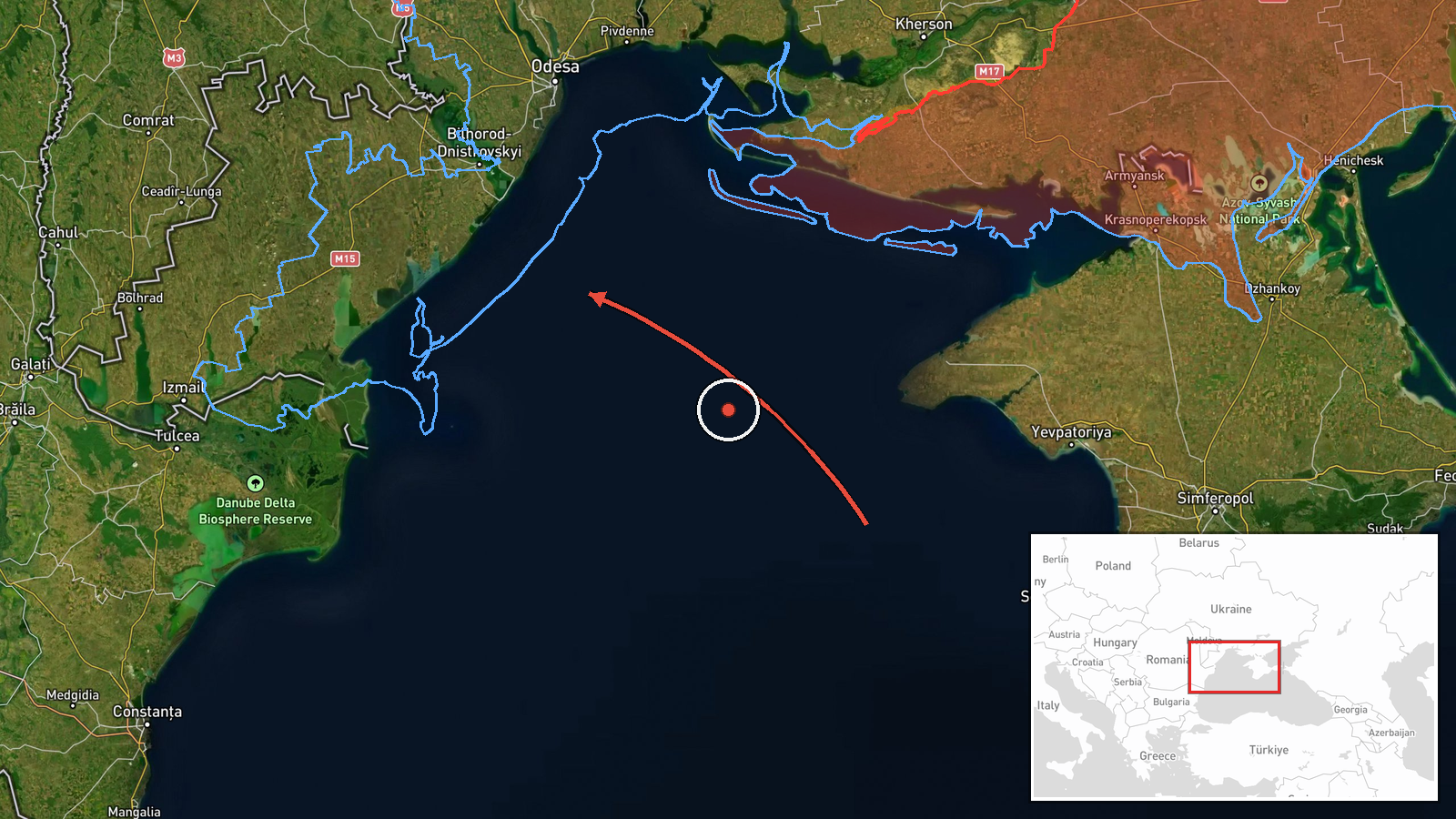
Ukrainian air monitoring reported on Telegram that one Russian Shahed-type drone was tracked moving from the Black Sea toward southern Odesa Oblast on 18 October 2026 at about 06:55 UTC. The original post, published by the Ukrainian Air Force monitoring channel @kpszsu, uses the term БпЛА, or unmanned aerial vehicle, and describes the track as heading to the south of Odesa region from the sea area. The report does not state whether the drone entered Ukrainian territory, struck any target, or was intercepted. Its wording describes a transit track rather than an impact, and no damage or casualties are mentioned in the source.
Context and assessment
Southern Odesa Oblast sits on the Black Sea coast and includes Odesa's port infrastructure, the Danube delta approaches and smaller settlements along the Izmail and Bolhrad axis. Repeated drone tracks from the sea toward this coast have been a recurring feature of Russian long-range strike activity against Ukrainian ports and logistics. Related reports from the same morning show a pattern: at 02:47 UTC jet-powered Geran-3 drones were tracked at the Odesa-Mykolaiv border heading north, and at 05:53 UTC a single Shahed-type drone was tracked from the Black Sea toward Odesa Oblast. The previous day also recorded a single drone from the sea toward southern Mykolaiv Oblast. Taken together, these tracks suggest sustained use of coastal approach routes over the region. A single-drone track may reflect probing, decoy use, or a routine transit within a larger wave, but the data alone cannot distinguish these possibilities.
Sources and confidence
The report rests on a single Telegram channel, @kpszsu, which is the official Ukrainian Air Force monitoring account. No independent outlet or second channel in the dataset confirms this specific track, so cross-confirmation is absent. The confidence score of 8.0 reflects an official source with a clear, time-stamped report, offset by single-source status and the lack of any corroborating impact or interception record. Confidence would rise with confirmation from a second monitoring or regional military administration channel, or with reports of interception or impact at a named location. It would fall if the track were later revised or retracted.
Location
The coordinates are a regional-level approximation for southern Odesa Oblast, not a settlement or facility, and the location confidence is low. The source gives no point of entry or end point, so the position reflects the general area named in the report. The region is flat steppe running to the Black Sea, with the Dniester and Danube estuaries, Lake Sasyk-type coastal lagoons and the Odesa port zone among the notable features nearby. Precise attribution to any specific site would require further reporting.
Related events nearby
- Ukrainian air monitoring: 1 Russian Shahed-type drone from Black Sea toward Odesa Oblast.2026-10-18 05:53 UTC · Drone Transit · Odesa Oblast, Ukraine
- Ukrainian air monitoring: jet-powered Shahed (Geran-3) drones tracked at the Odesa-Mykolaiv border, heading no2026-10-18 02:47 UTC · Drone Transit · Odesa-Mykolaiv Oblast border, Ukraine
- Ukrainian air monitoring: 1 Russian Shahed-type drone heading toward Vylkove.2026-10-18 07:01 UTC · Drone Transit · Vylkove, Ukraine
- Ukrainian air monitoring: 1 Russian Shahed-type drone from Black Sea toward southern Mykolaiv Oblast.2026-10-17 07:29 UTC · Drone Transit · southern Mykolaiv Oblast, Ukraine
▶ View this event on the live map

Intel Mapper aggregates open-source reports from monitored Telegram and X channels, geolocates them, cross-checks duplicates across sources and assigns a confidence score. Entries are updated as new confirmations arrive. Read how we verify events.