Jet-powered Shahed (Geran-3) drones tracked at Odesa-Mykolaiv border, heading north
What happened
Ukrainian air monitoring reported on Telegram through the channel @kpszsu that jet-powered Shahed drones, which the post identifies as Geran-3 type, were tracked on the border between Odesa and Mykolaiv oblasts, moving on a northern course. The event is dated 18 October 2026 at 02:47 UTC. The original Ukrainian-language post is brief: it describes jet-powered unmanned aerial vehicles at the boundary of the two regions with a heading described as north. It does not give a number of drones, a target, or any impact. The report is a transit notice rather than a strike report, so no outcome is described in the source. Russia is listed as the actor, consistent with the attribution in the monitoring post.
Context and assessment
The border area between Odesa and Mykolaiv oblasts lies along the northwestern Black Sea coast, a corridor that Russian drones have repeatedly crossed on their way toward Ukrainian cities and infrastructure further inland. Five related monitoring reports from the previous day and a half show a sustained pattern in the same airspace. On 17 October, single Shahed-type drones were logged coming from the Black Sea toward southern Mykolaiv Oblast at 07:29, passing through Mykolaiv Oblast on a northwesterly heading at 07:39, passing Bashtanka toward Nova Odesa at 12:09, and moving from Odesa Oblast toward Berezivka at 12:44. Another jet-powered Geran-3 was logged from Kherson Oblast toward Mykolaiv Oblast at 02:05 on 18 October. The sequence suggests repeated single-drone movements rather than one large raid, with jet-powered variants appearing alongside other Shahed-type drones. Operationally, this may indicate routine transit or probing along several axes, possibly to test air defence coverage or to reach targets in the interior. Because these are individual sightings, they do not by themselves establish intent, and the northward heading should be read as a direction of travel rather than a confirmed destination.
Sources and confidence
Only one channel reported this event: the Telegram account @kpszsu, which is widely understood to be the Ukrainian Air Force's monitoring output. No independent outlet or second channel in the dataset confirms the sighting, so cross-confirmation is absent. The 8.0 confidence score reflects a single-source report from an official-style monitoring channel, whose track is consistent with five nearby reports from the same period. The score would rise if the Air Force, regional military administrations, or independent trackers logged the same drones on this heading, and it would fall if the track were later revised or retracted. The record is not marked as corrected.
Location
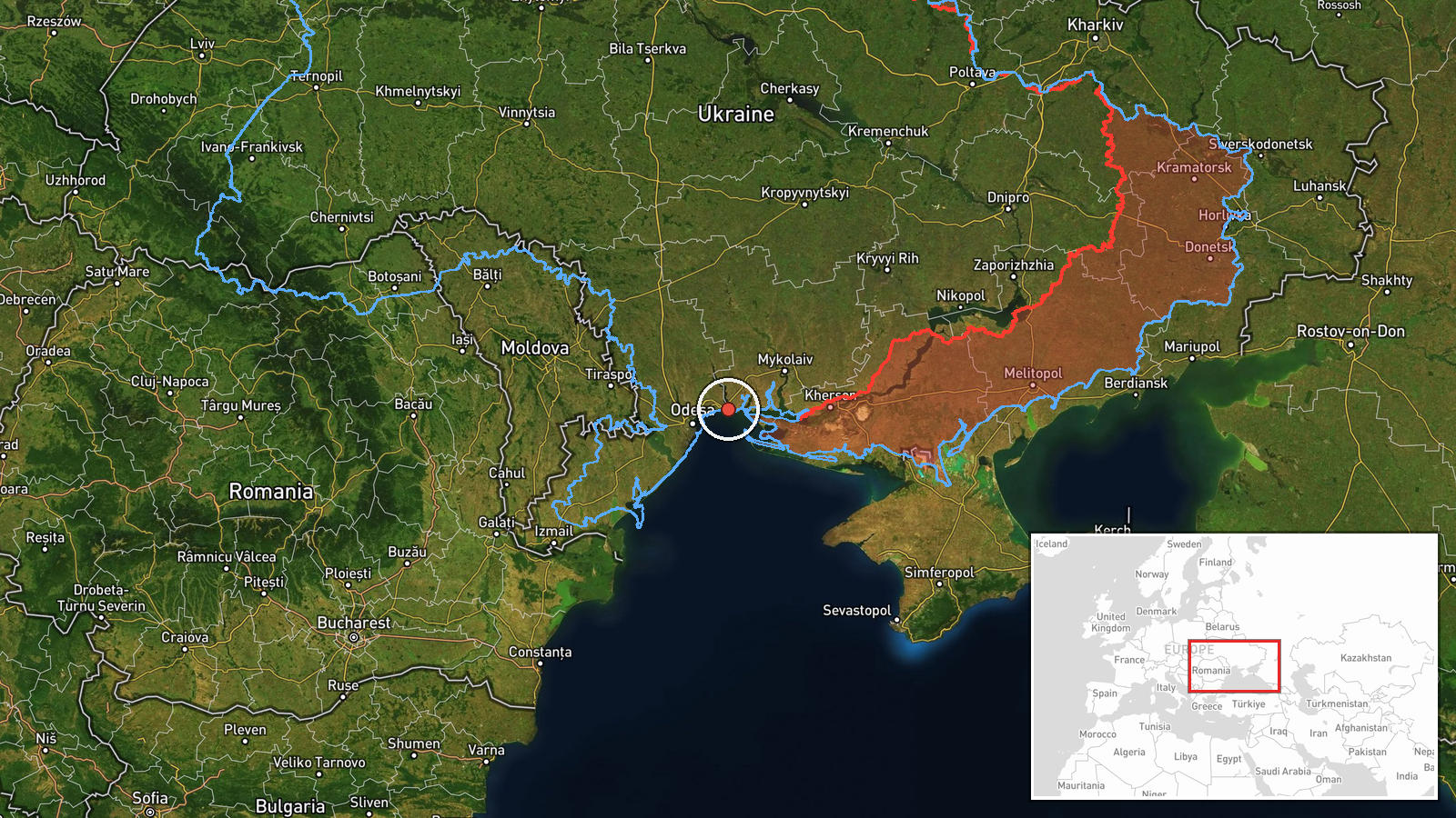
The coordinates (46.62181, 31.21486) are a region-level approximation placed in the general area of the Odesa-Mykolaiv oblast boundary. Location confidence is rated low, and precision is marked as region rather than settlement. No specific town is named in the source, so the point should not be read as an exact position. The area is mainly flat steppe near the Black Sea coast, with the Southern Buh estuary and its river channels as notable nearby features.
Related events nearby
- Ukrainian air monitoring: 1 Russian Shahed-type drone from Black Sea toward southern Mykolaiv Oblast.2026-10-17 07:29 UTC · Drone Transit · southern Mykolaiv Oblast, Ukraine
- Ukrainian air monitoring: 1 Russian Shahed-type drone from Odesa Oblast toward Berezivka.2026-10-17 12:44 UTC · Drone Transit · Berezivka, Ukraine
- Ukrainian air monitoring: 1 Russian jet-powered Shahed (Geran-3) drone from Kherson Oblast toward Mykolaiv Obl2026-10-18 02:05 UTC · Drone Transit · Mykolaiv Oblast, Ukraine
- Ukrainian air monitoring: 1 Russian jet-powered Shahed (Geran-3) drone passing Mykolaiv Oblast, heading northw2026-10-17 07:39 UTC · Drone Transit · Mykolaiv Oblast, Ukraine
- Ukrainian air monitoring: 1 Russian Shahed-type drone passing Bashtanka, heading toward Nova Odesa.2026-10-17 12:09 UTC · Drone Transit · Nova Odesa, Ukraine
▶ View this event on the live map

Intel Mapper aggregates open-source reports from monitored Telegram and X channels, geolocates them, cross-checks duplicates across sources and assigns a confidence score. Entries are updated as new confirmations arrive. Read how we verify events.