Jet-powered Shahed drone reported transiting Mykolaiv Oblast near Bashtanka, heading northwest
What happened
Ukrainian air monitoring reported on 17 October 2026 at 07:39 UTC that one jet-powered Shahed-type drone, identified in the report as a Geran-3, was passing near Bashtanka in Mykolaiv Oblast and moving in a northwest direction. The original Ukrainian-language post, published on the Telegram channel @kpszsu, uses the phrase "реактивний БпЛА," meaning a jet-powered unmanned aerial vehicle, and names Bashtanka as a reference point rather than a strike site. The report describes a transit, not an impact. It mentions no casualties, damage, interception, or final destination. The event rests on that single channel and is recorded with region-level geolocation.
Context and assessment
Mykolaiv Oblast sits on the steppe between the Black Sea coast and the Kherson front, and its towns and rail and road links are regularly crossed by long-range drones heading into the interior. The report fits a recent pattern of single-track transits across the south. On 16 October, Ukrainian monitoring reported one Shahed-type drone moving from Kherson Oblast toward Mykolaiv Oblast at 14:34 UTC, and earlier that day at 09:03 UTC, two or more jet-powered Geran-3 drones passing Mykolaiv Oblast heading north. At 09:50 UTC a single jet-powered drone was reported approaching Ochakiv from the Black Sea. On 17 October, at 06:44 UTC, another Shahed-type drone was reported passing Kherson Oblast heading northwest, and at 01:43 UTC a guided glide bomb was reported heading toward Kherson city. The repeated northwest headings in the Kherson and Bashtanka reports may point to a common flight corridor, or to separate groups following similar routes. Operationally, such transits can serve as reconnaissance, can be aimed at distant targets, or can be used to stretch air defences. The data alone does not show which, and the reports name no intended target.
Sources and confidence
All of the information comes from one Telegram channel, @kpszsu, which carries the official Ukrainian air-monitoring alerts. No independent confirmation from other channels, regional authorities, or track data appears in the record. The score of 8.0 reflects the channel's institutional role and its consistency with the surrounding reports, but it is held below the top range because the claim is single-sourced and describes a fast-moving airborne object. Corroboration from a second monitoring feed, a regional military administration statement, or flight-track data would raise confidence. A correction, a revised sighting, or a later statement that the object was a different type would lower it. The record is not marked as corrected.
Location
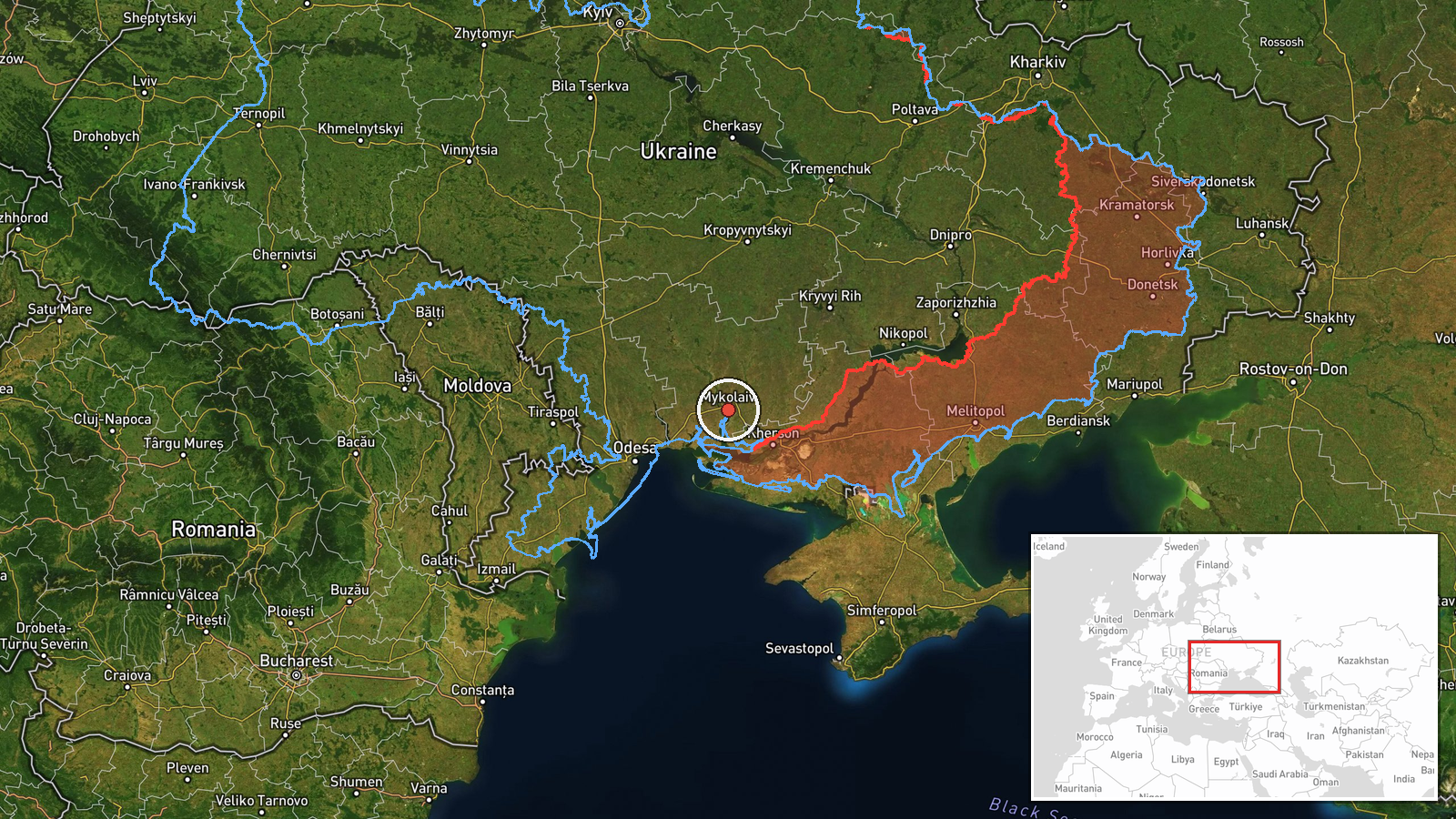
The coordinates, 46.97 N and 32.00 E, are a region-level approximation for Mykolaiv Oblast rather than a fix on Bashtanka, which lies somewhat northeast of the point. The place name comes from the original report's wording. The area is flat steppe drained by the Southern Bug and its tributaries, with the Dnipro-Buh estuary to the east and the Black Sea coast, including Ochakiv, to the southwest. Its rural roads and farmland make it a common corridor for drones moving between the coast and the interior.
Related events nearby
- Ukrainian air monitoring: 1 Russian Shahed-type drone from Kherson Oblast toward Mykolaiv Oblast.2026-10-16 14:34 UTC · Drone Transit · Mykolaiv Oblast, Ukraine
- Ukrainian air monitoring: 2+ Russian jet-powered Shahed (Geran-3) drones passing Mykolaiv Oblast, heading nort2026-10-16 09:03 UTC · Drone Transit · Mykolaiv Oblast, Ukraine
- Ukrainian air monitoring: 1 Russian jet-powered Shahed (Geran-3) drone from Black Sea toward Ochakiv.2026-10-16 09:50 UTC · Drone Transit · Ochakiv, Ukraine
- Ukrainian air monitoring: 1 Russian Shahed-type drone passing Kherson Oblast, heading northwest.2026-10-17 06:44 UTC · Drone Transit · Kherson Oblast, Ukraine
- Ukrainian air monitoring: 1 Russian guided glide bomb (KAB) heading toward Kherson.2026-10-17 01:43 UTC · Airstrike · Kherson, Ukraine
▶ View this event on the live map

Intel Mapper aggregates open-source reports from monitored Telegram and X channels, geolocates them, cross-checks duplicates across sources and assigns a confidence score. Entries are updated as new confirmations arrive. Read how we verify events.