Single Shahed-type drone reported moving from Kherson Oblast toward Mykolaiv Oblast
What happened
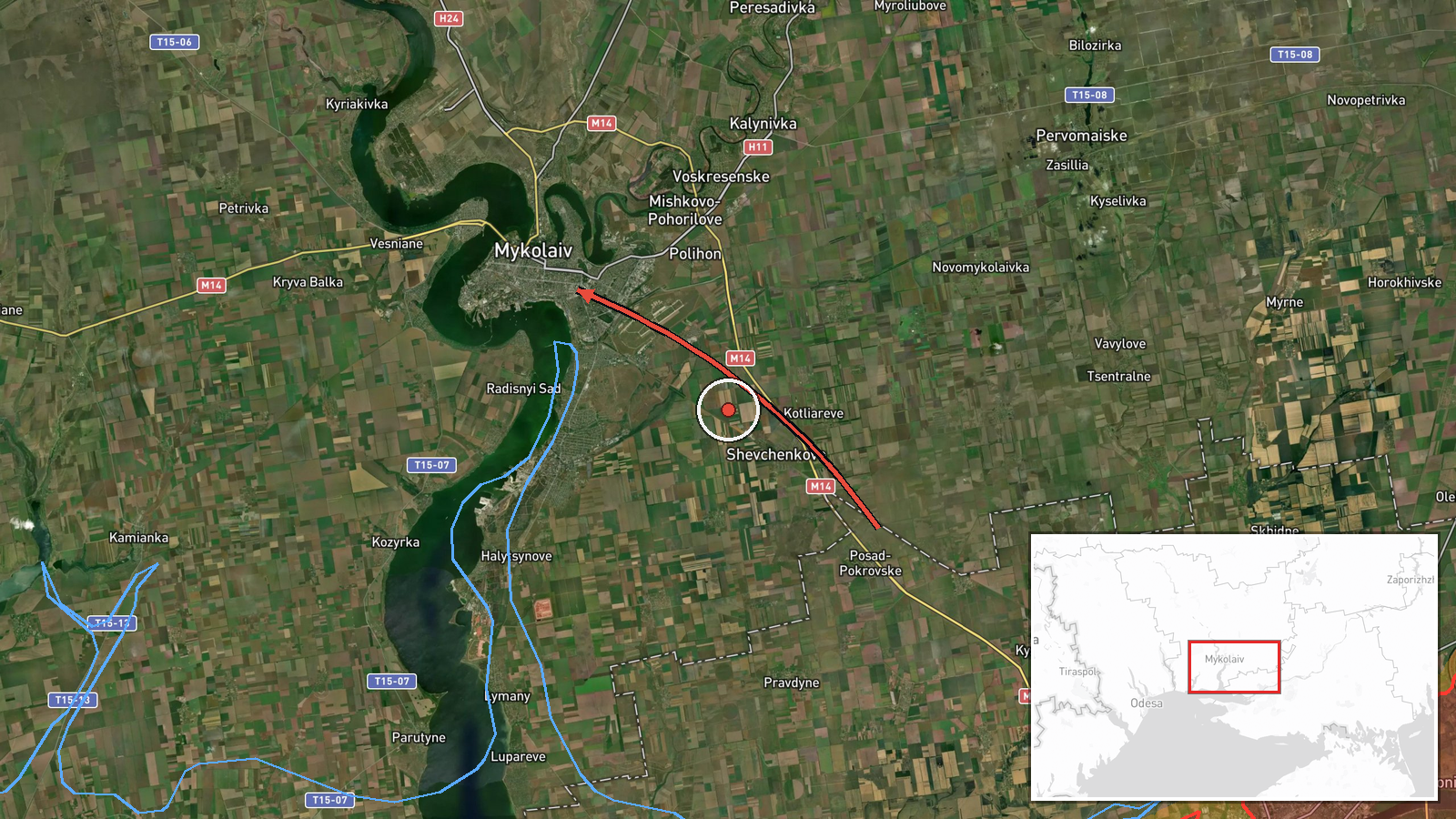
Ukraine's air monitoring channel on Telegram, @kpszsu, reported at 14:34 UTC on 16 October 2026 that one Russian Shahed-type drone was tracked flying from Kherson Oblast on a western course toward Mykolaiv Oblast. The original Ukrainian post describes the object as an attack unmanned aerial vehicle and says it was heading west toward Mykolaiv territory. The report names no town, target, or impact point, and it does not say whether the drone struck anything or was intercepted. The event is classified as a drone transit, meaning the notice concerns movement through airspace rather than a confirmed hit. As a short tracking notice, it gives no details on altitude, speed, or final destination.
Context and assessment
Mykolaiv Oblast lies on the northwestern Black Sea coast, west of Kherson, and includes the city of Mykolaiv, port infrastructure, and the coastal town of Ochakiv. The area is a regular transit corridor for Shahed-type drones moving between southern launch zones and interior targets. Five related Ukrainian monitoring notices from the same day place drones in or near the oblast: one from south of Kropyvnytskyi toward Mykolaiv at 01:04 UTC, two or more from the Black Sea toward southern Mykolaiv at 01:07, a drone passing western Mykolaiv heading north at 04:01, two or more jet-powered Geran-3 types passing at 09:03, and one from the Black Sea toward Ochakiv at 09:50. Together these point to repeated sorties crossing the oblast through most of the day, with headings shifting between north and west. This may indicate sustained pressure along several approaches rather than a single strike package, though one tracking post cannot establish intent. The Geran-3 references suggest jet-powered variants are active in the same corridor, which could affect interception timing. Each entry is a monitoring notice, so repeated mentions may reflect the same airframes tracked at different points.
Sources and confidence
The report rests on one Telegram channel, @kpszsu, which publishes Ukrainian air monitoring notices. No second outlet, official statement, or independent tracking source appears in the record, so cross-confirmation is absent. The score of 8.0 reflects a consistent, official-style monitoring format and same-day notices that align in region and direction. It is held back by the single-source status and the lack of corroborating reports. Confidence would rise with a second monitoring source, a regional military administration statement, or debris or impact reports matching the track. It would fall if later notices contradicted the route or identified the object differently.
Location
Coordinates are approximate and set at region level, with location confidence rated low. The point, near 46.97 north and 32.0 east, falls in central Mykolaiv Oblast rather than at a named settlement, facility, or intercept site, because the source names only the oblast. The surrounding terrain is flat coastal lowland with estuaries of the Southern Bug and Dnipro-Buh rivers. Ochakiv on the Black Sea coast is a notable nearby reference point.
Related events nearby
- Ukrainian air monitoring: 2+ Russian jet-powered Shahed (Geran-3) drones passing Mykolaiv Oblast, heading nort2026-10-16 09:03 UTC · Drone Transit · Mykolaiv Oblast, Ukraine
- Ukrainian air monitoring: 1 Russian Shahed-type drone from south of Kropyvnytskyi toward Mykolaiv Oblast.2026-10-16 01:04 UTC · Drone Transit · Mykolaiv Oblast, Ukraine
- Ukrainian air monitoring: 1 Russian jet-powered Shahed (Geran-3) drone from Black Sea toward Ochakiv.2026-10-16 09:50 UTC · Drone Transit · Ochakiv, Ukraine
- Ukrainian air monitoring: 1 Russian jet-powered Shahed (Geran-3) drone passing western Mykolaiv Oblast, headin2026-10-16 04:01 UTC · Drone Transit · western Mykolaiv Oblast, Ukraine
- Ukrainian air monitoring: 2+ Russian jet-powered Shahed (Geran-3) drones from Black Sea toward southern Mykola2026-10-16 01:07 UTC · Drone Transit · southern Mykolaiv Oblast, Ukraine
▶ View this event on the live map

Intel Mapper aggregates open-source reports from monitored Telegram and X channels, geolocates them, cross-checks duplicates across sources and assigns a confidence score. Entries are updated as new confirmations arrive. Read how we verify events.