Jet-powered Geran-3 drone reported moving from Kherson Oblast toward Mykolaiv Oblast
What happened
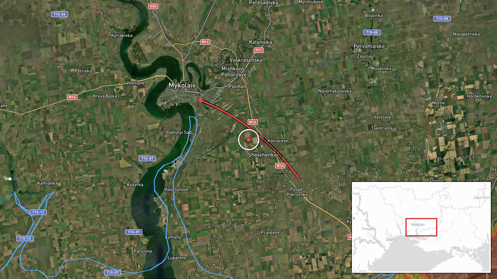
Ukrainian air monitoring channel @kpszsu reported on Telegram that one Russian jet-powered Shahed-type drone, described in the post as a Geran-3, was flying from Kherson Oblast on a course toward Mykolaiv Oblast. The event is timestamped 18 October 2026 at 02:05 UTC. The original Ukrainian-language post used a motorcycle icon and the phrase reactive UAV in Kherson region heading toward Mykolaiv region, which reads as a transit notice rather than a report of impact. The source describes no strike, damage, or casualties. The location is recorded only at oblast level, so the map point marks the general Mykolaiv Oblast area rather than a specific settlement or facility. The report is a single-channel notice, and the drone's final destination is not stated.
Context and assessment
Mykolaiv Oblast sits on the route between Kherson and the Black Sea port cities, and Russian long-range drones have repeatedly crossed this corridor on their way to targets further west and north. The related events show a sequence on 17 October 2026 with the same type of drone moving through the region. A transit was logged over Kherson Oblast at 06:44 heading northwest, a passage through Mykolaiv Oblast at 07:39 heading northwest, and then a series of notices in the Bashtanka area between 11:08 and 11:13, with one heading toward Nova Odesa at 12:09. Taken together, the pattern suggests a drone or drones repeatedly crossing the same southern corridor over several hours rather than a single isolated flight. Operationally, such routing may reflect an effort to reach targets in western or central Ukraine, to saturate air defence along the route, or to probe gaps in coverage, though the reports alone cannot establish which. The 18 October entry continues this pattern, but the sources do not say where the drone was headed or whether it was shot down or lost.
Sources and confidence
The event rests on a single Telegram channel, @kpszsu, which posts Ukrainian air monitoring alerts. Its related entries on 17 October use the same wording and channel, which supports consistency across the sequence, but they are not independent confirmation of this specific flight. No second Ukrainian official source, regional administration, or independent monitor in the dataset corroborates the 18 October notice. The confidence score of 8.0 reflects the channel's established role in issuing such alerts and the repetition of similar entries, offset by the single-source basis and the absence of impact reporting. Confidence would rise with corroboration from regional military administrations or other monitoring accounts, or with track data. It would fall if the channel corrected or withdrew the alert, or if later notices contradicted the route.
Location
The location is an approximate point for Mykolaiv Oblast, placed at region level rather than at a settlement or facility, and the low location confidence reflects that. The coordinates, roughly 46.97 north and 32.0 east, sit in southern Ukraine on the flat steppe north of the Black Sea coast. Notable nearby features include the Southern Bug and Dnipro estuary system, the city of Mykolaiv, and the Kherson area to the southeast, along with the coastal routes that link them.
Related events nearby
- Ukrainian air monitoring: 1 Russian jet-powered Shahed (Geran-3) drone passing Mykolaiv Oblast, heading northw2026-10-17 07:39 UTC · Drone Transit · Mykolaiv Oblast, Ukraine
- Ukrainian air monitoring: 1 Russian Shahed-type drone passing Bashtanka, heading toward Nova Odesa.2026-10-17 12:09 UTC · Drone Transit · Nova Odesa, Ukraine
- Ukrainian air monitoring: 1 Russian Shahed-type drone heading toward Bashtanka.2026-10-17 11:13 UTC · Drone Transit · Bashtanka, Ukraine
- Ukrainian air monitoring: 1 Russian Shahed-type drone passing Bashtanka district, heading west.2026-10-17 11:08 UTC · Drone Transit · Bashtanka district, Ukraine
- Ukrainian air monitoring: 1 Russian Shahed-type drone passing Kherson Oblast, heading northwest.2026-10-17 06:44 UTC · Drone Transit · Kherson Oblast, Ukraine
▶ View this event on the live map

Intel Mapper aggregates open-source reports from monitored Telegram and X channels, geolocates them, cross-checks duplicates across sources and assigns a confidence score. Entries are updated as new confirmations arrive. Read how we verify events.