Shahed-type drone reported over Bashtanka district, Mykolaiv Oblast, heading west
What happened
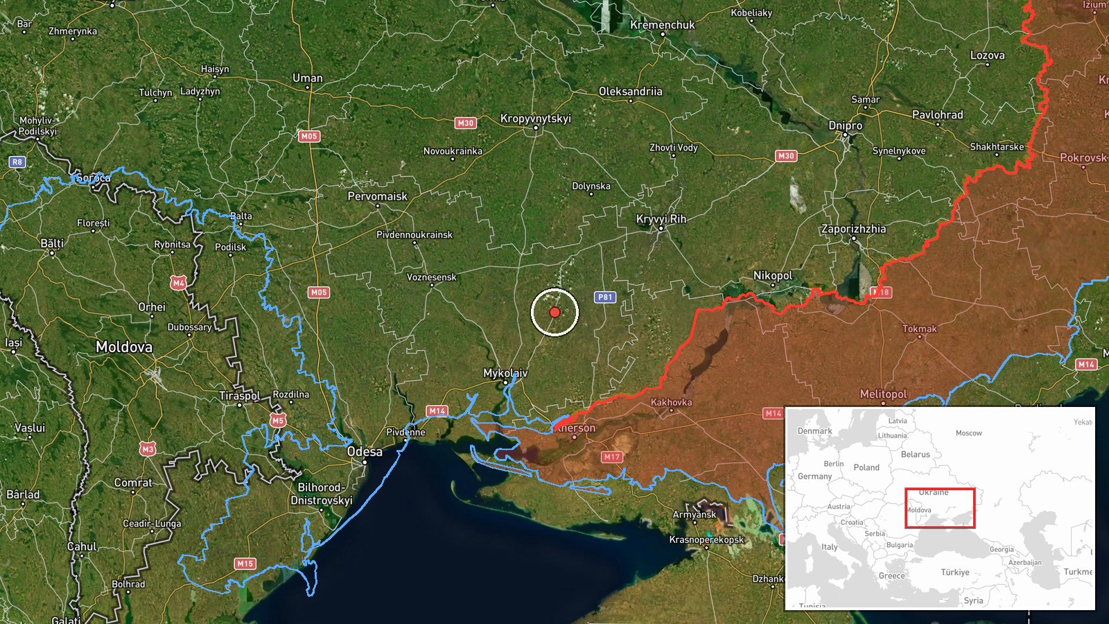
At 11:08 UTC on 17 October 2026, the Telegram channel @kpszsu, which relays Ukrainian air monitoring reports, said one Russian Shahed-type drone was passing Bashtanka district in Mykolaiv Oblast and heading west. The original Ukrainian post calls it an 'ударний БпЛА,' a strike unmanned aerial vehicle, and gives only the district and the direction of travel. It reports no impact, casualties, or damage, and names no target. The record is therefore a transit observation: the drone was tracked in flight, but nothing confirms it struck anything. Because only one channel carried the item, the details rest on that single posting and its wording.
Context and assessment
Bashtanka lies in the agricultural interior of Mykolaiv Oblast, not far from the Kherson Oblast border, so its significance here lies less in the town itself than in the corridor it sits within. The related events show a cluster of single-drone reports across the same region over roughly a day. Earlier on 17 October, one Shahed-type drone was reported passing Bereznehuvate heading north at 03:24 UTC. At 07:14 UTC another track ran from Kherson Oblast toward Velyka Oleksandrivka, and at 07:39 UTC a jet-powered Geran-3 drone was reported passing Mykolaiv Oblast heading northwest. On 16 October, a drone was reported moving from Kherson Oblast toward Mykolaiv Oblast. A follow-up at 11:13 UTC described a drone heading toward Bashtanka itself. Taken together, the pattern suggests individual drones moving north and west through the south, and some entries may describe the same aircraft at different points. Such transits are generally consistent with long-range strike or reconnaissance routing, but single-channel monitoring cannot show intent or final targets. The Geran-3 mention indicates that reporting distinguishes airframe types, though it does not by itself establish a change in tempo.
Sources and confidence
Only one channel, Telegram @kpszsu, appears in the record, and no secondary outlet or independent sensor confirms the track. The confidence score of 8.0 reflects a credible monitoring feed with consistent wording across related posts, a clear direction of travel, and a precise timestamp. It is held below the top of the scale because the report is single-sourced, no target or impact is recorded, and the original text uses operational language without independent verification. Confidence would rise with corroboration from a second monitoring channel, regional military administration statements, or additional reports tracking the same aircraft. It would fall if later reporting contradicted the direction of travel or identified the object differently.
Location
The location is settlement-level, placed on Bashtanka district as reported, so the coordinates mark the district area rather than a precise point on the drone's track. Location confidence is recorded as high because the district name appears directly in the source text. Bashtanka lies in Mykolaiv Oblast in southern Ukraine, in largely flat agricultural country with steppe terrain and river valleys to the south.
Related events nearby
- Ukrainian air monitoring: 1 Russian Shahed-type drone heading toward Bashtanka.2026-10-17 11:13 UTC · Drone Transit · Bashtanka, Ukraine
- Ukrainian air monitoring: 1 Russian Shahed-type drone passing Bereznehuvate, heading north.2026-10-17 03:24 UTC · Drone Transit · Bereznehuvate, Ukraine
- Ukrainian air monitoring: 1 Russian Shahed-type drone passing Bashtanka, heading toward Nova Odesa.2026-10-17 12:09 UTC · Drone Transit · Nova Odesa, Ukraine
- Ukrainian air monitoring: 1 Russian jet-powered Shahed (Geran-3) drone passing Mykolaiv Oblast, heading northw2026-10-17 07:39 UTC · Drone Transit · Mykolaiv Oblast, Ukraine
- Ukrainian air monitoring: 1 Russian Shahed-type drone from Kherson Oblast toward Mykolaiv Oblast.2026-10-16 14:34 UTC · Drone Transit · Mykolaiv Oblast, Ukraine
▶ View this event on the live map

Intel Mapper aggregates open-source reports from monitored Telegram and X channels, geolocates them, cross-checks duplicates across sources and assigns a confidence score. Entries are updated as new confirmations arrive. Read how we verify events.