Single Shahed-type drone reported heading toward Bashtanka, Mykolaiv Oblast, on 17 October
What happened
Ukrainian air monitoring reported through the Telegram channel @kpszsu that one Russian Shahed-type drone was heading toward Bashtanka at 11:13 UTC on 17 October 2026. The original Ukrainian-language post, a short alert tagged with a scooter emoji, reads roughly as 'strike UAV toward Bashtanka.' The message describes a single drone in transit. It does not report an impact, an interception, or any damage, and it does not say where the drone ended up. Bashtanka is a settlement in Mykolaiv Oblast in southern Ukraine. The report is the only source in the dataset for this specific heading warning, so its wording is the basis for everything recorded here. Five minutes earlier, a separate monitoring alert placed a Shahed-type drone passing through Bashtanka district heading west, which suggests the track was already being followed when this warning was issued.
Context and assessment
Bashtanka sits in the Mykolaiv region, an area that has repeatedly come under Russian drone activity as routes move across the southern front between Kherson and Mykolaiv. The related reports in the dataset show a dense pattern across the same few hours. A drone passed Bereznehuvate heading north at 03:24 UTC. A Shahed-type drone came from Kherson Oblast toward Velyka Oleksandrivka at 07:14. A jet-powered Geran-3 passed through Mykolaiv Oblast heading northwest at 07:39. A drone from Kherson Oblast was tracked toward Mykolaiv Oblast the previous afternoon. Taken together, these look less like one isolated launch and more like a sustained stream of long-range drones crossing the oblast on different headings, several of them tracked as they change direction. The report of a drone passing Bashtanka district heading west at 11:08 fits that pattern. The Geran-3 entry is notable because the dataset distinguishes this jet-powered variant from piston-engine Shahed-type airframes. Operationally, a drone heading toward a named settlement could indicate a target, a decoy, or simply a route the drone is flying through. The data alone cannot tell these apart.
Sources and confidence
The alert comes from one source, the Telegram channel @kpszsu, which carries Ukrainian air monitoring messages. No second channel or outlet in the dataset reports this specific heading warning, so it has not been cross-confirmed. The confidence score of 8.0 reflects a consistent cluster of related drone reports in the same hours, but it stays below the top of the scale because it rests on a single channel and describes a transit rather than a verified impact. Confidence would rise with independent confirmation from another monitoring source or a later report of a strike or interception. It would fall if the track were revised or corrected.
Location
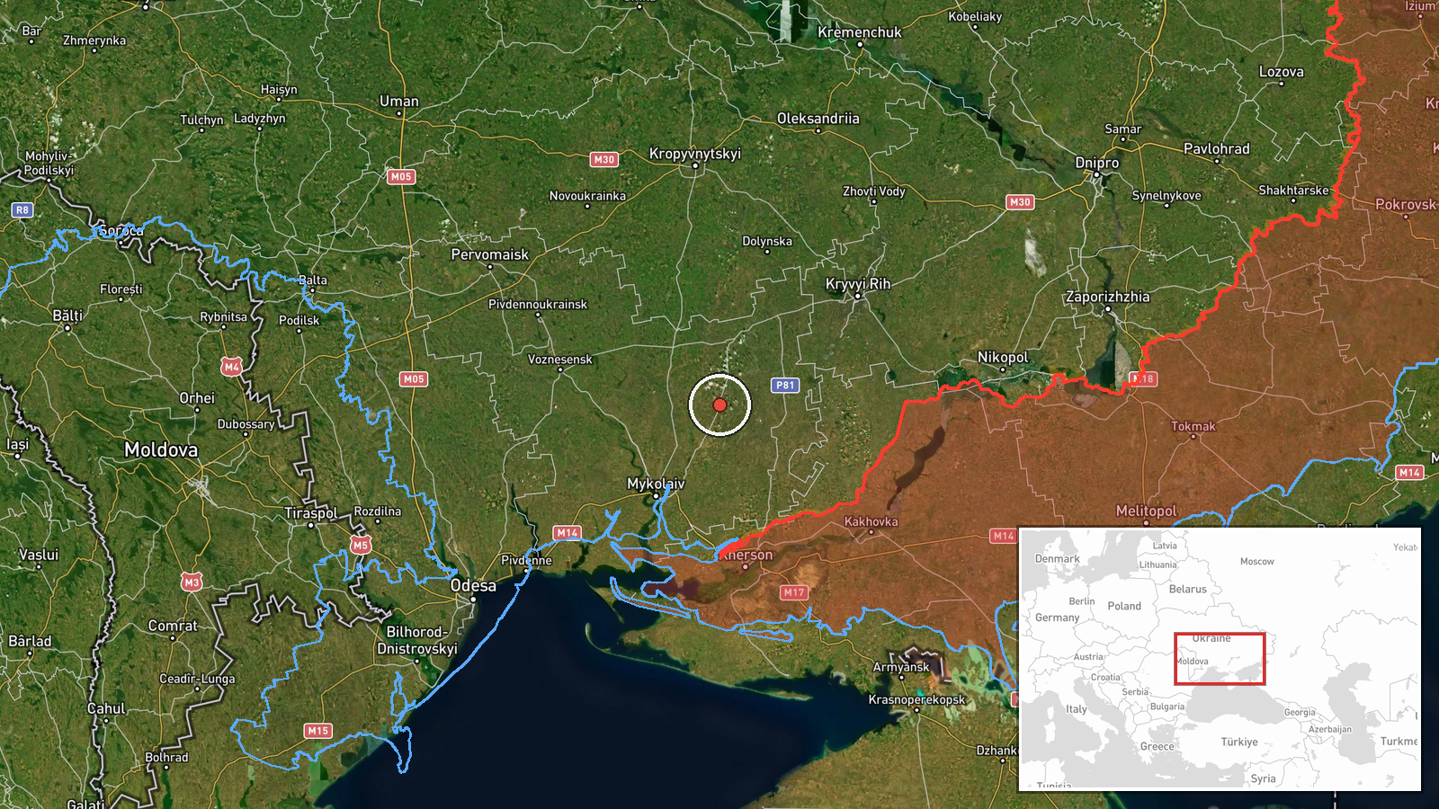
The coordinates correspond to the settlement of Bashtanka and are rated at settlement-level precision with high location confidence. Bashtanka lies in Mykolaiv Oblast in southern Ukraine, on the flat steppe terrain typical of the region, inland from the Black Sea coast and north of the Kherson border zone. The point is a town-level approximation rather than a specific facility, and the dataset does not identify any installation at the site.
Related events nearby
- Ukrainian air monitoring: 1 Russian Shahed-type drone passing Bashtanka district, heading west.2026-10-17 11:08 UTC · Drone Transit · Bashtanka district, Ukraine
- Ukrainian air monitoring: 1 Russian Shahed-type drone passing Bereznehuvate, heading north.2026-10-17 03:24 UTC · Drone Transit · Bereznehuvate, Ukraine
- Ukrainian air monitoring: 1 Russian Shahed-type drone passing Bashtanka, heading toward Nova Odesa.2026-10-17 12:09 UTC · Drone Transit · Nova Odesa, Ukraine
- Ukrainian air monitoring: 1 Russian jet-powered Shahed (Geran-3) drone passing Mykolaiv Oblast, heading northw2026-10-17 07:39 UTC · Drone Transit · Mykolaiv Oblast, Ukraine
- Ukrainian air monitoring: 1 Russian Shahed-type drone from Kherson Oblast toward Mykolaiv Oblast.2026-10-16 14:34 UTC · Drone Transit · Mykolaiv Oblast, Ukraine
▶ View this event on the live map

Intel Mapper aggregates open-source reports from monitored Telegram and X channels, geolocates them, cross-checks duplicates across sources and assigns a confidence score. Entries are updated as new confirmations arrive. Read how we verify events.