Single Shahed-type drone reported passing Bereznehuvate, Mykolaiv Oblast, heading north
What happened
Ukrainian air monitoring channel @kpszsu reported at 03:24 UTC on 17 October 2026 that one Russian Shahed-type drone was passing Bereznehuvate, a settlement in Mykolaiv Oblast, on a northward heading. The original Ukrainian-language post is brief. It labels the object as a UAV (БпЛА) passing near the settlement with a northern course. The report does not describe any impact, damage, casualties, or interception, and it does not say whether the drone was tracked to a specific target. The event is classified as a drone transit rather than a strike. The attribution to Russia and the Shahed-type label come from the channel's own framing of the aircraft, not from independent identification of the airframe or its payload.
Context and assessment
Bereznehuvate sits in the southern Ukrainian steppe between Kherson and Mykolaiv, a corridor that has seen repeated Shahed-type movements. The related reports show the pattern. Earlier on 16 October a single drone was reported moving from Kherson Oblast toward Mykolaiv Oblast, and the same day two or more jet-powered Geran-3 drones were logged passing Mykolaiv Oblast heading north. Overnight into 17 October, monitoring reports placed a single drone passing Arkhanhelske heading north, then another passing Beryslav district toward Velyka Oleksandrivka, with the timestamps falling within roughly ten minutes of each other. Across consecutive reports, northward-tracking aircraft appear to follow a repeated corridor, which may point toward rear areas or targets farther north, although a transit report alone cannot establish intent. A guided glide bomb airstrike toward Kherson was logged at the same timestamp as the Beryslav-area report, indicating parallel Russian activity in the same southern sector. Taken together, the timeline suggests sustained, low-density drone traffic rather than a single mass raid, consistent with reconnaissance, decoy, or strike-support flights. Operational meaning remains hedged because the data does not show targets or outcomes.
Sources and confidence
The report comes from one Telegram channel, @kpszsu, which republishes Ukrainian air-monitoring alerts. No second channel, outlet, or official statement is attached, so the item rests on a single source. The confidence score of 8.0 is relatively high because the channel is an established monitoring feed, the post is specific about location and heading, and similar transit reports appear in the surrounding timeline. It is not higher because nothing independent corroborates it and no imagery or flight data is attached. Confidence would rise with confirmation from another monitoring channel or a regional military administration. It would fall if later reporting contradicts the track or identifies the object as something other than a Shahed-type drone.
Location
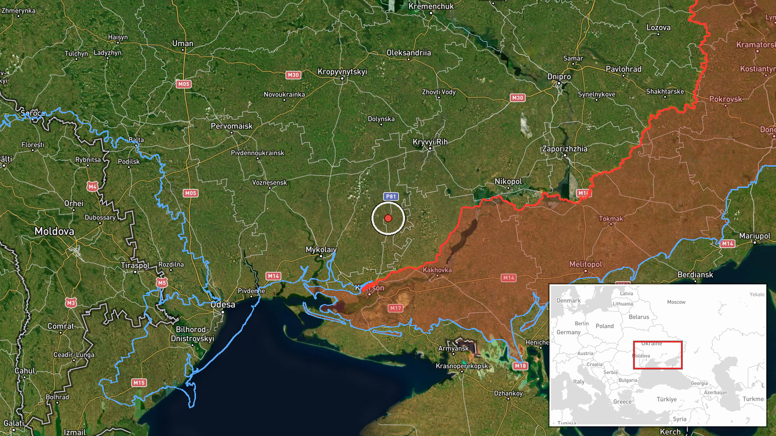
The location was assigned at settlement precision, so the coordinates mark the community of Bereznehuvate rather than a specific facility. The location confidence is high because the source names the settlement directly. The town lies in Mykolaiv Oblast in the flat southern steppe, farmland drained by rivers flowing toward the Southern Bug and the Dnipro delta. Because the drone was reported passing the settlement, the point is a transit reference, not an impact site.
Related events nearby
- Ukrainian air monitoring: 1 Russian Shahed-type drone passing Beryslav district, heading toward Velyka Oleksan2026-10-17 01:43 UTC · Drone Transit · Velyka Oleksandrivka, Ukraine
- Ukrainian air monitoring: 1 Russian Shahed-type drone passing Arkhanhelske, heading north.2026-10-17 01:34 UTC · Drone Transit · Arkhanhelske, Ukraine
- Ukrainian air monitoring: 1 Russian Shahed-type drone from Kherson Oblast toward Mykolaiv Oblast.2026-10-16 14:34 UTC · Drone Transit · Mykolaiv Oblast, Ukraine
- Ukrainian air monitoring: 2+ Russian jet-powered Shahed (Geran-3) drones passing Mykolaiv Oblast, heading nort2026-10-16 09:03 UTC · Drone Transit · Mykolaiv Oblast, Ukraine
- Ukrainian air monitoring: 1 Russian guided glide bomb (KAB) heading toward Kherson.2026-10-17 01:43 UTC · Airstrike · Kherson, Ukraine
▶ View this event on the live map

Intel Mapper aggregates open-source reports from monitored Telegram and X channels, geolocates them, cross-checks duplicates across sources and assigns a confidence score. Entries are updated as new confirmations arrive. Read how we verify events.