Jet-powered Shahed (Geran-3) drones reported heading north along Odesa-Mykolaiv border, Ukraine
What happened
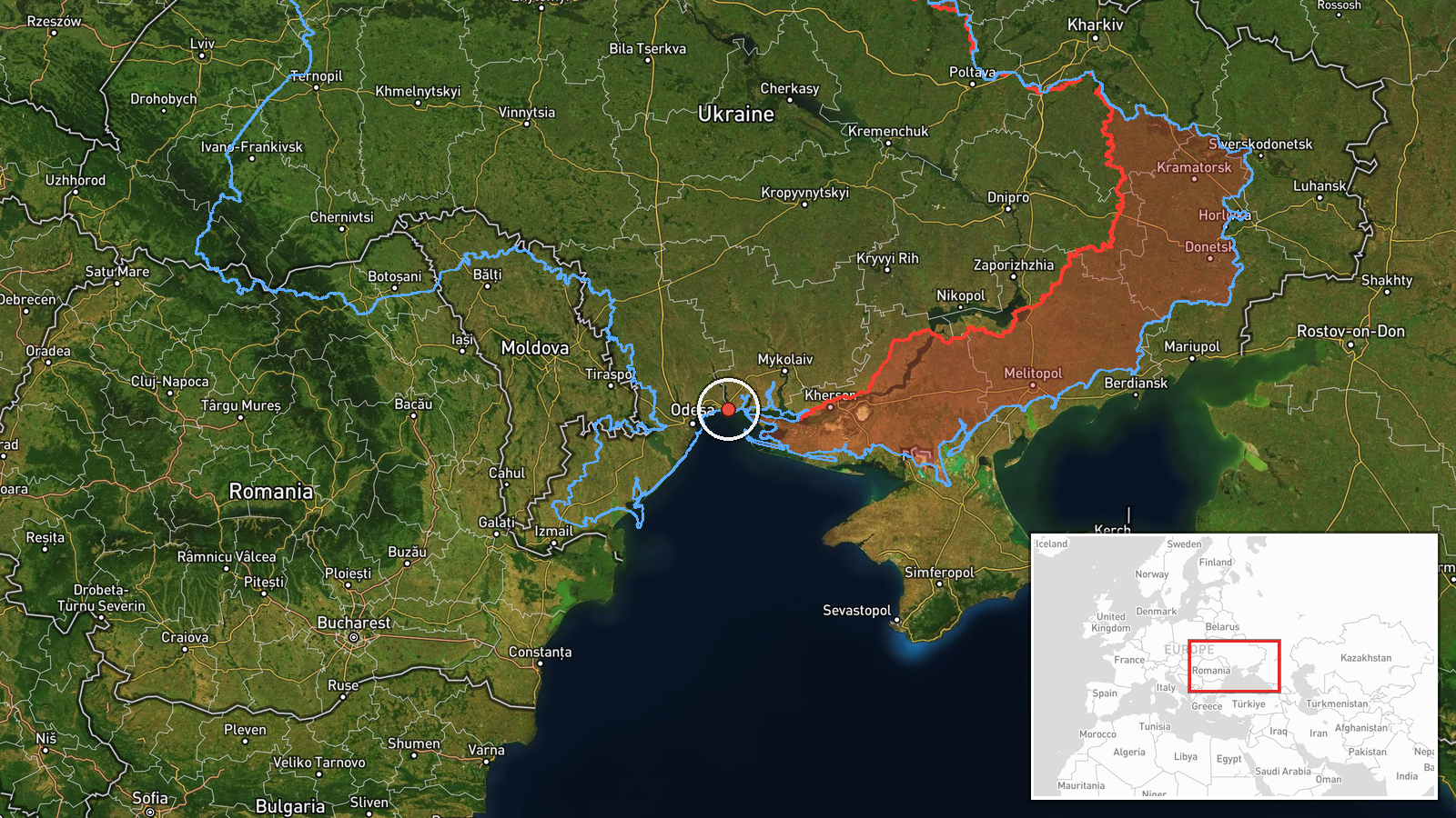
Ukrainian air monitoring reported at 14:02 UTC on 19 October 2026 that jet-powered Shahed-type drones, identified in the report as Geran-3, were moving along the border between Odesa and Mykolaiv oblasts on a northern heading. The original post, published by the Telegram channel @kpszsu, which is the channel used for Ukrainian Air Force air-situation updates, uses the phrase 'реактивні БпЛА' and gives only a direction. It does not state how many drones were involved, their altitude, or any impact. The report describes a transit rather than a strike and names no settlement. Because the only source is that single channel, the sighting is recorded as a reported transit pending confirmation.
Context and assessment
The border area between Odesa and Mykolaiv oblasts sits on the route that Russian long-range drones have repeatedly used to move from the Black Sea toward inland Ukraine, and the surrounding coastal and estuarine zone is frequently crossed by such traffic. This report fits a pattern visible earlier the same day in the related events. Air monitoring logged a drone heading toward northern Mykolaiv Oblast at 03:00 UTC, a report of two or more drones toward southern Mykolaiv Oblast at 03:07, a drone passing north of Buialyk at 05:25, a drone from the Black Sea toward Ochakiv at 06:28, and another from the Black Sea toward southern Mykolaiv Oblast at 06:53. The sequence suggests a sustained series of separate transits from the sea rather than one isolated flight. Operationally, a northbound track along the oblast boundary may indicate drones routed to avoid particular air-defence concentrations, or to reach targets further inland, but the available reports do not establish either intent. Each entry describes movement only, so the day's pattern should be read as an indicator of air activity, not as confirmed target selection.
Sources and confidence
The event rests on one Telegram channel, @kpszsu, which carries Ukrainian air-situation messages. No second outlet, wire service, or independent sensor report appears in the data. The score of 8.0 reflects a credible, official-style channel with a consistent record of such alerts, combined with the fact that the wording is specific about drone type and direction. It is held below the top of the scale because the report is unconfirmed by any other source and the report gives no count. Confidence would rise with corroboration from other Ukrainian official channels, regional military administrations, or independent trackers recording the same track. It would fall if later updates revise the drone type, heading, or location.
Location
The location is approximate. The report names only the border zone between Odesa and Mykolaiv oblasts, not a settlement, and the coordinates correspond to a regional-level point, so the location confidence is low. The area lies on the northern Black Sea coast, where the flat steppe is cut by river mouths, estuaries and lagoons linked to the Southern Bug system. The terrain is open and low, with few natural barriers, and the coast lies a short distance to the south.
Related events nearby
- Ukrainian air monitoring: 1 Russian jet-powered Shahed (Geran-3) drone from Black Sea toward Ochakiv.2026-10-19 06:28 UTC · Drone Transit · Ochakiv, Ukraine
- Ukrainian air monitoring: 1 Russian jet-powered Shahed (Geran-3) drone from Black Sea toward southern Mykolaiv2026-10-19 06:53 UTC · Drone Transit · southern Mykolaiv Oblast, Ukraine
- Ukrainian air monitoring: 2+ Russian jet-powered Shahed (Geran-3) drones heading toward southern Mykolaiv Obla2026-10-19 03:07 UTC · Drone Transit · southern Mykolaiv Oblast, Ukraine
- Ukrainian air monitoring: 1 Russian jet-powered Shahed (Geran-3) drone passing Mykolaiv Oblast, heading northw2026-10-19 16:10 UTC · Drone Transit · Mykolaiv Oblast, Ukraine
- Ukrainian air monitoring: 1 Russian jet-powered Shahed (Geran-3) drone passing north of Buialyk, heading north2026-10-19 05:25 UTC · Drone Transit · north of Buialyk, Ukraine
▶ View this event on the live map

Intel Mapper aggregates open-source reports from monitored Telegram and X channels, geolocates them, cross-checks duplicates across sources and assigns a confidence score. Entries are updated as new confirmations arrive. Read how we verify events.