Jet-powered Shahed drone reported from Black Sea toward southern Mykolaiv Oblast
What happened
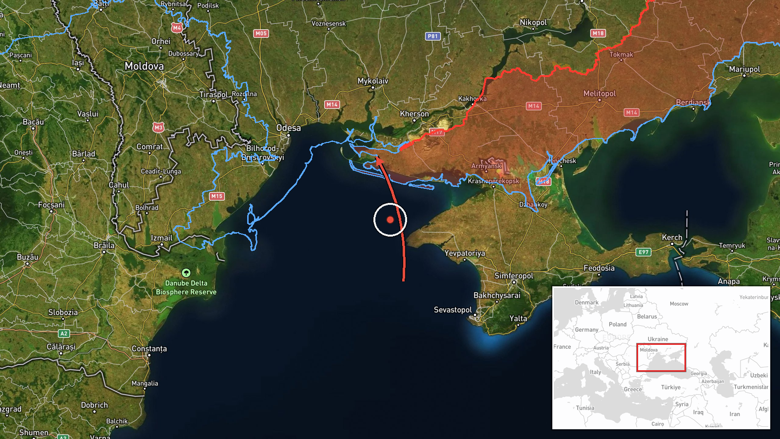
Ukrainian air monitoring reported on Telegram that one Russian jet-powered Shahed-type drone, identified as the Geran-3, was moving from the Black Sea toward southern Mykolaiv Oblast on 19 October 2026 at about 06:53 UTC. The original Ukrainian post read as a short transit alert, describing a jet-powered UAV heading to the south of Mykolaiv region from the sea area. The report does not describe any impact, damage, or casualties, and it gives no precise track or point of impact beyond the regional direction. The alert was one of several drone transit notices issued that morning for the same general corridor, which points to a sustained flow of single aircraft rather than one isolated sighting.
Context and assessment
Mykolaiv Oblast sits on the northern Black Sea coast and includes Ochakiv, a port town near the Dnipro-Buh estuary, as well as the city of Mykolaiv, a port and shipbuilding centre that has been struck repeatedly since 2022. The related alerts from the same morning show a pattern. Drones were reported heading toward northern and southern parts of the oblast at about 03:00 and 03:07 UTC, one passed north of Buialyk heading north at 05:25, and another came from the Black Sea toward Ochakiv at 06:28. Taken together, the sequence suggests operators are routing Geran-3 aircraft over the sea and along the coast, possibly to approach from unexpected directions, stretch air defence coverage, or probe for gaps near ports and logistics nodes. The jet-powered variant is faster and harder to intercept than older piston-engine Shaheds, which may be part of why monitoring channels flag its type explicitly. These readings are inferences from alert wording alone. The data does not show intended targets, and single transit alerts often do not end in strikes.
Sources and confidence
This event rests on one channel, the Telegram account @kpszsu, which is associated with Ukrainian air force monitoring. Official military alert channels are usually reliable on drone movements, but the report has no independent cross-confirmation from other outlets or from the Ukrainian Air Force's own website. The confidence score of 8.0 reflects the official-style origin and its consistency with the nearby alerts. It is not higher because the event is single-sourced and reports only a transit. Confidence would rise with corroboration from radar summaries, regional military administration statements, or reports of debris or impacts. It would fall if the alert were later revised, withdrawn, or found to refer to a different track.
Location
The location is recorded at region level, not as a specific settlement or facility. The coordinates given are an approximate centre point for southern Mykolaiv Oblast, and the location confidence is low. The alert names no town as a destination. The setting is flat coastal steppe along the Black Sea, with lagoons, estuaries and the Dnipro-Buh river system, so the drone's path toward the oblast crosses largely open ground and water.
Related events nearby
- Ukrainian air monitoring: 2+ Russian jet-powered Shahed (Geran-3) drones heading toward southern Mykolaiv Obla2026-10-19 03:07 UTC · Drone Transit · southern Mykolaiv Oblast, Ukraine
- Ukrainian air monitoring: 1 Russian jet-powered Shahed (Geran-3) drone from Black Sea toward Ochakiv.2026-10-19 06:28 UTC · Drone Transit · Ochakiv, Ukraine
- Ukrainian air monitoring: 1 Russian jet-powered Shahed (Geran-3) drone heading toward northern Mykolaiv Oblast2026-10-19 03:00 UTC · Drone Transit · northern Mykolaiv Oblast, Ukraine
- Ukrainian air monitoring: 1 Russian jet-powered Shahed (Geran-3) drone passing north of Buialyk, heading north2026-10-19 05:25 UTC · Drone Transit · north of Buialyk, Ukraine
- Ukrainian air monitoring: 1 Russian jet-powered Shahed (Geran-3) drone passing Yelanets, heading north.2026-10-19 07:07 UTC · Drone Transit · Yelanets, Ukraine
▶ View this event on the live map

Intel Mapper aggregates open-source reports from monitored Telegram and X channels, geolocates them, cross-checks duplicates across sources and assigns a confidence score. Entries are updated as new confirmations arrive. Read how we verify events.