Single jet-powered Shahed (Geran-3) drone reported transiting north of Buialyk, Odesa Oblast
What happened
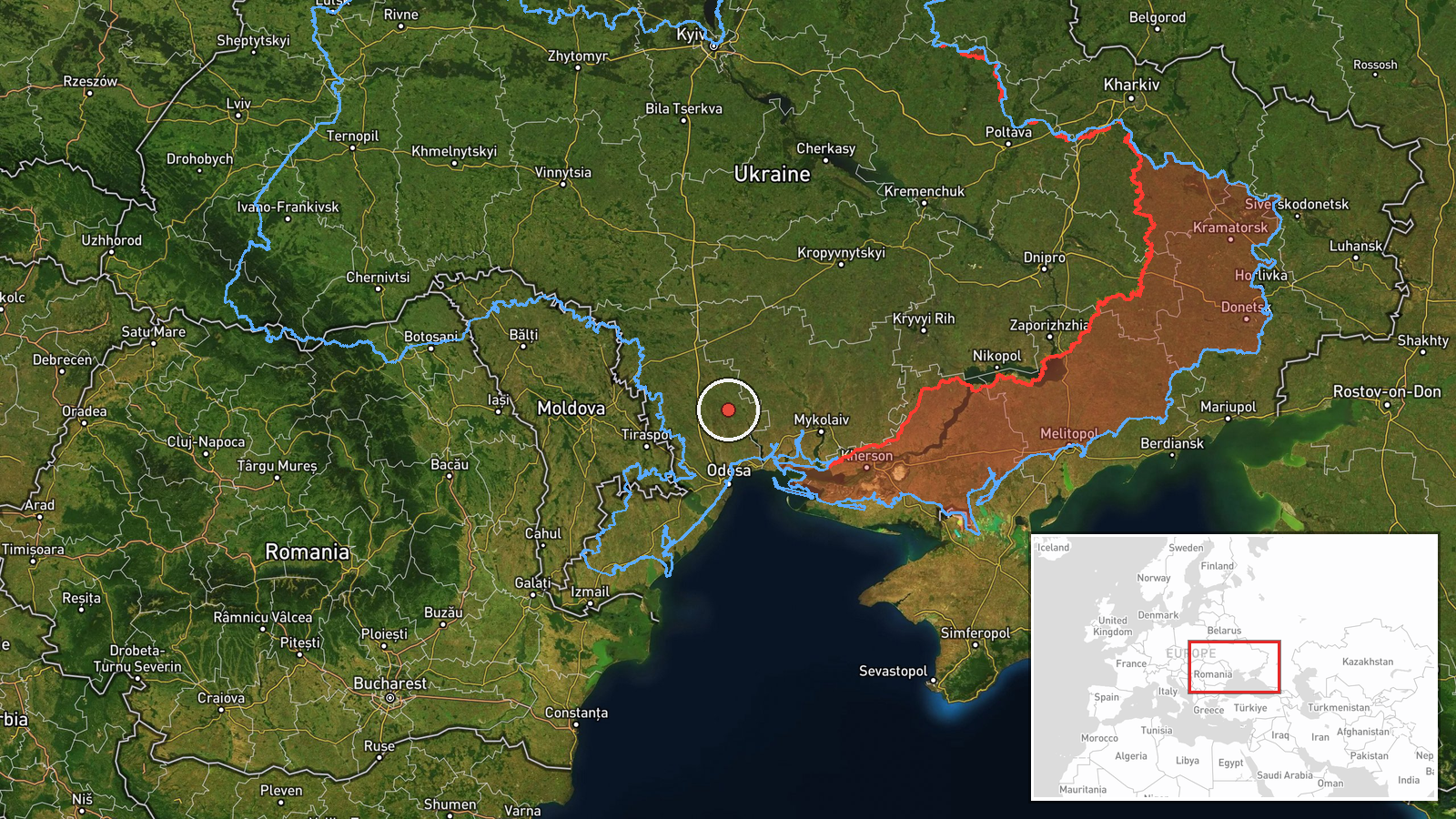
Ukraine's air monitoring channel on Telegram, @kpszsu, reported on 19 October 2026 at 05:25 UTC that one jet-powered drone, identified as a Russian Shahed-type Geran-3, was passing north of the settlement of Buialyk in Odesa Oblast and heading north. The original Ukrainian-language post uses the term 'reactive UAV' and gives only a direction of travel. It does not report any impact, casualties or interception. The notice is a transit report rather than a strike report. Because it names a settlement as the reference point and gives no track data, the exact route is not known. The event rests on a single Telegram post.
Context and assessment
The location lies in Odesa Oblast, a southwestern region whose Black Sea ports, energy assets and logistics routes have repeatedly been named in Ukrainian air alerts. The related reports show a sequence on 18 and 19 October. Early on 18 October, single drones were logged from the Black Sea toward Odesa Oblast and then toward its southern districts. Early on 19 October, a jet-powered Geran-3 was logged heading toward northern Mykolaiv Oblast, followed by a larger group of at least two drones heading toward southern Mykolaiv, and then another jet-powered drone passing southern Kirovohrad Oblast while heading north. The Buialyk report, given the same day, fits a northbound track through Odesa Oblast. Taken together, the pattern suggests drones entering from the sea and moving inland across several oblasts, possibly to probe air defence coverage, to cover routes toward deeper targets, or as part of mixed raids. Individual transit reports cannot confirm intent, and the chain may reflect a single drone being tracked across several reporting zones rather than separate launches.
Sources and confidence
One Telegram channel, @kpszsu, is the only source for this entry. It is tied to Ukraine's Air Force air-monitoring reporting and is generally regarded as a timely primary source for transit notices. The confidence score of 8.0 reflects that institutional origin and the clear wording of the original post. It is held below the top of the scale because there is no independent corroboration from a second channel, radar-based reporting, or subsequent official summary, and the post contains no coordinates or impact information. Confidence would rise with a matching official summary, corroborating local reports, or consistent entries from neighbouring monitoring channels. It would fall if the post were corrected, deleted, or contradicted by later air-monitoring updates.
Location
The coordinates, 47.18084 N and 30.72032 E, mark the Buialyk settlement reference point, not a measured drone position, and the location is recorded at region-level precision with low confidence. The track is described only as north of the settlement. The area is in southwestern Ukraine within Odesa Oblast, with flat agricultural terrain, river estuaries and lowlands running toward the Black Sea coast and the Odesa hinterland.
Related events nearby
- Ukrainian air monitoring: 1 Russian jet-powered Shahed (Geran-3) drone from Black Sea toward Ochakiv.2026-10-19 06:28 UTC · Drone Transit · Ochakiv, Ukraine
- Ukrainian air monitoring: 1 Russian jet-powered Shahed (Geran-3) drone heading toward northern Mykolaiv Oblast2026-10-19 03:00 UTC · Drone Transit · northern Mykolaiv Oblast, Ukraine
- Ukrainian air monitoring: 2+ Russian jet-powered Shahed (Geran-3) drones heading toward southern Mykolaiv Obla2026-10-19 03:07 UTC · Drone Transit · southern Mykolaiv Oblast, Ukraine
- Ukrainian air monitoring: 1 Russian jet-powered Shahed (Geran-3) drone passing southern Kirovohrad Oblast, hea2026-10-19 03:13 UTC · Drone Transit · southern Kirovohrad Oblast, Ukraine
- Ukrainian air monitoring: 1 Russian Shahed-type drone from Black Sea toward southern Odesa Oblast.2026-10-18 06:55 UTC · Drone Transit · southern Odesa Oblast, Ukraine
▶ View this event on the live map

Intel Mapper aggregates open-source reports from monitored Telegram and X channels, geolocates them, cross-checks duplicates across sources and assigns a confidence score. Entries are updated as new confirmations arrive. Read how we verify events.