Single Geran-3 jet drone tracked passing Yelanets in Mykolaiv Oblast, heading north
What happened
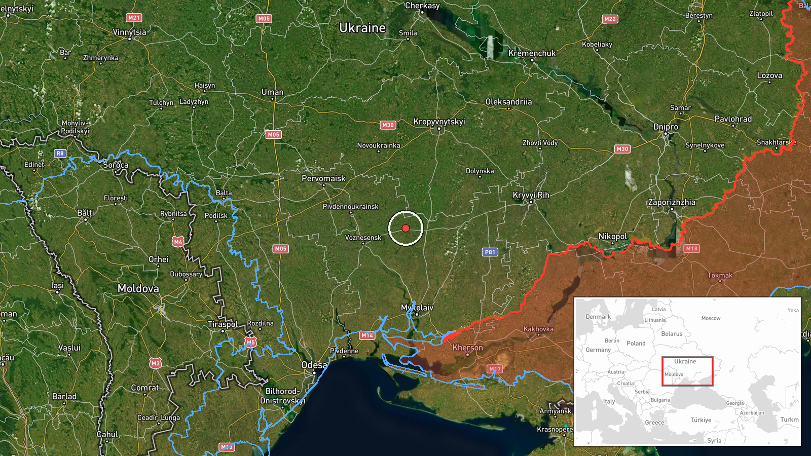
Ukrainian air monitoring channel @kpszsu reported on Telegram that one Russian jet-powered Shahed, designated Geran-3, was passing at or near Yelanets, a settlement in Mykolaiv Oblast in southern Ukraine, on 19 October 2026 at about 07:07 UTC. The post, written in Ukrainian, described the object as a jet-type UAV (реактивний БпЛА) moving in a northerly direction. No impact, casualties, or damage were mentioned in the report. The item is a transit notice rather than a strike report, and it is currently sourced to a single channel.
Context and assessment
Yelanets sits on the northern edge of the Mykolaiv area, a corridor that drones heading toward central and northern Ukraine have repeatedly crossed. The same morning, monitoring posts logged a sequence of Geran-3 tracks farther west and north: one heading toward northern Mykolaiv Oblast around 03:00 UTC, another passing southern Kirovohrad Oblast at 03:13, and several near Kropyvnytskyi between 03:21 and 04:43. The Yelanets track, reported roughly two and a half hours after the first of these, appears to belong to the same wave moving northward through the region. The sequence suggests a set of drones launched from the south or southeast, with some turning west while others continued north. Because the reports are fragmentary, the pattern may indicate routing toward multiple targets or dispersal to complicate air defence, but the data alone cannot confirm intent or destination.
Sources and confidence
Only one source is listed: the Telegram channel @kpszsu, which reports Ukrainian air monitoring. No independent outlet or second channel has been found to corroborate this specific track. Confidence is set at 8.0 because the channel is an official military monitoring source with a consistent reporting format, and the location is precisely matched to a settlement. It is held below the top of the scale because the report is not cross-confirmed, the track was not tied to any impact, and single-channel transit notices can be updated or revised. Confidence would rise with corroboration from additional monitoring or media sources, or with reported impacts nearby. It would fall if the track were revised, withdrawn, or shown to refer to a different object.
Location
The location is set to Yelanets, a settlement in Mykolaiv Oblast, at the settlement precision level with high location confidence. The source names the settlement directly, so the coordinates reflect the settlement centre rather than a point on the flight path. The area is flat steppe farmland in southern Ukraine, drained by the Inhul and Ingulets river systems to the west and north. The drone's track is described as passing at or over the settlement, so the actual flight path may have been several kilometres away.
Related events nearby
- Ukrainian air monitoring: 1 Russian jet-powered Shahed (Geran-3) drone heading toward northern Mykolaiv Oblast2026-10-19 03:00 UTC · Drone Transit · northern Mykolaiv Oblast, Ukraine
- Ukrainian air monitoring: 1 Russian jet-powered Shahed (Geran-3) drone passing southern Kirovohrad Oblast, hea2026-10-19 03:13 UTC · Drone Transit · southern Kirovohrad Oblast, Ukraine
- Ukrainian air monitoring: 2+ Russian jet-powered Shahed (Geran-3) drones passing south of Kropyvnytskyi, headi2026-10-19 04:36 UTC · Drone Transit · south of Kropyvnytskyi, Ukraine
- Ukrainian air monitoring: one Russian jet-powered Shahed (Geran-3) drone tracked approaching Kropyvnytskyi fro2026-10-19 03:21 UTC · Drone Transit · Kropyvnytskyi, Kirovohrad Oblast, Ukraine
- Ukrainian air monitoring: jet-powered Shahed (Geran-3) drones tracked over central Kirovohrad Oblast, heading 2026-10-19 04:43 UTC · Drone Transit · Central Kirovohrad Oblast, Ukraine
▶ View this event on the live map

Intel Mapper aggregates open-source reports from monitored Telegram and X channels, geolocates them, cross-checks duplicates across sources and assigns a confidence score. Entries are updated as new confirmations arrive. Read how we verify events.