Jet-powered Shahed (Geran-3) drone reported transiting Mykolaiv Oblast toward the northwest
What happened
Ukraine's Air Force, via its official Telegram channel (@kpszsu), reported at 16:10 UTC on 19 October 2026 that one Russian jet-powered Shahed-type drone, identified in the report as a Geran-3, was passing near Voznesensk in Mykolaiv Oblast and moving northwest. The original Ukrainian wording describes a reactive UAV passing Voznesensk, with the heading given as northwest. The report does not describe any impact, casualties, damage, or intended target. The event is recorded as a transit, meaning air monitoring tracked the drone's movement rather than a confirmed strike. Only this single channel is cited for the event.
Context and assessment
Mykolaiv Oblast sits on the northern Black Sea coast between Odesa and Kherson, and Voznesensk lies on the Southern Bug river, a corridor that has repeatedly carried drone traffic toward the Odesa and Mykolaiv regions. Related air monitoring reports from the same day describe a sequence of Geran-3 drones entering from the Black Sea and moving toward Ochakiv, then toward southern Mykolaiv Oblast, with separate reports of drones heading toward northern Mykolaiv and along the Odesa-Mykolaiv border. Taken together, the pattern points to repeated routing of jet-powered drones through the oblast across a single day rather than one isolated flight. Because the data records only transits, it does not establish what the drones were aiming at, and a northwesterly heading could reflect a route toward several possible destinations or a diversion. Jet-powered variants are generally faster than the piston-engine Shahed, which may shorten the time available for air defense to respond; that is a general characteristic, not a finding from this report. The clustering of reports in one region within a short window is consistent with sustained pressure on local air defense and warning networks, but the data alone does not show whether the sequence was an attack wave, probing activity, or separate launches.
Sources and confidence
The event rests on a single channel: the official Telegram account of Ukraine's Air Force (@kpszsu), which publishes routine aerial-threat monitoring updates. No independent outlet, satellite source, or second monitoring channel in the data confirms this specific report, so cross-confirmation is absent. The confidence score of 8.0 reflects the generally high reliability of official military warning channels for aerial-threat tracking, tempered by the lack of independent corroboration and by the report's general wording about position. Confidence would rise with a second official source, independent tracking data, or corroborating reports of the drone's path. It would fall if the Air Force issued a correction or if independent tracking placed the drone elsewhere.
Location
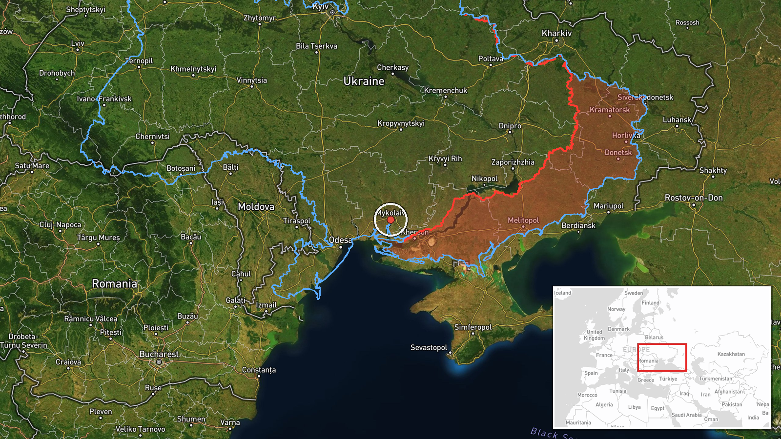
The location is approximate. The report names Voznesensk, a city on the Southern Bug in Mykolaiv Oblast, but the event is geocoded at region level, with coordinates of 46.97 N, 32.00 E. That point lies roughly 80 km south-southeast of Voznesensk, so the pin should be read as the oblast rather than the city. The setting is flat agricultural steppe in southern Ukraine, with the Southern Bug river and the Black Sea coast to the south as notable nearby features.
Related events nearby
- Ukrainian air monitoring: 1 Russian jet-powered Shahed (Geran-3) drone from Black Sea toward Ochakiv.2026-10-19 06:28 UTC · Drone Transit · Ochakiv, Ukraine
- Ukrainian air monitoring: 1 Russian jet-powered Shahed (Geran-3) drone from Black Sea toward southern Mykolaiv2026-10-19 06:53 UTC · Drone Transit · southern Mykolaiv Oblast, Ukraine
- Ukrainian air monitoring: 2+ Russian jet-powered Shahed (Geran-3) drones heading toward southern Mykolaiv Obla2026-10-19 03:07 UTC · Drone Transit · southern Mykolaiv Oblast, Ukraine
- Ukrainian air monitoring: 1 Russian jet-powered Shahed (Geran-3) drone heading toward northern Mykolaiv Oblast2026-10-19 03:00 UTC · Drone Transit · northern Mykolaiv Oblast, Ukraine
- Ukrainian air monitoring reports jet-powered Shahed (Geran-3) drones on the Odesa-Mykolaiv border, heading nor2026-10-19 14:02 UTC · Drone Transit · Odesa-Mykolaiv Oblast border, Ukraine
▶ View this event on the live map

Intel Mapper aggregates open-source reports from monitored Telegram and X channels, geolocates them, cross-checks duplicates across sources and assigns a confidence score. Entries are updated as new confirmations arrive. Read how we verify events.