Jet-powered Shahed (Geran-3) drone reported over Mykolaiv district, heading northwest
What happened
Ukrainian air monitoring, as posted on the Telegram channel @kpszsu, reported one Russian jet-powered Shahed drone, identified in the post as a Geran-3, passing through Mykolaiv district in southern Ukraine and moving in a northwestern direction. The post was published at 01:36 UTC on 20 October 2026. The original Ukrainian text describes a jet-type unmanned aerial vehicle (реактивний БпЛА) and gives only the district and heading, with no detail on altitude, speed, or intended target. The event is classified as a drone transit rather than a strike. The source reports no explosions, casualties, or damage. The location is recorded at settlement precision for the district as a whole, so the drone's exact position at the time of posting is not established.
Context and assessment
Mykolaiv district sits on the northern Black Sea approach, close to the Southern Bug estuary and the port and shipbuilding infrastructure of the city of Mykolaiv. Its position between the coast and inland Ukrainian cities makes it a routine corridor for drones entering from the sea. The related alerts show that pattern clearly. Between roughly 03:00 and 20:58 UTC on 19 October, Ukrainian monitoring logged at least five separate Geran-3 transits, several of them described as coming from the Black Sea and heading toward Ochakiv or southern Mykolaiv Oblast, and one moving through the wider oblast in the afternoon. The repetition of the same vehicle type, direction and corridor over a single day may indicate sustained launches along a maritime route, drones being routed toward targets further inland or along the coast, or the same drone being tracked across several alert updates. The source data cannot distinguish these possibilities. Jet-powered variants are faster and harder to intercept than older propeller-driven Shaheds, which is why repeated air alerts in the south carry operational weight for regional air defence and civil warning systems.
Sources and confidence
The event rests on a single channel, Telegram @kpszsu, which is generally associated with Ukraine's Air Force and is widely used for official air alerts. No independent outlet, regional administration, or second monitoring channel in the data confirms this specific report. The confidence score of 8.0 reflects the official-style origin of the channel, the specificity of the drone type, and its consistency with a pattern of similar alerts earlier the same day. It is held below the maximum because there is no cross-confirmation and no follow-up on the track. Confidence would rise with corroboration from regional military administrations, reports of interception or debris, or radar-based tracking. It would fall if the channel later amended or withdrew the alert, or if subsequent reports placed the drone elsewhere.
Location
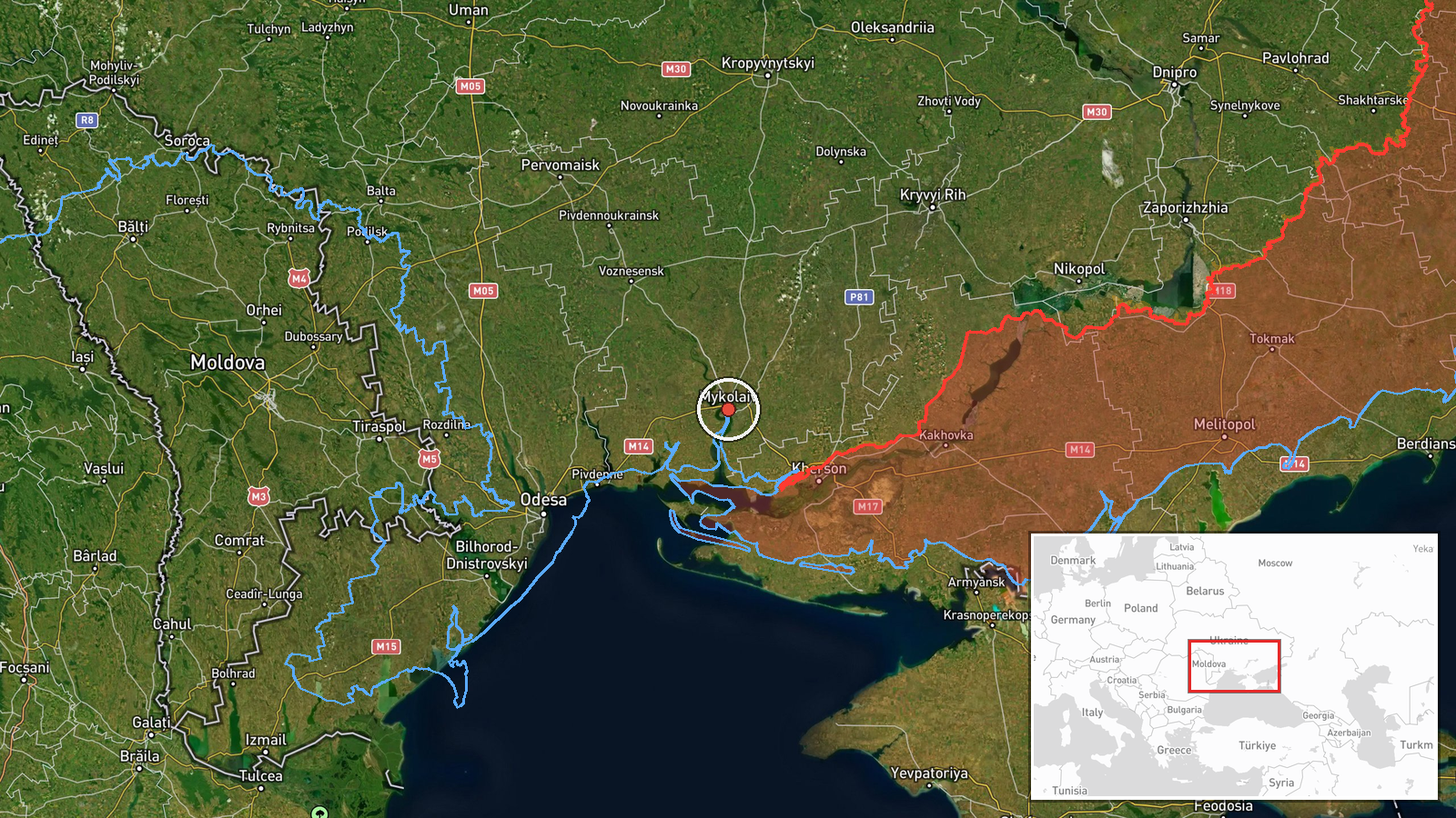
The coordinates correspond to the city of Mykolaiv, the regional centre, which is named as the district reference point. This is a settlement-level approximation, since the report refers to the district rather than a fixed point. The city lies where the Southern Bug and Inhul rivers meet near their estuary, roughly 60 km north of the Black Sea coast. Nearby features include the Dnipro-Bug estuary to the south and Kherson Oblast to the east.
Related events nearby
- Ukrainian air monitoring: 1 Russian Shahed-type drone over Mykolaiv; 1 Russian Shahed-type drone heading towar2026-10-20 06:20 UTC · Drone Transit · Mykolaiv, Ukraine
- Ukrainian air monitoring: 1 Russian jet-powered Shahed (Geran-3) drone passing Mykolaiv Oblast, heading northw2026-10-20 05:43 UTC · Drone Transit · Mykolaiv Oblast, Ukraine
- Ukrainian air monitoring: 1 Russian jet-powered Shahed (Geran-3) drone passing Mykolaiv Oblast, heading northw2026-10-19 16:10 UTC · Drone Transit · Mykolaiv Oblast, Ukraine
- Ukrainian air monitoring: 2+ Russian Shahed-type drones from Mykolaiv Oblast toward Voskresenske.2026-10-20 02:45 UTC · Drone Transit · Voskresenske, Ukraine
- Ukrainian air monitoring: 1 Russian jet-powered Shahed (Geran-3) drone passing Berezanka, heading northwest.2026-10-20 10:11 UTC · Drone Transit · Berezanka, Ukraine
▶ View this event on the live map

Intel Mapper aggregates open-source reports from monitored Telegram and X channels, geolocates them, cross-checks duplicates across sources and assigns a confidence score. Entries are updated as new confirmations arrive. Read how we verify events.