Ukraine reports 2+ Russian Shahed-type drones heading toward Voskresenske, Mykolaiv Oblast
What happened
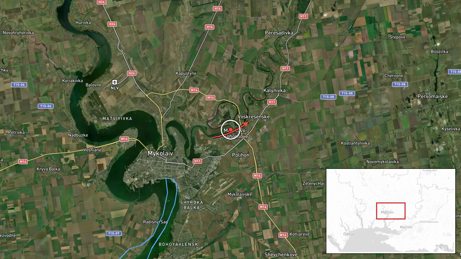
Ukrainian air monitoring reported at 02:45 UTC on 20 October 2026 a group of at least two Russian Shahed-type strike drones moving toward Voskresenske in Mykolaiv Oblast from the south. The sole source is the Telegram channel @kpszsu, which posted the message in Ukrainian, describing a group of strike UAVs approaching the settlement. The summary's terms 'Shahed-type' and 'Russia' reflect the channel's framing and the event classification rather than independent confirmation. The report does not describe impacts, damage, casualties, interceptions, or the drones' final status, and the dataset contains no follow-up update. It is classified as a drone transit, which means the record concerns the movement of aircraft toward an area rather than a confirmed strike.
Context and assessment
Mykolaiv Oblast has been crossed repeatedly by drones in the preceding day. Related reports from 19 October describe single jet-powered Geran-3 drones heading toward northern Mykolaiv Oblast, passing the oblast with a northwest heading, and approaching Ochakiv twice from the Black Sea direction. The pattern is one of recurring single-airframe transits along a corridor that enters from the coast and moves inland. This event differs in size, since it is the first in the set described as a group of two or more and the first named with Voskresenske as its destination. That could indicate a change in tasking, a more concentrated attempt along the same corridor, or simply several airframes flying the same route. Operationally, drones entering from the Black Sea side may be used to probe air defence, saturate defences, or reach infrastructure in the oblast, but the available data cannot establish the intended target. The jet-powered Geran-3 variant is faster than piston-engined models, which would shorten warning times for local populations. These readings remain inferences from the pattern rather than established intent.
Sources and confidence
The event rests on one channel, Telegram @kpszsu, with no cross-confirmation in the dataset. The confidence score of 8.0 reflects the channel's association with Ukraine's Air Force, its routine use for air alerts, and consistency with a series of related reports on the same corridor the previous day. It falls short of the top of the scale because the event relies on a single post, has no independent imagery or wire confirmation, and includes no outcome. The score would rise with matching reports from other Ukrainian official or regional channels, statements from the Mykolaiv regional military administration, or local air alert records. It would fall with a correction, a retraction, or the absence of corresponding alerts in the area.
Location
The coordinates are 47.01334, 32.14542, with precision marked as settlement and location confidence as high, so the point represents the settlement itself rather than a specific facility. Voskresenske lies in Mykolaiv Oblast in southern Ukraine, on flat steppe near the lower Southern Bug, north of the Black Sea coast and the Ochakiv approaches. Notable nearby features include the Southern Bug river system and the broader Mykolaiv area to the northeast.
Related events nearby
- Ukrainian air monitoring: 1 Russian jet-powered Shahed (Geran-3) drone passing Mykolaiv Oblast, heading northw2026-10-19 16:10 UTC · Drone Transit · Mykolaiv Oblast, Ukraine
- Ukrainian air monitoring: 1 Russian jet-powered Shahed (Geran-3) drone passing Mykolaiv district, heading nort2026-10-20 01:36 UTC · Drone Transit · Mykolaiv district, Ukraine
- Ukrainian air monitoring: 1 Russian jet-powered Shahed (Geran-3) drone from Black Sea toward Ochakiv.2026-10-19 20:58 UTC · Drone Transit · Ochakiv, Ukraine
- Ukrainian air monitoring: 1 Russian jet-powered Shahed (Geran-3) drone from Black Sea toward Ochakiv.2026-10-19 06:28 UTC · Drone Transit · Ochakiv, Ukraine
- Ukrainian air monitoring: 1 Russian jet-powered Shahed (Geran-3) drone from Black Sea toward southern Mykolaiv2026-10-19 06:53 UTC · Drone Transit · southern Mykolaiv Oblast, Ukraine
▶ View this event on the live map

Intel Mapper aggregates open-source reports from monitored Telegram and X channels, geolocates them, cross-checks duplicates across sources and assigns a confidence score. Entries are updated as new confirmations arrive. Read how we verify events.