Jet-powered Shahed-type drone reported passing Mykolaiv Oblast, heading northwest
What happened
Ukraine's Air Force monitoring channel on Telegram, @kpszsu, reported one jet-powered Shahed-type drone, described in the post as a Geran-3, passing near Oleksandrivka in Mykolaiv Oblast at about 05:43 UTC on 20 October 2026. The original Ukrainian wording, 'Реактивний БпЛА повз Олександрівку на Миколаївщині', says only that the jet-type UAV moved past the village and was heading in a northwestern direction. The report does not mention impacts, casualties, interceptions or damage, and its summary attributes the drone to Russia. The post is a brief transit notice rather than a strike report. Because the location is given at regional level and the village name is shared by several settlements in Ukraine, the event is treated cautiously.
Context and assessment
Mykolaiv Oblast sits on the northern Black Sea coast between Odesa and Kherson, and its southern districts, including the Ochakiv area, have recently been a recurring route for long-range drones moving inland. The related events show a dense run of transit reports across roughly 24 hours. Two notices on 19 October place a single Geran-3 approaching Ochakiv from the Black Sea, at 06:28 and 20:58 UTC. Another, at 16:10, places one drone passing through Mykolaiv Oblast heading northwest, and a fourth, at 01:36 on 20 October, describes a similar track through Mykolaiv district. The 02:45 report of two or more Shahed-type drones moving from Mykolaiv Oblast toward Voskresenske suggests that more than one aircraft may have used the same corridor overnight. Taken together, the pattern points to repeated sorties that enter from the sea and track northwest across the oblast, possibly toward targets farther inland or along the western approaches. Transit notices do not reveal what the aircraft were aimed at, and the reports cannot confirm intent. The repetition does, however, suggest a sustained corridor rather than an isolated flight.
Sources and confidence
This is a single-source event. The Telegram channel @kpszsu, associated with Ukraine's Air Force monitoring, is the only outlet recorded, and no wire service, Ukrainian media outlet or second monitoring channel is listed as confirming the sighting. The confidence score of 8.0 reflects an official-type origin and a pattern consistent with the related reports, but it is held back by the lack of cross-confirmation and by the brevity of the notice. Confidence would rise if a second monitoring channel, a regional military administration or flight-tracking data confirmed the track, or if the Air Force gave a more precise location. It would fall if the channel corrected the report or if the village could not be matched to the named settlement.
Location
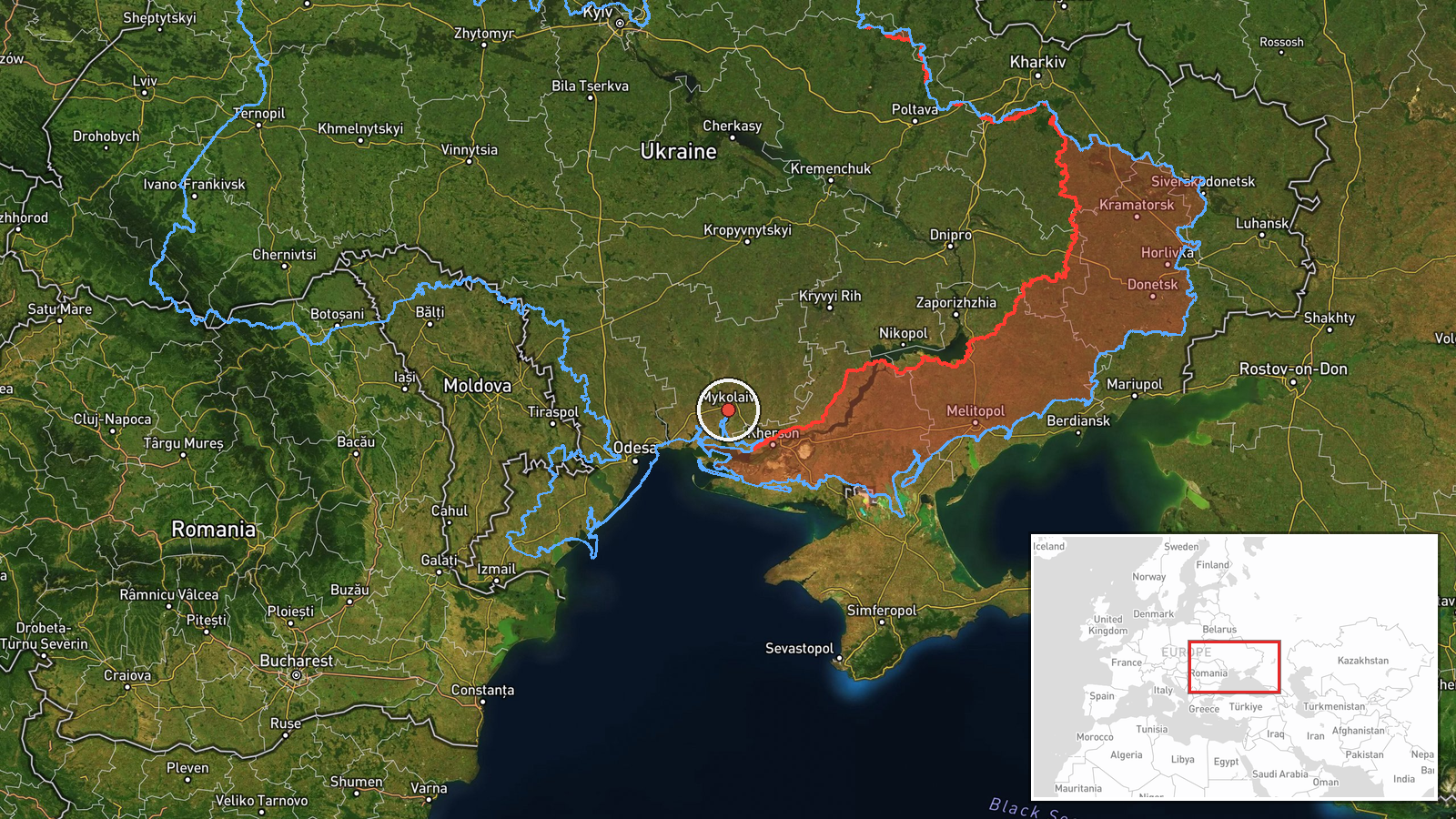
The coordinates (46.97, 32.00) are a region-level placeholder rather than a verified point, and they fall near the city of Mykolaiv instead of the named village. Location confidence is recorded as low. Oleksandrivka is a common settlement name in Ukraine, so the village cannot be matched with certainty. The setting is the flat Black Sea lowland near the Southern Bug and Dnipro-Buh estuary, with the coast lying to the south.
Related events nearby
- Ukrainian air monitoring: 1 Russian Shahed-type drone over Mykolaiv; 1 Russian Shahed-type drone heading towar2026-10-20 06:20 UTC · Drone Transit · Mykolaiv, Ukraine
- Ukrainian air monitoring: 1 Russian jet-powered Shahed (Geran-3) drone passing Mykolaiv Oblast, heading northw2026-10-19 16:10 UTC · Drone Transit · Mykolaiv Oblast, Ukraine
- Ukrainian air monitoring: 1 Russian jet-powered Shahed (Geran-3) drone passing Mykolaiv district, heading nort2026-10-20 01:36 UTC · Drone Transit · Mykolaiv district, Ukraine
- Ukrainian air monitoring: 2+ Russian Shahed-type drones from Mykolaiv Oblast toward Voskresenske.2026-10-20 02:45 UTC · Drone Transit · Voskresenske, Ukraine
- Ukrainian air monitoring: 1 Russian jet-powered Shahed (Geran-3) drone from Black Sea toward Ochakiv.2026-10-19 20:58 UTC · Drone Transit · Ochakiv, Ukraine
▶ View this event on the live map

Intel Mapper aggregates open-source reports from monitored Telegram and X channels, geolocates them, cross-checks duplicates across sources and assigns a confidence score. Entries are updated as new confirmations arrive. Read how we verify events.