Russian Geran-3 jet drone reported transiting eastern Odesa Oblast, heading west
What happened
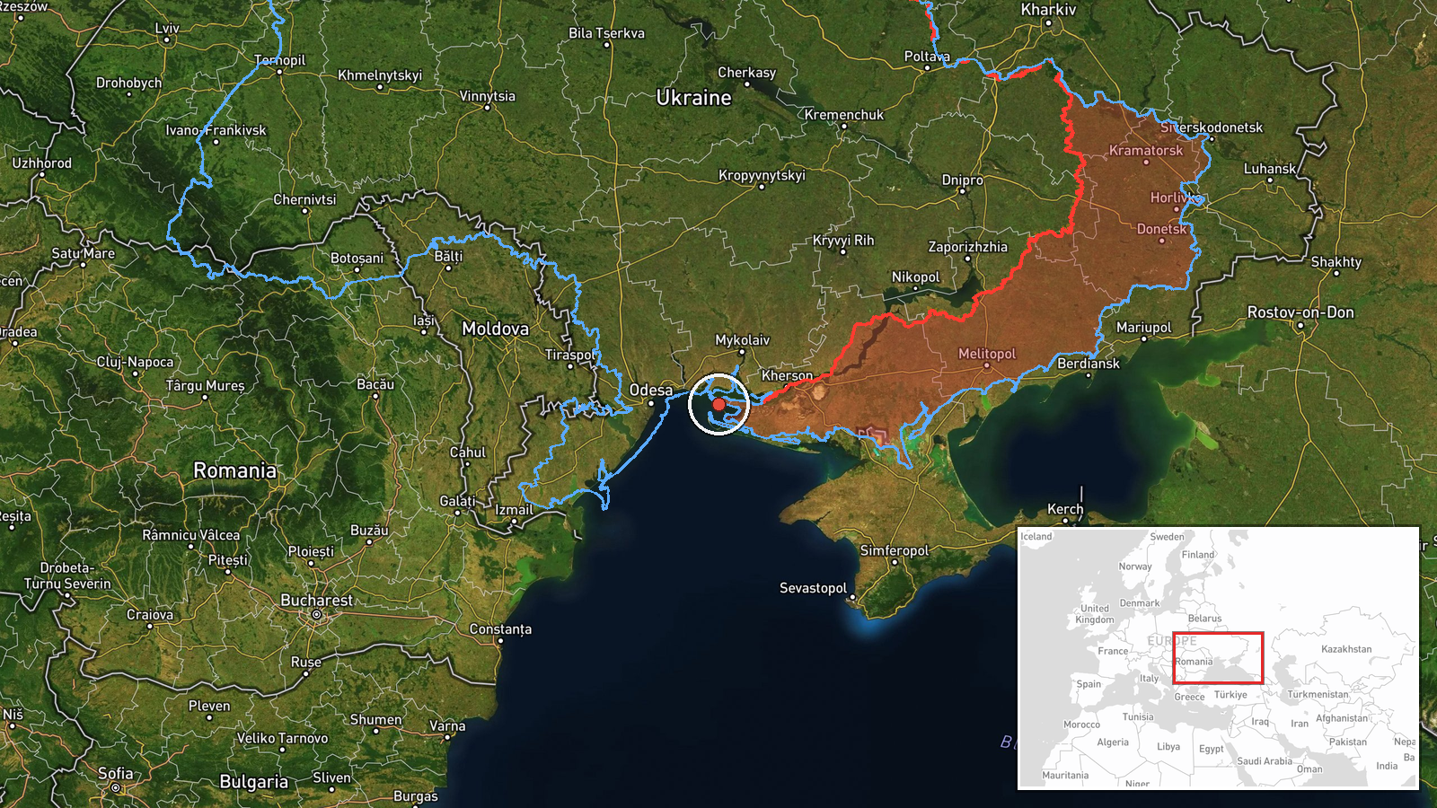
Ukrainian air monitoring, relayed through the Telegram channel @kpszsu, reported one Russian jet-powered Shahed-type drone, described in the channel's wording as a Geran-3, passing through eastern Odesa Oblast in southern Ukraine on a westward heading. The report is timestamped 06:30 UTC on 20 October 2026. The original Ukrainian text describes a jet-type UAV in the east of the Odesa region moving west, without mentioning impacts, casualties, or a target. It is a transit notice rather than a strike report, so it records only the drone's presence and direction. No other channel in the data set carries this specific report.
Context and assessment
Eastern Odesa Oblast lies on the northwestern Black Sea coast, where the port city of Odesa and the surrounding coastal ports give the region considerable economic and logistical weight. It has been a recurring focus of Russian long-range drone activity since 2022. The related events in the data set show a sustained pattern over the preceding day and a half: a drone from the Black Sea heading toward Ochakiv on 19 October at 20:58, a drone from the Black Sea toward southern Mykolaiv Oblast at 06:53 that day, reports at 14:02 of drones on the Odesa-Mykolaiv border heading north, and two drones tracked over Mykolaiv on the morning of 20 October, one of them heading toward Kharkiv. Taken together, these entries suggest a series of single-drone tracks moving through the southwestern coastal belt rather than one coordinated salvo. Operationally, such tracks may indicate reconnaissance, route testing, or drones dispatched toward targets further north or east, though the data cannot confirm which. Because this report describes only a transit, it cannot be tied to a specific target. The westward heading is not necessarily inconsistent with the other tracks, which moved in several directions.
Sources and confidence
The report comes from a single Telegram channel, @kpszsu, which carries Ukrainian Air Force air-alert and monitoring messages. No second channel, official statement, or news outlet in the data set repeats it, so cross-confirmation is absent. The confidence score of 8.0 reflects a routinely used monitoring source with a clear, timestamped message, offset by the lack of corroboration and the transit-only nature of the report. Confidence would rise with a second independent monitoring channel, radar-derived track data, or a later air-alert or debris report in the area. It would fall if the channel later revised the message or if the track proved to involve a different drone type.
Location
The coordinates were assigned at region level rather than to a specific settlement, which is why location confidence is rated low. The report names only eastern Odesa Oblast, so the point marks an approximate position within that area. The region is largely flat steppe with farmland, lagoons, and estuaries along the Black Sea littoral, and the oblast's boundary with Mykolaiv Oblast lies to the northeast. The approximate placement should be treated as indicative only.
Related events nearby
- Ukrainian air monitoring: 1 Russian jet-powered Shahed (Geran-3) drone from Black Sea toward Ochakiv.2026-10-19 20:58 UTC · Drone Transit · Ochakiv, Ukraine
- Ukrainian air monitoring reports jet-powered Shahed (Geran-3) drones on the Odesa-Mykolaiv border, heading nor2026-10-19 14:02 UTC · Drone Transit · Odesa-Mykolaiv Oblast border, Ukraine
- Ukrainian air monitoring: 1 Russian Shahed-type drone over Mykolaiv; 1 Russian Shahed-type drone heading towar2026-10-20 06:20 UTC · Drone Transit · Mykolaiv, Ukraine
- Ukrainian air monitoring: 1 Russian jet-powered Shahed (Geran-3) drone passing Mykolaiv Oblast, heading northw2026-10-20 05:43 UTC · Drone Transit · Mykolaiv Oblast, Ukraine
- Ukrainian air monitoring: 1 Russian jet-powered Shahed (Geran-3) drone passing Mykolaiv Oblast, heading northw2026-10-19 16:10 UTC · Drone Transit · Mykolaiv Oblast, Ukraine
▶ View this event on the live map

Intel Mapper aggregates open-source reports from monitored Telegram and X channels, geolocates them, cross-checks duplicates across sources and assigns a confidence score. Entries are updated as new confirmations arrive. Read how we verify events.