Single Russian Geran-3 jet-powered drone reported heading toward Borodianka, Kyiv Oblast
What happened
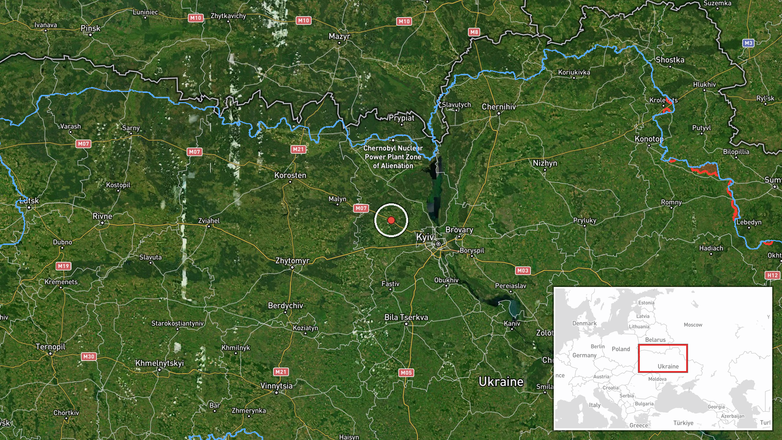
Ukraine's Air Force Telegram channel (@kpszsu) reported at 03:11 UTC on 21 October 2026 that one Russian jet-powered Shahed (Geran-3) drone was heading toward Borodianka, a town in Kyiv Oblast northwest of the capital. The original Ukrainian post used the phrasing 'реактивний БпЛА на Бородянку', meaning a jet-powered unmanned aerial vehicle toward Borodianka, and did not report impact, damage, or casualties. The report is a trajectory warning from air monitoring, not a confirmed strike. It is the only source so far, and no independent outlet has yet repeated or verified it.
Context and assessment
Borodianka sits in the Kyiv Oblast corridor that Russian forces passed through in early 2022, and the town was heavily damaged during that period, which gives it lasting significance in Ukrainian public reporting. The event belongs to a sequence of single-drone transit reports in the same northwestern arc. Earlier that day, similar alerts named Vorzel on 20 October at 09:52 UTC, Makariv at 12:00 UTC, and Hostomel at 13:34 UTC. Overnight into 21 October, reports named Nemishaieve at 02:23 UTC and Irpin at 02:25 UTC, with Borodianka following at 03:11 UTC. The steady progression of towns along one axis, each with a single drone, may indicate a sustained stream of drones routed along a flight path toward the capital region, possibly as part of a broader long-range strike campaign. Single-drone transit reports do not by themselves indicate whether a target is intended at each location, and the sequence does not establish the drones' final destinations.
Sources and confidence
The report comes from one Telegram channel, the Ukrainian Air Force's public monitoring feed, which is a routine and generally reliable channel for aerial threat alerts but is still a single source. Cross-confirmation is absent: no second Ukrainian official channel, regional military administration, or wire service has been identified for this specific alert. The confidence score of 8.0 reflects the channel's established track record for air alerts and the consistency of the broader sequence of reports, offset by the lack of corroboration for this particular message. Confidence would rise with a matching statement from the Kyiv Oblast military administration, reports of an air-defense engagement, or verified imagery of the drone. It would fall if later updates change the drone's heading, if the alert is retracted, or if subsequent reports cannot be matched to the sequence.
Location
The location is a settlement-level match to Borodianka, Kyiv Oblast, with high location confidence. The coordinates (about 50.643 N, 29.923 E) represent the town's centre rather than a specific facility, and the original post named only the settlement. The town lies northwest of Kyiv in a transitional zone of lowland, river valleys, forest belts, and farmland. Major roads and rail lines run through the wider Kyiv Oblast, and the area is typically used as an approach corridor for drones routed toward the capital.
Related events nearby
- Ukrainian air monitoring: 1 Russian jet-powered Shahed (Geran-3) drone over Nemishaieve.2026-10-21 02:23 UTC · Drone Transit · Nemishaieve, Ukraine
- Ukrainian air monitoring: 1 Russian jet-powered Shahed (Geran-3) drone heading toward Vorzel.2026-10-20 09:52 UTC · Drone Transit · Vorzel, Ukraine
- Ukrainian air monitoring: 1 Russian jet-powered Shahed (Geran-3) drone heading toward Makariv.2026-10-20 12:00 UTC · Drone Transit · Makariv, Ukraine
- Ukrainian air monitoring: 1 Russian jet-powered Shahed (Geran-3) drone heading toward Hostomel.2026-10-20 13:34 UTC · Drone Transit · Hostomel, Ukraine
- Ukrainian air monitoring: 1 Russian jet-powered Shahed (Geran-3) drone heading toward Irpin.2026-10-21 02:25 UTC · Drone Transit · Irpin, Ukraine
▶ View this event on the live map

Intel Mapper aggregates open-source reports from monitored Telegram and X channels, geolocates them, cross-checks duplicates across sources and assigns a confidence score. Entries are updated as new confirmations arrive. Read how we verify events.