Single jet-powered Shahed (Geran-3) drone reported heading toward Vorzel, Kyiv Oblast
What happened
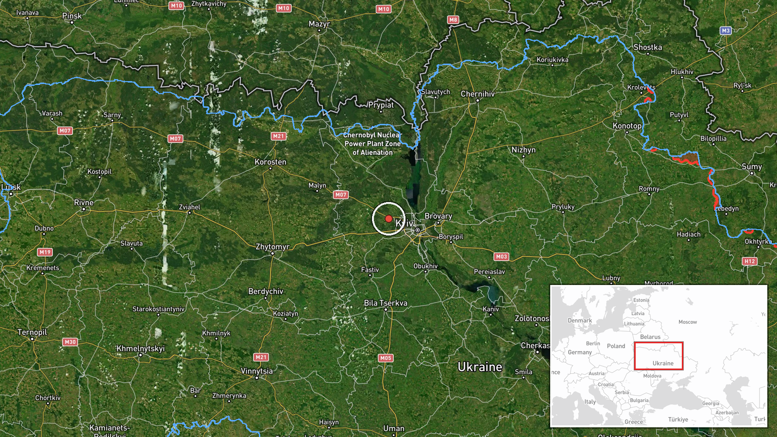
Ukrainian air monitoring reported on Telegram that one Russian jet-powered Shahed (Geran-3) drone was heading toward Vorzel, a settlement in Kyiv Oblast, in an alert timed at 09:52 UTC on 20 October 2026. The original post, written in Ukrainian, describes a jet-type unmanned aerial vehicle on a course toward Vorzel approaching from the northwest. The report is a short monitoring alert rather than an account of impact, and it does not say whether the drone was intercepted, lost from tracking, or struck anything. The summary attributes the drone to Russia. The alert comes from a single source, the @kpszsu Telegram account, and no casualties or damage are mentioned in the data.
Context and assessment
Vorzel sits northwest of Kyiv, on the approaches that run between the capital and the Chernihiv direction, so it is a logical point on the track of drones that enter Ukrainian airspace from the north. The related alerts show a sustained pattern in the same window. Beginning at 23:55 UTC on 19 October, single Geran-3 drones were tracked passing Vyshhorod toward Kyiv, followed by a drone at 06:10 and another from western Chernihiv Oblast toward Kyiv Oblast at 06:22. At 09:49 two or more drones were reported heading toward Kyiv, and at 09:58 one was seen passing Boyarka. The Vorzel alert, issued four minutes after the Boyarka report, fits this sequence of tracks converging on the Kyiv area from several directions. Operationally, this may indicate that some drones are being routed around the city's core toward secondary positions, that the flights are intended to saturate air defenses across several approaches, or that the track was simply updated as the drone moved. Monitoring alerts of this kind often change course in later updates, so the Vorzel report should be read as a track position, not a confirmed target.
Sources and confidence
All information comes from one Telegram channel, @kpszsu, and no second independent source is listed in the data. The channel posts routine air monitoring alerts and its track language is consistent with several related alerts in the same window, which supports a confidence score of 8.0. The score is not higher because there is no cross-confirmation, no official statement tying the drone to a specific impact point, and no imagery or wreckage. Confidence would rise with independent monitoring reports, an official Kyiv Oblast or air force statement, or confirmation of interception or impact near Vorzel. It would fall if later updates contradict the course, if the track is attributed to another area, or if no follow-up reports appear.
Location
The location is recorded at settlement precision, with coordinates of 50.5444 N and 30.15305 E placed at the centre of Vorzel, and location confidence is rated high. Vorzel lies in Kyiv Oblast on the northwestern side of the capital. The terrain is largely flat, with forest belts, small river valleys and the Irpin river corridor to the south and west, and the main road and rail routes that link Kyiv with the north run nearby. Because the alert gives a direction of travel rather than a fixed target, the coordinates identify the settlement the drone was reported heading toward, not a specific facility.
Related events nearby
- Ukrainian air monitoring: 1 Russian jet-powered Shahed (Geran-3) drone heading toward Horenychi.2026-10-20 10:22 UTC · Drone Transit · Horenychi, Ukraine
- Ukrainian air monitoring: 1 Russian jet-powered Shahed (Geran-3) drone heading toward Akademmistechko, Kyiv.2026-10-20 10:20 UTC · Drone Transit · Akademmistechko, Kyiv, Ukraine
- Ukrainian air monitoring: 1 Russian jet-powered Shahed (Geran-3) drone from Kyiv Oblast toward Vyshneve.2026-10-20 10:40 UTC · Drone Transit · Vyshneve, Ukraine
- Ukrainian air monitoring: 1 Russian jet-powered Shahed (Geran-3) drone heading toward Shuliavka, Kyiv.2026-10-20 10:20 UTC · Drone Transit · Shuliavka, Kyiv, Ukraine
- Ukrainian air monitoring: 1 Russian jet-powered Shahed (Geran-3) drone heading toward Zhuliany, Kyiv.2026-10-20 10:24 UTC · Drone Transit · Zhuliany, Kyiv, Ukraine
▶ View this event on the live map

Intel Mapper aggregates open-source reports from monitored Telegram and X channels, geolocates them, cross-checks duplicates across sources and assigns a confidence score. Entries are updated as new confirmations arrive. Read how we verify events.