Ukrainian Air Force reports jet-powered Shahed drone tracked toward Vyshneve, Kyiv Oblast
What happened
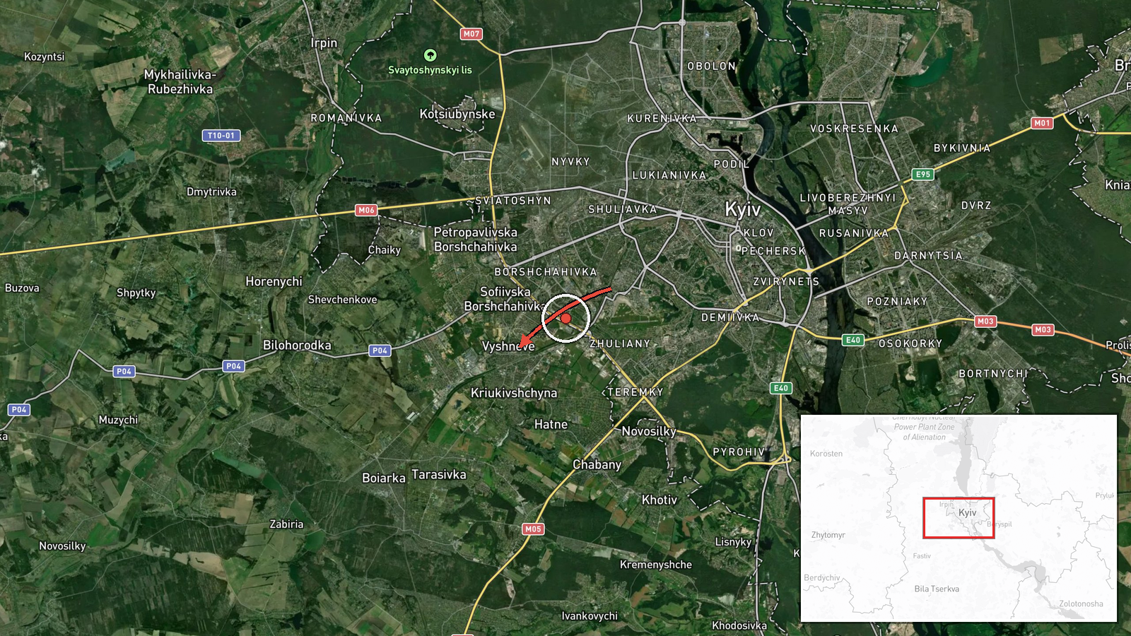
Ukraine's Air Force monitoring channel on Telegram, @kpszsu, reported at about 10:40 UTC on 20 October 2026 that one jet-powered Shahed-type drone, identified as a Geran-3, was moving through Kyiv Oblast on a course toward Vyshneve, a settlement on the western approaches to the capital. The original post, written in Ukrainian, described a jet-type unmanned aerial vehicle in the Kyiv region heading toward Vyshneve and did not state any strike, impact, or casualties. The report is a transit notice that records a track and a stated direction, not a confirmed attack on the town. Five other drone-transit reports using the same Geran-3 wording were logged between 10:20 and 10:55 UTC for other Kyiv-area locations.
Context and assessment
Vyshneve lies on the western edge of the Kyiv metropolitan area, so a drone tracked toward it is effectively approaching the capital's outer belt, where residential districts, transport routes and industrial sites sit close together. The related reports show the same pattern: within roughly 35 minutes, separate notices named Akademmistechko, Zhuliany and Teremky inside Kyiv city, and Sovky and Chabany in the surrounding oblast. Each report carries a single drone and a different nominal destination, which suggests a sustained stream of tracks spread across the capital's perimeter rather than one concentrated target. The jet-powered Geran-3 is faster and harder to intercept than earlier piston-engine Shahed variants, which explains why monitoring posts emphasise the propulsion type. Operationally, a spread of tracks like this may be intended to stretch air defence coverage and reaction time, or it may reflect a larger salvo whose individual drones were assigned different aim points. The data alone cannot confirm either explanation, and the transit notices do not establish what, if anything, was struck.
Sources and confidence
The report rests on a single channel, @kpszsu, the official Ukrainian Air Force monitoring account, which is widely relayed by Ukrainian media and open-source monitors. No second independent source appears in the data, and no local authority, imagery or other feed confirms the track. The confidence score of 8.0 reflects the official origin and the specific, consistent wording across related posts, but it is held below the top range because it is single-sourced and the outcome is unverified. Independent confirmation from regional officials, flight-tracking or radar-based feeds, or imagery of the area would raise confidence. Contradictory tracks, a correction, or absence of any follow-up from local authorities would lower it. The record is not marked as corrected.
Location
The location is recorded at settlement precision with high location confidence, meaning the coordinates point to the town of Vyshneve rather than a specific facility or street. Vyshneve is a town in Kyiv Oblast on the western edge of the capital's metropolitan area. The surrounding terrain is largely flat, with forest belts, rivers and suburban housing and transport corridors leading toward Kyiv city. Several of the related report locations, including Chabany and Sovky, lie in the same general western and northwestern sector of the oblast.
Related events nearby
- Ukrainian air monitoring: 1 Russian jet-powered Shahed (Geran-3) drone heading toward Borshchahivka, Kyiv.2026-10-20 11:04 UTC · Drone Transit · Borshchahivka, Kyiv, Ukraine
- Ukrainian air monitoring: 1 Russian jet-powered Shahed (Geran-3) drone heading toward Zhuliany, Kyiv.2026-10-20 11:05 UTC · Drone Transit · Zhuliany, Kyiv, Ukraine
- Ukrainian air monitoring: 1 Russian jet-powered Shahed (Geran-3) drone heading toward Zhuliany, Kyiv.2026-10-20 10:24 UTC · Drone Transit · Zhuliany, Kyiv, Ukraine
- Ukrainian air monitoring: 1 Russian jet-powered Shahed (Geran-3) drone heading toward Teremky, Kyiv.2026-10-20 10:55 UTC · Drone Transit · Teremky, Kyiv, Ukraine
- Ukrainian air monitoring: 1 Russian jet-powered Shahed (Geran-3) drone heading toward Chabany.2026-10-20 10:48 UTC · Drone Transit · Chabany, Ukraine
▶ View this event on the live map

Intel Mapper aggregates open-source reports from monitored Telegram and X channels, geolocates them, cross-checks duplicates across sources and assigns a confidence score. Entries are updated as new confirmations arrive. Read how we verify events.