Jet-powered Geran-3 drone reported heading toward Chabany near Kyiv, per Ukrainian air monitoring
What happened
Ukrainian air monitoring reported one Russian jet-powered Shahed-type drone, identified as a Geran-3, on a course toward Chabany, a settlement in Kyiv Oblast. The event was logged at 10:48 UTC on 20 October 2026. The original Ukrainian-language post, published by the official Air Force Telegram channel @kpszsu, described the drone as moving toward Chabany and Kyiv, so the report names the city as the broader direction of travel rather than a confirmed impact point. The post reports a track, not an strike outcome, and no damage, casualties or interceptions are described in the material available.
Context and assessment
Chabany lies just outside the Ukrainian capital, and by the listed coordinates it sits roughly a dozen kilometres south-southwest of central Kyiv. The report fits a cluster of similar transit alerts issued within about thirty minutes that morning. Related entries place single Geran-3 drones heading toward Zhuliany at 10:24 UTC, Boyarka at 10:34, Vyshneve at 10:40 (described as coming from Kyiv Oblast), Sovky at 10:42, and Teremky at 10:55. Taken together, these suggest several separate tracks converging on the Kyiv area rather than one drone moving through a single corridor. Operationally, a sequence of individually tracked jet-powered drones approaching the capital from different directions may indicate a sustained, distributed launch rather than a single raid. Such patterns are commonly used to saturate air defence attention and sensor coverage, though the data alone cannot confirm intent or target selection.
Sources and confidence
The report rests on a single Telegram channel, @kpszsu, which is the official Ukrainian Air Force account and is generally regarded as a primary source for air-threat warnings. No independent outlet in the provided data cross-confirms this specific track. The confidence score of 8.0 reflects the channel's official standing and the consistency with related alerts that morning, but it is held below the maximum because the entry is unconfirmed by a second source and describes a heading rather than an observed position. Confidence would rise with corroboration from radar-based reporting, regional military administration statements, or later updates confirming the drone's path. It would fall if the track were withdrawn, revised, or contradicted by subsequent official updates.
Location
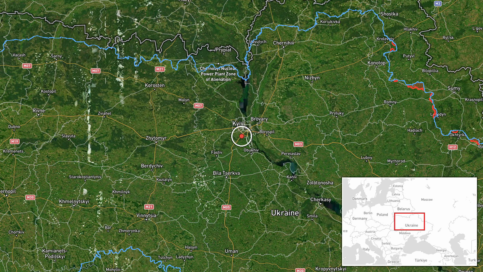
The location is recorded at settlement level for Chabany in Kyiv Oblast, with high location confidence in the dataset. The coordinates, approximately 50.341 north and 30.429 east, place the point to the south-west of the capital, in a largely flat, agricultural and suburban belt. The area sits within reach of the Dnipro river valley and the outer ring of Kyiv's suburbs, where several neighbouring settlements appear in the same alert series. Because the source describes a heading toward Chabany and Kyiv, the marker reflects the named settlement as the reference point for the track, not a surveyed impact site.
Related events nearby
- Ukrainian air monitoring: 1 Russian jet-powered Shahed (Geran-3) drone heading toward Teremky, Kyiv.2026-10-20 10:55 UTC · Drone Transit · Teremky, Kyiv, Ukraine
- Ukrainian air monitoring: 1 Russian jet-powered Shahed (Geran-3) drone heading toward Zhuliany, Kyiv.2026-10-20 11:31 UTC · Drone Transit · Zhuliany, Kyiv, Ukraine
- Ukrainian air monitoring: 1 Russian jet-powered Shahed (Geran-3) drone heading toward Zhuliany, Kyiv.2026-10-20 11:05 UTC · Drone Transit · Zhuliany, Kyiv, Ukraine
- Ukrainian air monitoring: 1 Russian jet-powered Shahed (Geran-3) drone heading toward Zhuliany, Kyiv.2026-10-20 10:24 UTC · Drone Transit · Zhuliany, Kyiv, Ukraine
- Ukrainian air monitoring: 1 Russian jet-powered Shahed (Geran-3) drone from Kyiv Oblast toward Vyshneve.2026-10-20 10:40 UTC · Drone Transit · Vyshneve, Ukraine
▶ View this event on the live map

Intel Mapper aggregates open-source reports from monitored Telegram and X channels, geolocates them, cross-checks duplicates across sources and assigns a confidence score. Entries are updated as new confirmations arrive. Read how we verify events.