Air force reports jet-powered Russian Shahed drone heading toward Zhuliany, Kyiv
What happened
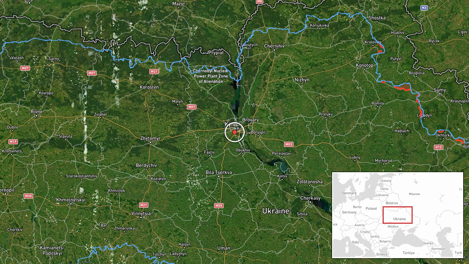
On 20 October 2026, at about 11:31 UTC, the Telegram channel of the Ukrainian Air Force (@kpszsu) posted a short air-monitoring alert. The original Ukrainian text reads 'Реактивний БпЛА курсом на Жуляни', which translates roughly as a jet-powered unmanned aerial vehicle on course for Zhuliany. The English summary identifies it as a single Russian jet-powered Shahed, designated Geran-3, heading toward Zhuliany, a district on the western side of Kyiv. The post does not report impact, casualties, or interception, and it gives no altitude or speed. The alert is one of several logged that morning as drones moved toward Kyiv and its outskirts, and it describes a drone in transit rather than a confirmed strike.
Context and assessment
Zhuliany matters mainly because of its location. It sits on the western edge of the capital and is home to an airfield, so it is a plausible reference point for air-defence tracking as well as a populated residential area. The related entries show a short sequence of similar transit alerts between 10:24 and 11:05 UTC, naming Vyshneve in Kyiv Oblast, Sovky, Teremky in western Kyiv, and Zhuliany again. Taken together, the sequence suggests individual drones or small groups converging on the Kyiv area from the west and northwest over roughly forty minutes. Two entries carry the same Zhuliany wording at 10:24 and 11:05, which may reflect repeated tracking updates or separate drones; the data does not say which. The Geran-3 is a jet-powered variant of the Shahed design and is generally understood to be faster than the earlier piston-engined models, which would shorten the warning window for civilians and defenders. Operationally, a spread of named waypoints around the capital is consistent with reconnaissance, saturation, or decoy activity, but the alerts alone do not reveal the intended target or the planned sequence.
Sources and confidence
The event rests on one channel, the official Telegram account of the Ukrainian Air Force that publishes aerial threat alerts. Its origin is credible for this type of warning, and the aircraft type and direction are specific, which supports the confidence score of 8.0. However, no second source in the data independently confirms the track, and the record is not corrected. The score is held below the maximum because the report is single-channel and does not describe an outcome. Confidence would rise with corroboration from Kyiv city or regional military administrations, a later impact or interception report, or wreckage reports from the area. It would fall if the alert were amended, withdrawn, or contradicted by air-monitoring updates.
Location
The location is recorded at settlement precision with high location confidence. The coordinates of 50.4 N and 30.45 E are an approximate centre point for Zhuliany rather than a specific street or facility. Zhuliany lies on the western side of Kyiv, a city that the Dnipro River divides, with the river running to the east of this district. The area includes the Zhuliany airport complex and residential neighbourhoods close to the city's western boundary, so an alert naming it may refer to either a flight-path reference point or a broader area of the city.
Related events nearby
- Ukrainian air monitoring: 1 Russian jet-powered Shahed (Geran-3) drone heading toward Zhuliany, Kyiv.2026-10-20 11:05 UTC · Drone Transit · Zhuliany, Kyiv, Ukraine
- Ukrainian air monitoring: 1 Russian jet-powered Shahed (Geran-3) drone heading toward Zhuliany, Kyiv.2026-10-20 10:24 UTC · Drone Transit · Zhuliany, Kyiv, Ukraine
- Ukrainian air monitoring: 1 Russian jet-powered Shahed (Geran-3) drone heading toward Sovky.2026-10-20 10:42 UTC · Drone Transit · Sovky, Ukraine
- Ukrainian air monitoring: 1 Russian jet-powered Shahed (Geran-3) drone heading toward Teremky, Kyiv.2026-10-20 10:55 UTC · Drone Transit · Teremky, Kyiv, Ukraine
- Ukrainian air monitoring reports Russian jet-powered Shahed (Geran-3) drones tracked over Shuliavka and the Mi2026-10-20 12:08 UTC · Drone Transit · Shuliavka, Kyiv, Ukraine
▶ View this event on the live map

Intel Mapper aggregates open-source reports from monitored Telegram and X channels, geolocates them, cross-checks duplicates across sources and assigns a confidence score. Entries are updated as new confirmations arrive. Read how we verify events.