Ukrainian monitoring reports jet-powered Shahed drone heading toward Lozova, Kharkiv Oblast
What happened
Ukrainian air monitoring reported on Telegram, through the channel @kpszsu, that one Russian jet-powered Shahed, described in the post as a Geran-3, was heading toward Lozova in Kharkiv Oblast. The message was posted at 04:27 UTC on 21 October 2026 and is logged as a drone transit, not a confirmed impact. The Ukrainian wording is terse, announcing a jet-powered drone bound for Lozova, and gives no altitude, speed, or expected time of arrival. The report describes only the direction of travel. The source material records no strike, damage, or casualties, and none are described here.
Context and assessment
Lozova is a rail junction in Kharkiv Oblast, a transport node whose importance to regional movement and logistics makes it a recurring name in air-alert reporting. The related events show a sequence over the previous day. At 08:53 UTC on 20 October, Ukrainian monitoring reported at least three Banderol mini cruise missiles moving from Kharkiv Oblast toward Lozova. At 09:00, a separate cruise missile was reported heading toward Pavlohrad, a city in neighbouring Dnipropetrovsk Oblast, and at 16:14 at least two Geran-3 drones were reported toward Pavlohrad. The pattern is a mix of low-signature cruise missiles and faster jet-powered drones directed at two separate localities within roughly a day. Operationally, combining weapon types and arrival profiles is often read as a way of stretching air defence coverage, though a single alert cannot establish intent. The drone report here may represent a follow-on wave, a diversion, or an independent sortie. Because the Geran-3 is jet-powered and generally faster than the older piston-engine Shahed variants, the timing window for interception is typically shorter, which is why transit alerts of this kind matter to local defenders and residents.
Sources and confidence
The report comes from one Telegram channel, @kpszsu, and no other outlet or channel in the provided data carries the same alert. The channel posts short, timestamped air-monitoring notices, which lends the message a routine, operational character, and the related Lozova and Pavlohrad alerts from the same day are consistent with it. Even so, the confidence score of 8.0 reflects a single-source transit alert with no imagery, no confirmed impact, and no independent verification. Confidence would rise with corroboration from Kharkiv regional authorities, other monitoring channels, or reports of air-raid alerts, explosions, or debris in Lozova. It would fall if the alert were updated or withdrawn, or if officials reported the drone was destroyed elsewhere or never entered Ukrainian airspace near the town.
Location
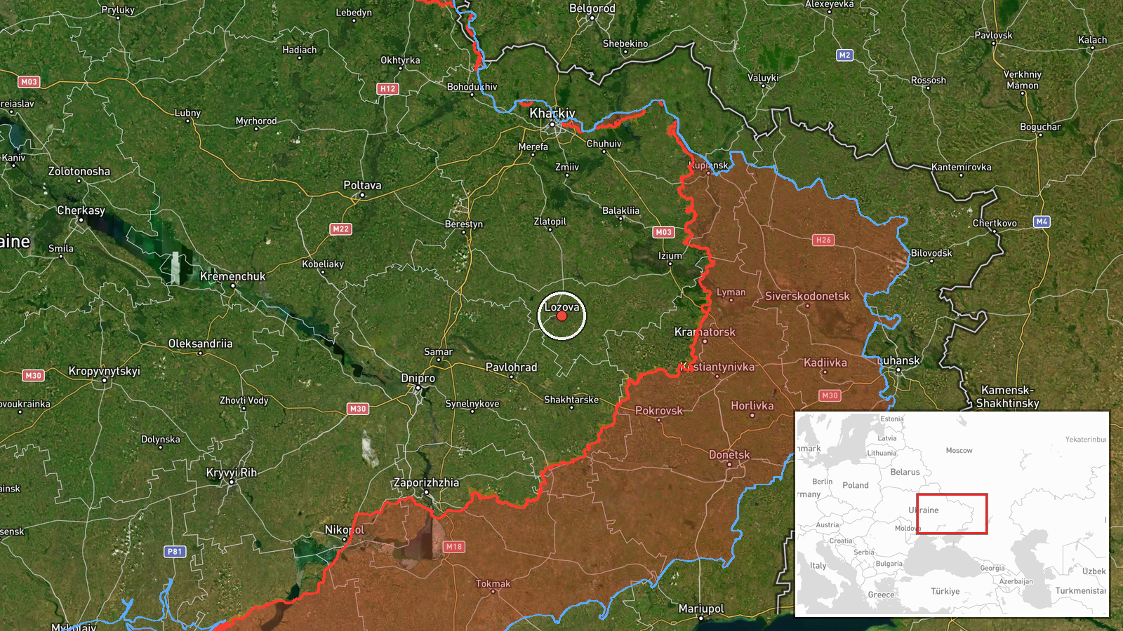
The coordinates correspond to the settlement of Lozova, which is the location named in the report. The precision is recorded as settlement level, not facility level, so the point marks the town rather than any specific installation. Lozova lies in the southwest of Kharkiv Oblast on open steppe typical of the region, where farmland and the railway network are the dominant features. Because drones can be engaged or can fall well away from their stated target, the point should be read as the town centre, not as the precise aim point.
Related events nearby
- Ukrainian air monitoring: 3+ Russian Banderol mini cruise missiles from Kharkiv Oblast toward Lozova.2026-10-20 08:53 UTC · Cruise Missile · Lozova, Ukraine
- Ukrainian air monitoring: 2+ Russian jet-powered Shahed (Geran-3) drones heading toward Pavlohrad.2026-10-20 16:14 UTC · Drone Transit · Pavlohrad, Ukraine
- Ukrainian air monitoring: 1 Russian Banderol mini cruise missile heading toward Pavlohrad.2026-10-20 09:00 UTC · Cruise Missile · Pavlohrad, Ukraine
- Ukrainian General Staff reports 37 Russian attacks on the Kostiantynivka axis, with offensive pressure toward 2026-10-21 05:05 UTC · Combat · Dobropillia, Donetsk, Ukraine
- Social media post shows an African national fighting in the Russian army, demonstrating trench-clearing skills2026-10-20 07:38 UTC · Combat · Near Dobropillya, Donetsk, Ukraine (front line, es
▶ View this event on the live map

Intel Mapper aggregates open-source reports from monitored Telegram and X channels, geolocates them, cross-checks duplicates across sources and assigns a confidence score. Entries are updated as new confirmations arrive. Read how we verify events.