Ukrainian air monitoring reports two or more Russian Geran-3 drones heading toward Pavlohrad
What happened
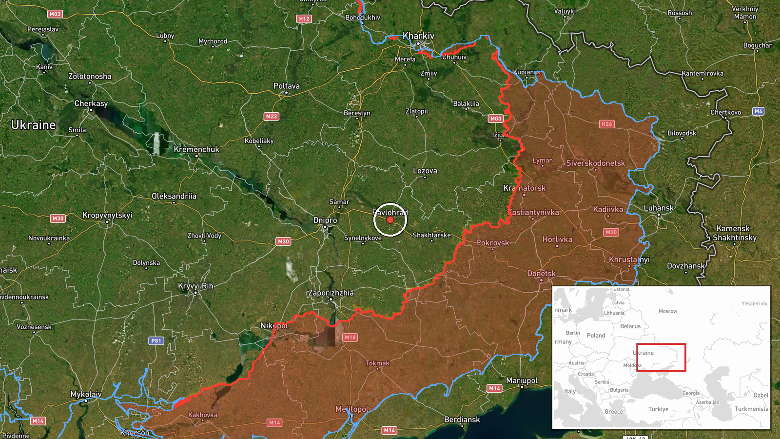
A Ukrainian air monitoring alert posted on Telegram by @kpszsu on 20 October 2026 at 16:14 UTC reported that two or more Russian jet-powered Shahed-type drones, identified in the post as Geran-3, were heading toward Pavlohrad. The original Ukrainian wording, roughly translated, says jet-type unmanned aerial vehicles are heading for Pavlohrad from the southeast. The post is a brief transit alert and describes no impacts, damage, or casualties. The phrase 'two or more' means the exact number was not fixed in the report. The event is logged as a Drone Transit, meaning an aerial object moving toward or through an area rather than a confirmed strike. Pavlohrad lies in Dnipropetrovsk Oblast, and this alert was one of several drone and missile warnings logged across the region that day.
Context and assessment
Pavlohrad has appeared repeatedly in the related events. Earlier on 19 October, a single Geran-3 drone was reported moving from Dnipropetrovsk Oblast toward Samar, and another was reported heading toward Pavlohrad that evening. Overnight and early on 20 October, two or more jet-powered drones were reported passing the Synelnykove district, first heading northwest, followed by a further report of Shahed-type drones over the same district. At 09:00 a Banderol mini cruise missile was reported heading toward Pavlohrad, and the current alert follows about seven hours later. The sequence suggests a sustained series of inbound tracks over a short period, combining jet-powered drones with a cruise missile. Operationally, repeated tracks toward the same city may indicate either persistent targeting of local infrastructure or a flight corridor that passes over it on the way to other objectives. Mixing drone types and a missile within one day could point to a deliberate saturation approach, though the monitoring data alone cannot show intent or the intended target.
Sources and confidence
The report rests on a single Telegram channel, @kpszsu, which is widely associated with Ukraine's air force monitoring. No independent outlet, regional official, or second channel in the data confirms the alert, so cross-confirmation is currently absent. The confidence score of 8.0 reflects the channel's official monitoring role and the consistency of the alert with the surrounding related events, which describe the same type of drone moving through the same area. Confidence would rise with corroboration from regional authorities, flight-tracking or radar data, or reports of explosions or damage in Pavlohrad. It would fall if later updates retracted or revised the track, or if no subsequent reporting matched the warning.
Location
The location is recorded at settlement level, with the coordinates set to the city of Pavlohrad, and location confidence is rated high. Pavlohrad is a city in Dnipropetrovsk Oblast in east-central Ukraine, on open steppe terrain that is typical of the region. The nearby Synelnykove district lies to the west and Samar to the east, both appearing in the related events. The alert describes the approach as coming from the southeast, which fits the drone tracks reported earlier across this part of the oblast.
Related events nearby
- Ukrainian air monitoring: 1 Russian Banderol mini cruise missile heading toward Pavlohrad.2026-10-20 09:00 UTC · Cruise Missile · Pavlohrad, Ukraine
- Ukrainian air monitoring: 1 Russian jet-powered Shahed (Geran-3) drone heading toward Pavlohrad.2026-10-19 21:21 UTC · Drone Transit · Pavlohrad, Ukraine
- Ukrainian air monitoring: 2+ Russian Shahed-type drones over Synelnykove district.2026-10-20 05:24 UTC · Drone Transit · Synelnykove district, Ukraine
- Ukrainian air monitoring: 2+ Russian jet-powered Shahed (Geran-3) drones passing Synelnykove district, heading2026-10-20 01:34 UTC · Drone Transit · Synelnykove district, Ukraine
- Ukrainian air monitoring: 3+ Russian Banderol mini cruise missiles from Kharkiv Oblast toward Lozova.2026-10-20 08:53 UTC · Cruise Missile · Lozova, Ukraine
▶ View this event on the live map

Intel Mapper aggregates open-source reports from monitored Telegram and X channels, geolocates them, cross-checks duplicates across sources and assigns a confidence score. Entries are updated as new confirmations arrive. Read how we verify events.