Single jet-powered Shahed (Geran-3) drone reported heading toward Kotsyubynske, Kyiv Oblast
What happened
Ukrainian air monitoring channel @kpszsu reported on Telegram that one Russian jet-powered Shahed, identified as a Geran-3, was heading toward Kotsyubynske, a settlement in Kyiv Oblast, at about 04:47 UTC on 21 October 2026. The original post is a brief Ukrainian-language alert describing a jet drone ("реактивний БпЛА") bound for the settlement, with no mention of impact, casualties or damage. The report describes a transit warning rather than a confirmed strike, and the source attributes the drone to Russia based on its type. Ukrainian air force alerts of this kind typically report the drone's track and heading as it moves, and the update may or may not have been followed by further messages.
Context and assessment
Kotsyubynske lies on the northwestern outskirts of Kyiv, close to the Irpin and Bucha corridor, so a drone tracked toward it is effectively on a path toward the capital's immediate periphery. The related events show a sustained pattern over the previous day and a half: single Geran-3 transit alerts were logged toward Akademmistechko, Sviatoshyn and Vynohradar in Kyiv on 20 October, and toward Irpin twice, at 11:14 and 02:25 on 21 October, with one of those described as coming from Kyiv Oblast. Taken together, the sequence suggests drones moving through or around the Kyiv area in a rolling pattern rather than a single isolated launch. Single-drone tracks of this kind are often associated with reconnaissance, saturation testing of air defence coverage, or attacks on distributed targets, though the data alone cannot establish which purpose applies here. Jet-powered variants are generally faster and harder to intercept than piston-engine Shaheds, which is why such alerts receive attention.
Sources and confidence
The event rests on a single Telegram channel, @kpszsu, which is linked to Ukrainian air force monitoring. No second outlet in the data independently confirms the Kotsyubynske track. The related events come from the same type of source, so they reinforce the pattern but do not add independent verification of this particular report. The confidence score of 8.0 reflects a credible official-linked channel with a consistent record across nearby alerts, offset by single-source status and the absence of any outcome reporting. Confidence would rise with corroboration from a second monitoring channel, local Kyiv Oblast authorities, or a track confirmation. It would fall if the drone was later reclassified or the alert was withdrawn.
Location
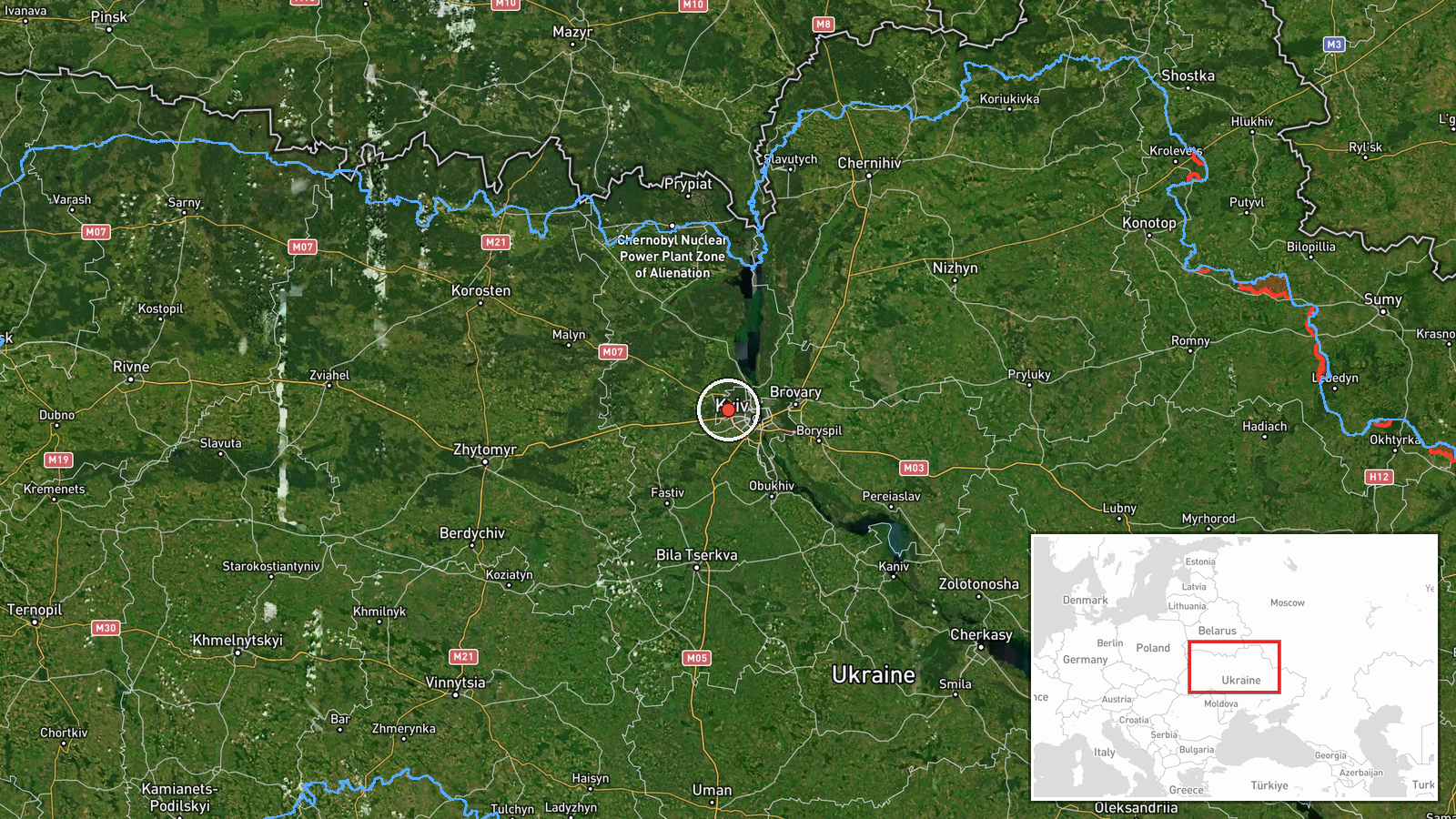
The location is a settlement-level match to Kotsyubynske, Kyiv Oblast, with coordinates near 50.488 N, 30.330 E and a high location confidence. The point reflects the settlement centre rather than a specific facility, since the source names only the community. Kotsyubynske sits in the Irpin river basin on the northwestern edge of the Kyiv metropolitan area, with open suburban terrain, forest belts and the Irpin corridor to the south and west. The settlement's position makes it a plausible waypoint on approaches toward the capital.
Related events nearby
- Ukrainian air monitoring: 1 Russian jet-powered Shahed (Geran-3) drone heading toward Kotsyubynske.2026-10-21 05:51 UTC · Drone Transit · Kotsyubynske, Ukraine
- Ukrainian air monitoring: 1 Russian jet-powered Shahed (Geran-3) drone heading toward Akademmistechko, Kyiv.2026-10-20 10:20 UTC · Drone Transit · Akademmistechko, Kyiv, Ukraine
- Ukrainian air monitoring: 1 Russian jet-powered Shahed (Geran-3) drone heading toward Sviatoshyn, Kyiv.2026-10-20 12:28 UTC · Drone Transit · Sviatoshyn, Kyiv, Ukraine
- Ukrainian air monitoring: 1 Russian jet-powered Shahed (Geran-3) drone heading toward Vynohradar, Kyiv.2026-10-21 05:07 UTC · Drone Transit · Vynohradar, Kyiv, Ukraine
- Ukrainian air monitoring: 1 Russian jet-powered Shahed (Geran-3) drone heading toward Vynohradar, Kyiv.2026-10-20 14:26 UTC · Drone Transit · Vynohradar, Kyiv, Ukraine
▶ View this event on the live map

Intel Mapper aggregates open-source reports from monitored Telegram and X channels, geolocates them, cross-checks duplicates across sources and assigns a confidence score. Entries are updated as new confirmations arrive. Read how we verify events.