Russian jet-powered Shahed drone reported in transit toward Mykolaiv from the north
What happened
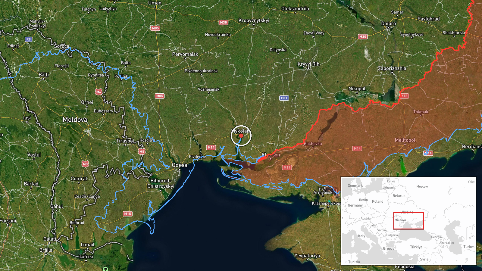
Ukraine's Air Force monitoring channel on Telegram (@kpszsu) reported one Russian jet-powered Shahed-type drone, identified in the report as a Geran-3, heading toward Mykolaiv from the north. The post is timestamped 21 October 2026 at 06:13 UTC. The original Ukrainian wording describes a jet-type UAV approaching Mykolaiv from the north. The report does not mention impacts, damage or casualties, and it gives no altitude, speed or interception outcome. Because the entry records only a transit warning, the event describes an aircraft in flight rather than a confirmed strike on the city.
Context and assessment
Mykolaiv is a major city on the Southern Bug estuary in southern Ukraine, with port, shipbuilding and industrial facilities, and it lies along the approach routes that Russian long-range drones have used toward the Black Sea coast and the Odesa-Mykolaiv axis. The related entries show the same airframe type moving through the region over about 24 hours. On 20 October, a Geran-3 was reported passing eastern Odesa Oblast heading west at 06:30 UTC. Later that day, reports placed a drone heading toward or passing Berezanka at 07:46, 08:44 and 10:11 UTC, with the last describing it heading northwest. Early on 21 October, a drone was reported over Ochakiv at 04:10 UTC. Taken together, the sequence is consistent with one or more drones repeatedly crossing the same corridor, possibly repositioning or being tracked across several monitoring points. The reports share a location pattern and aircraft type, but they do not confirm a single continuous track. Analysts should read the cluster as a sign of sustained drone activity in the area rather than evidence of a specific target.
Sources and confidence
The event rests on one channel, the official Telegram feed of Ukraine's Air Force (@kpszsu), which posts routine air alerts and drone tracking updates. No second outlet in the data independently confirms the Mykolaiv report, so it is recorded as single-source. The confidence score of 8.0 reflects the channel's official standing and the consistency of the surrounding reports, offset by the lack of independent corroboration and the absence of any reported impact. Confidence would rise with a second official or regional military administration post, air defence confirmation, or local reports of sound or debris. It would fall if later updates show a different track or that the drone never reached the city's airspace.
Location
The coordinates (46.97 N, 32.00 E) are at settlement precision and place the marker at the city of Mykolaiv, matching the named target; location confidence is rated high. Mykolaiv sits on the Southern Bug near its estuary toward the Dnipro-Bug limans, a short distance inland from the Black Sea coast. The surrounding terrain is flat steppe, with river channels, port infrastructure and shipyards in and around the city.
Related events nearby
- Ukrainian air monitoring: 1 Russian jet-powered Shahed (Geran-3) drone passing Berezanka, heading northwest.2026-10-20 10:11 UTC · Drone Transit · Berezanka, Ukraine
- Ukrainian air monitoring: 1 Russian jet-powered Shahed (Geran-3) drone passing Berezanka, heading northwest.2026-10-20 08:44 UTC · Drone Transit · Berezanka, Ukraine
- Ukrainian air monitoring: 1 Russian jet-powered Shahed (Geran-3) drone heading toward Berezanka.2026-10-20 07:46 UTC · Drone Transit · Berezanka, Ukraine
- Ukrainian air monitoring: 1 Russian jet-powered Shahed (Geran-3) drone over Ochakiv.2026-10-21 04:10 UTC · Drone Transit · Ochakiv, Ukraine
- Ukrainian air monitoring: 1 Russian jet-powered Shahed (Geran-3) drone passing southern Mykolaiv Oblast, headi2026-10-20 07:30 UTC · Drone Transit · southern Mykolaiv Oblast, Ukraine
▶ View this event on the live map

Intel Mapper aggregates open-source reports from monitored Telegram and X channels, geolocates them, cross-checks duplicates across sources and assigns a confidence score. Entries are updated as new confirmations arrive. Read how we verify events.