Ukrainian air monitoring reports one jet-powered Shahed drone transiting southern Mykolaiv Oblast
What happened
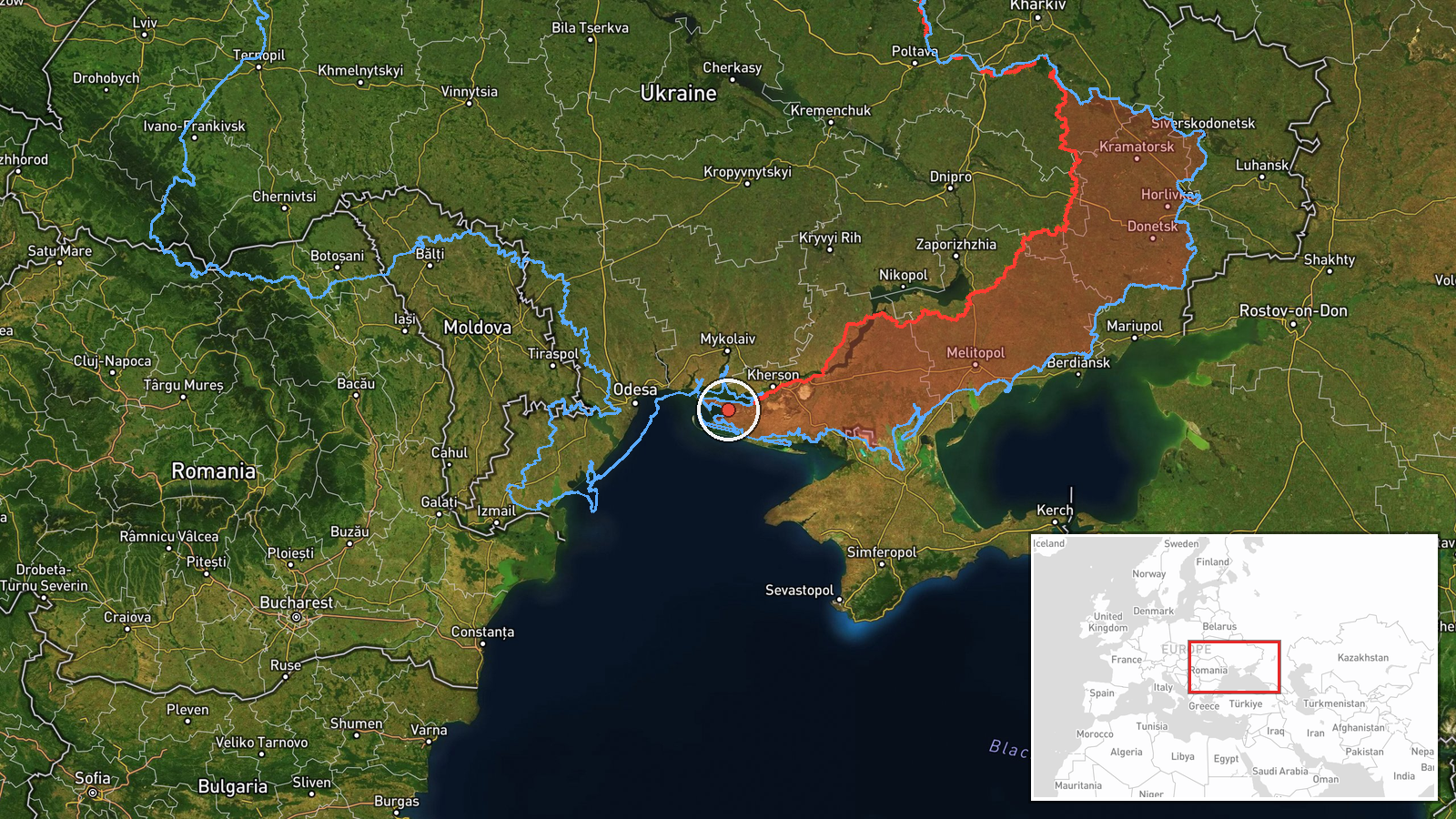
Ukraine's air force monitoring channel on Telegram, @kpszsu, reported on 20 October 2026 at 07:30 UTC that one jet-powered Shahed-type drone, which the post identifies as a Geran-3, was passing over the southern part of Mykolaiv Oblast on a west or northwest heading. The original Ukrainian-language post describes it as a reactive unmanned aircraft and gives only a general area rather than a settlement. The report does not mention impacts, casualties, or air defence engagement, and it does not say whether the drone was intercepted or left the area. The event is classified as a drone transit, meaning a sighting of an aircraft in flight rather than a confirmed strike. Attribution to Russia reflects the post's identification of the Shahed design rather than an independent technical check.
Context and assessment
Southern Mykolaiv Oblast lies between the Black Sea coast and the Dnipro-Bug estuary, with Odesa Oblast to the west and Kherson Oblast to the east. The area has been part of the wider pattern of drone activity along Ukraine's southern coast, where long-range drones often enter over the Black Sea and then move inland. The related reports on 19 and 20 October show this sequence: a drone from the Black Sea toward Ochakiv at 20:58 UTC on 19 October, a passage over eastern Odesa Oblast at 06:30, a drone over Mykolaiv city at 06:20, a passage over Mykolaiv Oblast heading northwest at 05:43, and another drone heading toward Kharkiv in the northeast. The timing and headings suggest several airframes or flight paths in the same window rather than one track. Transits of this kind are often used by monitoring units to map approach routes, and they can precede or accompany strikes elsewhere, though a transit alone does not establish intent. The westward headings are consistent with flights moving toward Odesa-area targets, but the data does not confirm a destination.
Sources and confidence
Only one channel, the Telegram account @kpszsu, carried this report, so there is no cross-confirmation. The account is associated with Ukraine's air force and is a recognised source for airborne threat warnings, but a single post is not independent verification. The score of 8.0 reflects a credible official-style source with a specific aircraft description, offset by single-source status and the absence of corroborating radar, video, or debris. Confidence would rise with reports from other monitoring channels, local officials in Mykolaiv Oblast, or imagery of the aircraft. It would fall if later updates reclassified the track or identified a different drone type.
Location
The location is region-level rather than settlement-level. The coordinates (46.42495, 32.0) are a generic point in southern Mykolaiv Oblast, not a place where the drone was observed, and the location confidence is low. The area sits on the Black Sea coast and the lower Southern Bug and Dnipro-Bug estuary, with flat steppe terrain, lagoons, and liman waters. Ochakiv, named in a related report, lies on the coast nearby.
Related events nearby
- Ukrainian air monitoring: 1 Russian jet-powered Shahed (Geran-3) drone heading toward southern Mykolaiv Oblast2026-10-20 07:00 UTC · Drone Transit · southern Mykolaiv Oblast, Ukraine
- Ukrainian air monitoring: 1 Russian jet-powered Shahed (Geran-3) drone passing eastern Odesa Oblast, heading w2026-10-20 06:30 UTC · Drone Transit · eastern Odesa Oblast, Ukraine
- Ukrainian air monitoring: 1 Russian jet-powered Shahed (Geran-3) drone from Black Sea toward Ochakiv.2026-10-19 20:58 UTC · Drone Transit · Ochakiv, Ukraine
- Ukrainian air monitoring: 1 Russian Shahed-type drone over Mykolaiv; 1 Russian Shahed-type drone heading towar2026-10-20 06:20 UTC · Drone Transit · Mykolaiv, Ukraine
- Ukrainian air monitoring: 1 Russian jet-powered Shahed (Geran-3) drone passing Mykolaiv Oblast, heading northw2026-10-20 05:43 UTC · Drone Transit · Mykolaiv Oblast, Ukraine
▶ View this event on the live map

Intel Mapper aggregates open-source reports from monitored Telegram and X channels, geolocates them, cross-checks duplicates across sources and assigns a confidence score. Entries are updated as new confirmations arrive. Read how we verify events.