Jet-powered Geran-3 drone reported heading toward southern Mykolaiv Oblast, Ukraine
What happened
Ukrainian air monitoring reported one Russian jet-powered Shahed-type drone, identified as a Geran-3, heading toward southern Mykolaiv Oblast at about 07:00 UTC on 20 October 2026. The original Ukrainian-language post, which reads roughly as a jet-powered UAV to the south of Mykolaiv region, gives no exact location, track, or outcome. The report describes a transit, meaning a drone moving through the area, rather than a strike. It came from a single channel, the Telegram account @kpszsu, which is widely associated with Ukraine's Air Force. The report does not say whether the drone was later intercepted, lost, or continued on course, and no damage or casualties are mentioned.
Context and assessment
Mykolaiv Oblast sits on the Black Sea approaches between Odesa to the west and the Dnipro-Buh estuary, so drones moving along this coast often pass through it on their way to other targets. The related events show a dense pattern over roughly 16 hours. On 19 October at 16:10 a Geran-3 was reported passing Mykolaiv Oblast heading northwest. Another came from the Black Sea toward Ochakiv at 20:58 that evening. On 20 October, the monitoring picked up a Geran-3 passing Mykolaiv Oblast northwest at 05:43, a Shahed-type drone over Mykolaiv city at 06:20 with a second heading toward Kharkiv, and a Geran-3 passing eastern Odesa Oblast westbound at 06:30. Taken together, these reports suggest a sustained flow of drones in the south, with some routes running north and east. Transit reports alone do not establish intended targets, so the pattern should be read as a sign of activity, not a confirmed attack plan.
Sources and confidence
Only one channel reported this event: the Telegram account @kpszsu, with no independent confirmation in the dataset. The confidence score of 8.0 is high for a single source, reflecting the official nature of the channel and the consistency of similar reports from the same monitoring stream in the related events. It is held below the maximum because the report lacks a precise track and has not been corroborated by a second source, news agency, or local authority. Confidence would rise with confirmation from regional military administrations, a recorded interception, or matching reports from other monitoring channels. It would fall if later updates contradicted the drone's heading or if the monitoring stream were retracted or corrected.
Location
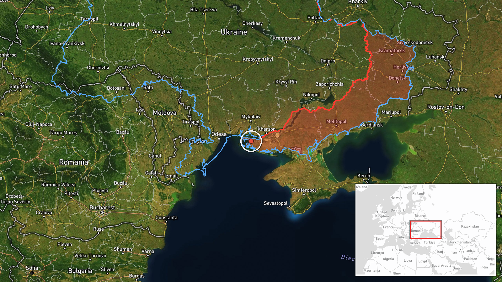
The location is recorded only at region level for southern Mykolaiv Oblast, Ukraine. The coordinates, about 46.42 north and 32.00 east, are an approximate central point rather than a settlement or facility. Geographically, the area lies along the northern Black Sea coast, including the Kinburn Spit, the Dnipro-Buh estuary, and the approaches to Ochakiv. Its flat, low-lying terrain and coastal waters make it a common route for drones heading north or east.
Related events nearby
- Ukrainian air monitoring: 1 Russian jet-powered Shahed (Geran-3) drone passing southern Mykolaiv Oblast, headi2026-10-20 07:30 UTC · Drone Transit · southern Mykolaiv Oblast, Ukraine
- Ukrainian air monitoring: 1 Russian jet-powered Shahed (Geran-3) drone passing eastern Odesa Oblast, heading w2026-10-20 06:30 UTC · Drone Transit · eastern Odesa Oblast, Ukraine
- Ukrainian air monitoring: 1 Russian jet-powered Shahed (Geran-3) drone from Black Sea toward Ochakiv.2026-10-19 20:58 UTC · Drone Transit · Ochakiv, Ukraine
- Ukrainian air monitoring: 1 Russian Shahed-type drone over Mykolaiv; 1 Russian Shahed-type drone heading towar2026-10-20 06:20 UTC · Drone Transit · Mykolaiv, Ukraine
- Ukrainian air monitoring: 1 Russian jet-powered Shahed (Geran-3) drone passing Mykolaiv Oblast, heading northw2026-10-20 05:43 UTC · Drone Transit · Mykolaiv Oblast, Ukraine
▶ View this event on the live map

Intel Mapper aggregates open-source reports from monitored Telegram and X channels, geolocates them, cross-checks duplicates across sources and assigns a confidence score. Entries are updated as new confirmations arrive. Read how we verify events.