Single jet-powered Shahed (Geran-3) drone reported heading west across eastern Rivne Oblast
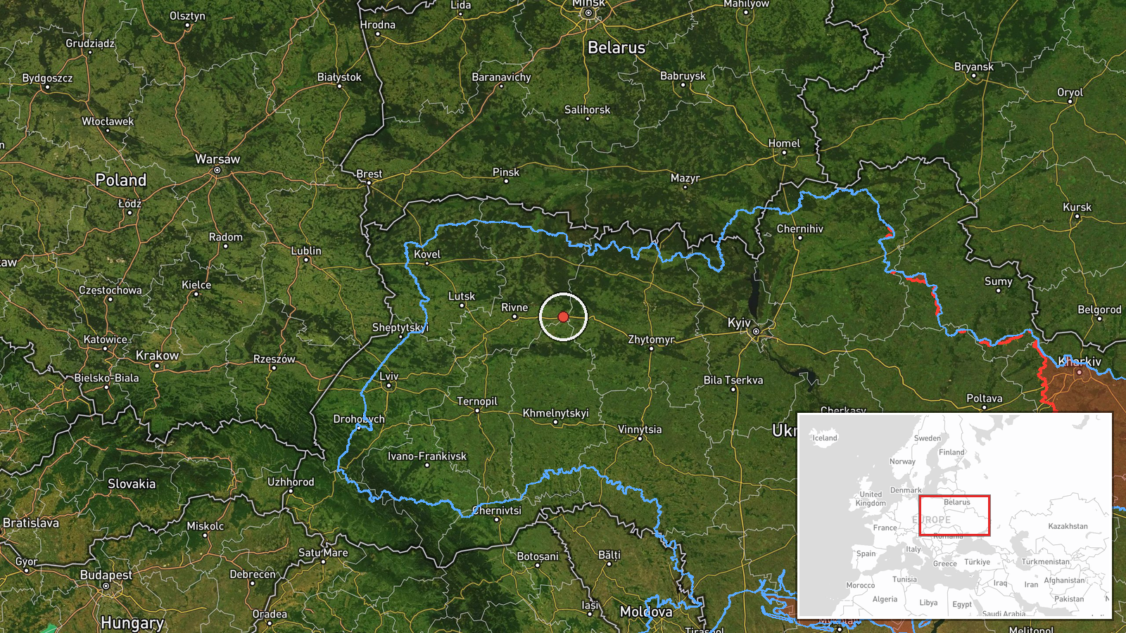
What happened
Ukrainian air monitoring channel @kpszsu reported on 21 October 2026 at 06:14 UTC that one Russian jet-powered Shahed, identified as a Geran-3, was moving across eastern Rivne Oblast on a westward heading. The report was a short alert posted in Ukrainian, describing the drone as a reactive unmanned aerial vehicle and giving only a general direction of travel. It did not name a settlement, a target, or any impact. The alert belongs to a sequence of transit reports from the same northwestern corridor over the preceding day, which is why it is treated as part of a wider movement pattern rather than an isolated sighting. No damage or casualties were reported in the source.
Context and assessment
Rivne and neighbouring Volyn Oblast lie in Ukraine's northwest, close to the Polish and Belarusian borders, and are routinely crossed by Shahed-type drones travelling toward western and central targets. Related events show a steady run of single and small-group transits on 20 and 21 October 2026, moving through Kostopil, Shepetivka and Berezne, with at least one earlier track originating in Rivne Oblast and another from Volyn Oblast. This sequence suggests either drones being routed along a northwest corridor or a series of separate launches reaching the same region. Single-drone alerts of this kind are often used by air defence units to track drones that are not yet targeting a specific city. Because the drone is described as heading west, it may be transiting the region rather than aiming at it, though that cannot be confirmed from the report alone. The incident is best read as an indicator of ongoing long-range drone activity over western Ukraine, not as evidence of a specific strike.
Sources and confidence
The event rests on a single Telegram channel, @kpszsu, which is an official-style Ukrainian air monitoring account. No independent outlet or second channel has confirmed this specific alert in the data provided, so cross-confirmation is absent. The confidence score of 8.0 reflects a credible primary channel with a consistent history of transit alerts, offset by the single-source status and the absence of any corroborating track or impact report. Confidence would rise if regional military administrations, air force statements, or other monitoring feeds reported the same drone along a matching path. It would fall if the alert were later corrected, withdrawn, or contradicted by air force tracking data.
Location
The coordinates are a regional-level placement for eastern Rivne Oblast, not a settlement or facility, so location confidence is rated low. The drone's exact position was not specified in the alert. The area is largely flat to gently rolling farmland and forest in the Polissia lowlands, with rivers and marshy ground typical of the region. Kostopil and Berezne, both mentioned in related alerts, lie within a short distance to the west and north-west of the placed point, which is useful context but does not pin down the event itself.
Related events nearby
- Ukrainian air monitoring: 1 Russian jet-powered Shahed (Geran-3) drone heading toward Shepetivka; 1 Russian je2026-10-20 13:09 UTC · Drone Transit · Shepetivka, Ukraine
- Ukrainian air monitoring: 1 Russian jet-powered Shahed (Geran-3) drone heading toward Shepetivka.2026-10-20 12:51 UTC · Drone Transit · Shepetivka, Ukraine
- Ukrainian air monitoring: 1 Russian Shahed-type drone passing Berezne, heading southwest.2026-10-21 06:18 UTC · Drone Transit · Berezne, Ukraine
- Ukrainian air monitoring: 1 Russian jet-powered Shahed (Geran-3) drone heading toward Kostopil.2026-10-20 10:44 UTC · Drone Transit · Kostopil, Ukraine
- Ukrainian air monitoring: 2+ Russian jet-powered Shahed (Geran-3) drones from Rivne Oblast toward Kostopil.2026-10-20 08:40 UTC · Drone Transit · Kostopil, Ukraine
▶ View this event on the live map

Intel Mapper aggregates open-source reports from monitored Telegram and X channels, geolocates them, cross-checks duplicates across sources and assigns a confidence score. Entries are updated as new confirmations arrive. Read how we verify events.