Jet-powered Shahed drones reported passing Nova Odesa area, Mykolaiv region, heading north
What happened
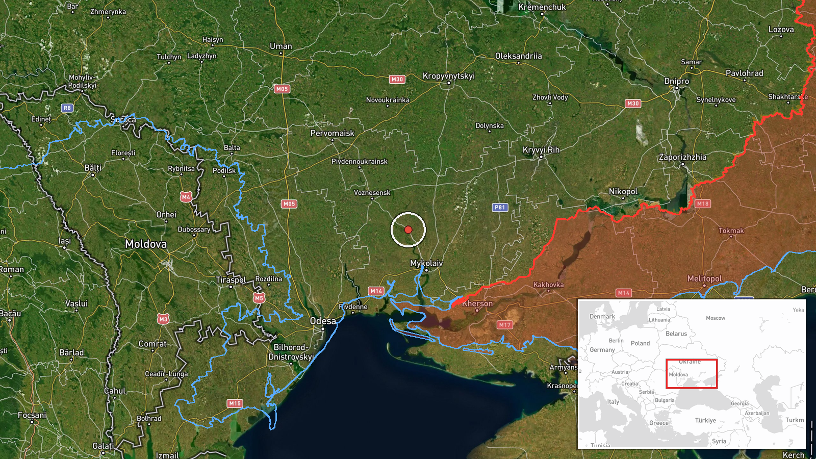
On 21 October 2026, at 08:32 UTC, Ukrainian air monitoring reported that jet-powered Shahed-type drones, described in the report as Russian Geran-3 models, were passing near Nova Odesa in Mykolaiv region and heading north. The original Ukrainian-language Telegram post places the drones in the area of the settlements of Voznesensk and Nova Odesa and gives the course as north. The wording describes transit movement rather than a strike. The post does not state a drone count beyond a plural, and it gives no impact point, casualties, or damage.
Context and assessment
Nova Odesa sits in the southern steppe of Mykolaiv region, on a corridor linking the Black Sea coast with inland towns and the Mykolaiv urban area. The related reports form a clear sequence over roughly 24 hours. A single drone was reported passing Berezanka northwest at 10:11 UTC on 20 October, followed by a report of two or more drones heading toward Berezivka at 14:28 and one heading toward Voznesensk at 15:20. Early on 21 October, three or more drones were reported coming from the Black Sea toward Ochakiv at 08:11, and one was reported heading toward Mykolaiv at 06:13. The pattern suggests a recurring route of drones moving from the sea across southern Odesa and Mykolaiv settlements, with reported group sizes varying. Operationally, transit reports of this kind usually indicate that air monitoring is tracking drones along a path rather than confirming targets. The Geran-3 is generally described as a jet-powered variant of the Shahed design, which would be faster than the older piston-engine versions. Any link between these reports and a specific intended target remains unclear from the data.
Sources and confidence
The event rests on one Telegram channel, handle @kpszsu, which is widely associated with Ukraine's Air Force, and no other outlet in the data corroborates it. The report is specific, with a timestamp, named settlements, and a stated direction, which supports its credibility. The confidence score of 8.0 reflects that institutional association and the consistency with nearby reports, but it is held below the top range because it is single-source and not independently verified. Confidence would rise if regional military administrations, other monitoring channels, or follow-up official statements confirmed the same track. It would fall if a correction or retraction were issued, or if later reporting placed the drones elsewhere. The event is currently not marked as corrected.
Location
The location is settlement-level, placed at the coordinates for Nova Odesa, with high location confidence because the report names the settlement directly. Nova Odesa lies in Mykolaiv oblast in southern Ukraine, in flat steppe terrain drained by tributaries of the Southern Bug river. The Black Sea coast lies to the south, and the wider region is largely agricultural with road and rail links to Mykolaiv and Voznesensk.
Related events nearby
- Ukrainian air monitoring: 1 Russian jet-powered Shahed (Geran-3) drone heading toward Mykolaiv.2026-10-21 06:13 UTC · Drone Transit · Mykolaiv, Ukraine
- Ukrainian air monitoring: 1 Russian jet-powered Shahed (Geran-3) drone heading toward Voznesensk.2026-10-20 15:20 UTC · Drone Transit · Voznesensk, Ukraine
- Ukrainian air monitoring: 1 Russian jet-powered Shahed (Geran-3) drone passing Berezanka, heading northwest.2026-10-20 10:11 UTC · Drone Transit · Berezanka, Ukraine
- Ukrainian air monitoring: 2+ Russian jet-powered Shahed (Geran-3) drones heading toward Berezivka.2026-10-20 14:28 UTC · Drone Transit · Berezivka, Ukraine
- Ukrainian air monitoring: 1 Russian jet-powered Shahed (Geran-3) drone from Odesa Oblast toward Raukhivka.2026-10-21 09:46 UTC · Drone Transit · Raukhivka, Ukraine
▶ View this event on the live map

Intel Mapper aggregates open-source reports from monitored Telegram and X channels, geolocates them, cross-checks duplicates across sources and assigns a confidence score. Entries are updated as new confirmations arrive. Read how we verify events.