Two or more jet-powered Shahed drones reported transiting Kyiv Oblast heading west
What happened
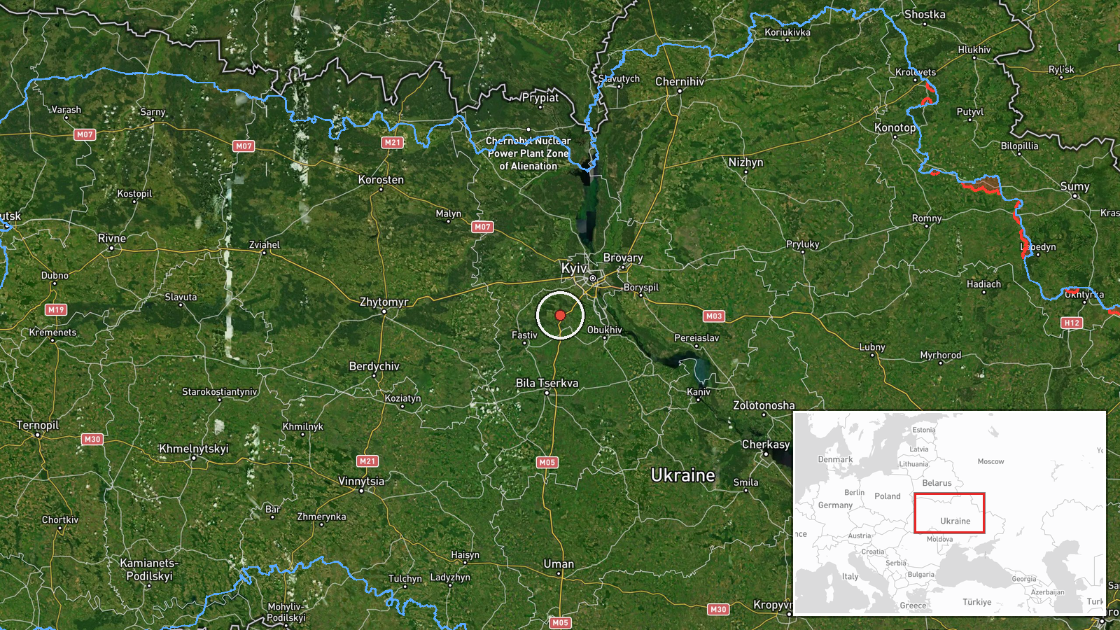
On 21 October 2026 at about 08:55 UTC, the Ukrainian air monitoring Telegram channel @kpszsu reported two or more Russian jet-powered Shahed (Geran-3) drones moving on a western course north of Bila Tserkva and in the area of Kagarlyk, both in Kyiv Oblast. The original post, written in Ukrainian, describes the objects as jet-type UAVs (Реактивні БпЛА) and gives the direction as western (курс західний). The report does not state any impact, casualties, or damage. The attribution to Russia and the Geran-3 designation come from the channel's wording, and the coordinates correspond to the settlement-level position of the report.
Context and assessment
Kyiv Oblast has been a recurring corridor for long-range drone traffic during the Russian air campaign against Ukraine, and this report sits within a sequence of transit alerts logged over the previous day and a half. Earlier entries on 20 October placed drones near Lubny, over Kyiv Oblast with one aircraft heading toward Makariv, near Hlevakha, and near Olyshivka on two occasions. The repeated westward and southwestern headings suggest drones moving through the oblast toward targets further west or being tracked as they cross the region rather than a single localized strike. Jet-powered Geran-3 variants are faster than the older piston-engine Shahed models, which typically shortens warning windows for air defence units and regional authorities. Operationally, a series of sightings along one axis may indicate a sustained raid package, decoy elements, or routing adjustments, but single-channel transit reports cannot confirm the intent behind the flight paths.
Sources and confidence
The report comes from a single channel, Telegram @kpszsu, and no other outlet in the provided data independently confirms it. Its related events come from the same type of air monitoring feed, which shows a consistent pattern but does not add independent verification. The confidence score of 8.0 reflects a credible official-style monitoring source with a clear and specific description, offset by the absence of cross-confirmation and the limited detail on the number of drones. Confidence would rise with corroboration from Ukrainian air force statements, regional military administration reports, or independent tracking data. It would fall if later official updates contradicted the direction, number, or type of aircraft.
Location
The location was assigned at settlement level, based on the report's reference to positions north of Bila Tserkva and in the Kagarlyk area, and the coordinates are rounded to that level rather than a precise point. Kyiv Oblast surrounds the national capital and is largely flat to gently rolling terrain, with the Dnipro and its tributaries, forests, and farmland across the region. Bila Tserkva lies southwest of Kyiv on the Ros River, and Kagarlyk lies to the southwest of the capital, placing the reported track in the western approaches to the city.
Related events nearby
- Ukrainian air monitoring: 2+ Russian jet-powered Shahed (Geran-3) drones passing Olyshivka, heading toward Kyi2026-10-21 07:58 UTC · Drone Transit · Kyiv Oblast, Ukraine
- Ukrainian air monitoring: 2+ Russian jet-powered Shahed (Geran-3) drones passing Olyshivka, heading toward Kyi2026-10-20 17:32 UTC · Drone Transit · Kyiv Oblast, Ukraine
- Ukrainian air monitoring: 2+ Russian jet-powered Shahed (Geran-3) drones passing Lubny, heading toward Kyiv Ob2026-10-20 15:36 UTC · Drone Transit · Kyiv Oblast, Ukraine
- Ukrainian air monitoring: 1 Russian jet-powered Shahed (Geran-3) drone heading toward Vasylkiv.2026-10-21 05:44 UTC · Drone Transit · Vasylkiv, Ukraine
- Ukrainian air monitoring: 1 Russian jet-powered Shahed (Geran-3) drone heading toward Vasylkiv.2026-10-21 02:29 UTC · Drone Transit · Vasylkiv, Ukraine
▶ View this event on the live map

Intel Mapper aggregates open-source reports from monitored Telegram and X channels, geolocates them, cross-checks duplicates across sources and assigns a confidence score. Entries are updated as new confirmations arrive. Read how we verify events.