Two or more Russian Geran-3 jet drones reportedly tracked toward Rivne Oblast, Ukraine
What happened
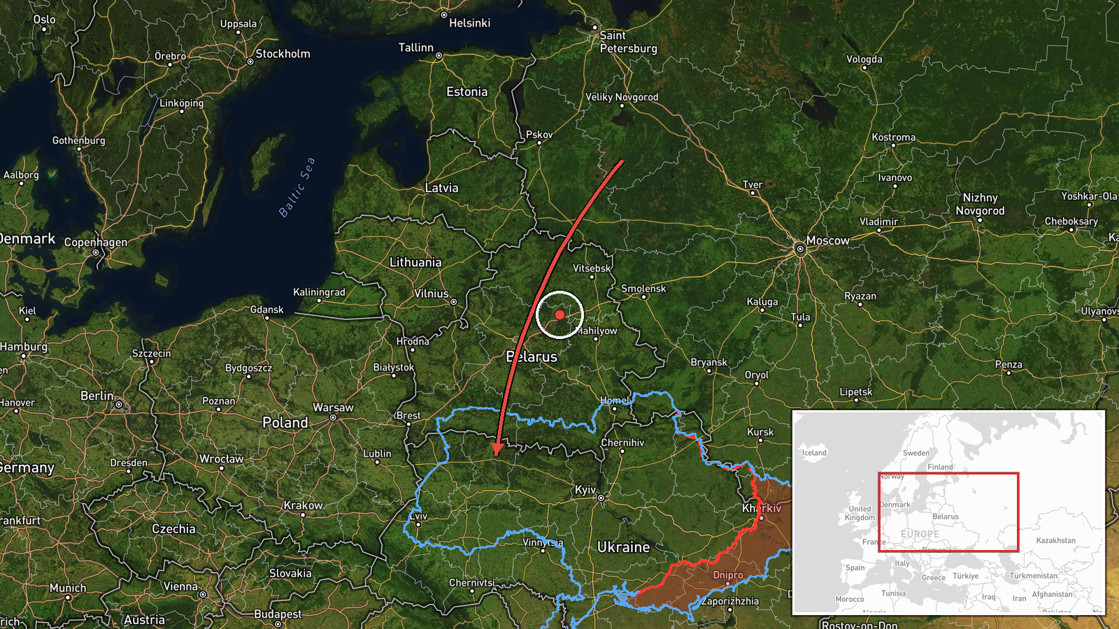
Ukrainian air monitoring reported on 21 October 2026 at 09:22 UTC that two or more Russian jet-powered Shahed drones, designated Geran-3, were moving toward Rivne Oblast. The original Ukrainian-language post, published on the Telegram channel @kpszsu, describes jet-powered UAVs arriving from the north and west of Zhytomyr Oblast and heading for Rivne region. The English summary adds that the drones were passing the settlement of Zakhod. The report does not mention impacts, damage, casualties, or interception results. It is classified as a drone transit rather than a strike. It rests on a single channel post, and the location is recorded at regional level rather than at a precise point.
Context and assessment
Rivne Oblast sits in northwestern Ukraine, between Zhytomyr to the east and Volyn to the west, and it borders Belarus to the north. Its position makes it a corridor for drones moving from northern Ukraine toward western regions. The related events show a steady pattern over the previous day and a half. On 20 October, Ukrainian monitoring tracked two or more drones heading toward Klevan at 09:47 UTC, followed by single drones toward Kostopil at 10:44, Dubno at 12:25, and Rivne at 12:59. Another single drone was reported toward Rivne at 04:58 on 21 October. The sequence of towns along this path suggests drones being tracked along a route rather than a single isolated flight. Operationally, this may indicate routing toward targets further west, or it may reflect deliberate pressure on air defence and warning networks along the way. Because the Geran-3 is jet-powered, it is generally faster than the piston-engine Shahed variants, which can shorten warning times. Nothing in the data confirms the intended target.
Sources and confidence
The report comes from one Telegram channel, @kpszsu, which is widely understood to be the Ukrainian Air Force's official channel for air-threat notices. No independent outlet or second channel is listed as confirming it. The confidence score of 8.0 reflects the official-channel origin and the consistency of the report with the earlier transit reports in the same area. It is not higher because there is no cross-confirmation and no post-event report. Confidence would rise with corroboration from regional military administrations, air alert logs, or debris reports. It would fall if the channel issued a correction, if later official statements contradicted the count or direction, or if no related impacts or sightings were reported.
Location
The location is approximate, recorded at regional level with coordinates of 50.62 N, 26.25 E, and a location confidence rated low. The event is placed in Rivne Oblast rather than at a settlement or facility. Rivne Oblast lies in the Polissia lowlands of northwestern Ukraine, an area of forests, wetlands, and farmland drained by rivers including the Horyn and Styr. The terrain is flat, which allows aerial movement to be tracked over long distances, but it offers few natural features for pinpointing a specific location in the report.
Related events nearby
- Ukrainian air monitoring: 1 Russian jet-powered Shahed (Geran-3) drone heading toward Rivne.2026-10-21 04:58 UTC · Drone Transit · Rivne, Ukraine
- Ukrainian air monitoring: 1 Russian jet-powered Shahed (Geran-3) drone heading toward Rivne.2026-10-20 12:59 UTC · Drone Transit · Rivne, Ukraine
- Ukrainian air monitoring: 1 Russian jet-powered Shahed (Geran-3) drone heading toward Kostopil.2026-10-20 10:44 UTC · Drone Transit · Kostopil, Ukraine
- Ukrainian air monitoring: 1 Russian jet-powered Shahed (Geran-3) drone heading toward Dubno.2026-10-20 12:25 UTC · Drone Transit · Dubno, Ukraine
- Ukrainian air monitoring: 1 Russian jet-powered Shahed (Geran-3) drone heading toward Dubno.2026-10-20 12:04 UTC · Drone Transit · Dubno, Ukraine
▶ View this event on the live map

Intel Mapper aggregates open-source reports from monitored Telegram and X channels, geolocates them, cross-checks duplicates across sources and assigns a confidence score. Entries are updated as new confirmations arrive. Read how we verify events.