Single jet-powered Shahed (Geran-3) drone reported transiting south of Chernihiv, heading west
What happened
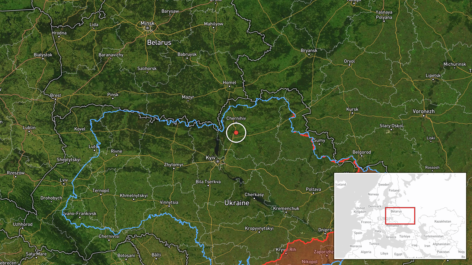
Ukraine's air force monitoring channel, the Telegram account @kpszsu, reported at 10:04 UTC on 21 October 2026 that a single jet-powered Shahed drone, identified in the post as a Geran-3, was passing to the south of Chernihiv and heading west. The original Ukrainian-language post read "Реактивний БпЛА на півдні від Чернігова, курс на захід," which translates roughly as a jet-type UAV south of Chernihiv on a westward course. The report did not describe any impact, debris fall, or casualties, and it did not state the drone's final destination. The event is recorded as a drone transit rather than a strike. Because the post gives only a general southern bearing from the city and no settlement name, the record reflects a regional position rather than a pinpointed track. Several other monitoring reports from the same morning, listed among related events, describe drones moving across northern Ukraine.
Context and assessment
Chernihiv sits in northern Ukraine close to the Belarus border, and the city has repeatedly appeared in Ukrainian reporting as a corridor for aerial activity heading toward Kyiv and surrounding oblasts. The related events on this morning show a dense pattern. At 04:18 UTC, Ukrainian monitoring reported at least two Geran-3 drones passing Mykhailo-Kotsiubynske heading south. At 05:10, a Banderol mini cruise missile was reported heading toward Chernihiv itself, and at 05:22 at least two more jet-powered Shaheds were reported heading toward Nosivka. Earlier, on 20 October, drones were reported heading toward Kozelets. Later, at 08:57, drones were reported moving from Chernihiv Oblast toward northern Kyiv Oblast. Taken together, these reports suggest a sustained flow of jet-type drones through the northern corridor rather than a single isolated track. Operationally, this may indicate route probing, an attempt to stretch air defense coverage across several oblasts at once, or drones aimed at targets further west or south. The jet-powered Geran-3 variant is generally understood to be faster than the older propeller-driven Shahed, which can shorten warning times. These readings remain interpretive, since the monitoring posts describe headings and transits rather than confirmed targets.
Sources and confidence
The event rests on one channel, the Telegram account @kpszsu, which is the official Ukrainian air force monitoring feed. No other outlet in the dataset independently reports this specific transit, so there is no cross-confirmation. The confidence score of 8.0 reflects that the source is an official military monitoring channel with a direct, time-stamped post, but the single-source status and the lack of a precise location limit it. Confidence would rise with corroboration from other Ukrainian official channels, regional administrations, or consistent reporting from related tracks. It would fall if the report were corrected, withdrawn, or contradicted by later monitoring. The record is not marked as corrected.
Location
The coordinates are a region-level approximation placed somewhere south of Chernihiv city, based only on the phrase "south of Chernihiv" in the post. No settlement, road, or facility was named, so the location confidence is low. The setting is the Chernihiv region of northern Ukraine, an area of farmland, forest, and river valleys in the Desna basin. The Belarus border lies to the north, and Kyiv Oblast begins to the south and west of the city.
Related events nearby
- Ukrainian air monitoring: 2+ Russian jet-powered Shahed (Geran-3) drones passing Mykhailo-Kotsiubynske, headin2026-10-21 04:18 UTC · Drone Transit · Mykhailo-Kotsiubynske, Ukraine
- Ukrainian air monitoring: 1 Russian Banderol mini cruise missile heading toward Chernihiv.2026-10-21 05:10 UTC · Cruise Missile · Chernihiv, Ukraine
- Ukrainian air monitoring: 2+ Russian jet-powered Shahed (Geran-3) drones heading toward Kozelets.2026-10-20 15:22 UTC · Drone Transit · Kozelets, Ukraine
- Ukrainian air monitoring: 2+ Russian jet-powered Shahed (Geran-3) drones heading toward Nosivka.2026-10-21 05:22 UTC · Drone Transit · Nosivka, Ukraine
- Ukrainian air monitoring: 2+ Russian jet-powered Shahed (Geran-3) drones from Chernihiv Oblast toward northern2026-10-21 08:57 UTC · Drone Transit · northern Kyiv Oblast, Ukraine
▶ View this event on the live map

Intel Mapper aggregates open-source reports from monitored Telegram and X channels, geolocates them, cross-checks duplicates across sources and assigns a confidence score. Entries are updated as new confirmations arrive. Read how we verify events.