Jet-powered Shahed drones reported moving from Chernihiv Oblast into northern Kyiv Oblast
What happened
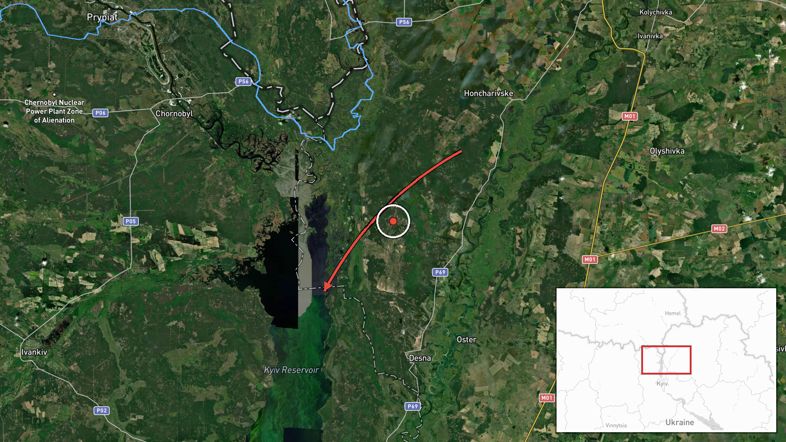
Ukrainian air monitoring reported at 08:57 UTC on 21 October 2026 that two or more Russian jet-powered Shahed (Geran-3) drones were moving from Chernihiv Oblast toward northern Kyiv Oblast, with the heading reportedly continuing toward Zhytomyr Oblast. The only source listed is a Telegram channel, @kpszsu, which carries Ukrainian air-threat monitoring messages. The original Ukrainian wording describes reactive jet-powered unmanned aerial vehicles (БпЛА) moving from Chernihivshchyna to the north of Kyiv region in the direction of Zhytomyr region. The message reports movement only. It does not describe impacts, casualties, or any strike, and the exact track between points is not established.
Context and assessment
Northern Kyiv Oblast sits on the main air corridor between the Chernihiv border region and the Ukrainian capital, so drone transits here are a routine indicator of threat activity over the approaches to Kyiv. The related events show a sustained pattern over roughly 21 hours. Between 11:07 and 15:22 UTC on 20 October, reports placed drones near Vyshhorod, the Kyiv Reservoir and Kozelets, with groups of two or more appearing from midday. A single drone was then reported passing the Kyiv Reservoir heading west at 18:44 and another was reported heading toward Dymer at 05:26 on 21 October. Operationally, repeated transits along this axis may indicate routing toward targets further west or south, reconnaissance of air defence positions, decoy activity, or staging before a larger raid. None of these readings can be confirmed from the data, and the varying headings suggest that the drones did not follow a single fixed route.
Sources and confidence
The event rests on one channel, Telegram @kpszsu, with no independent confirmation from another monitoring source, official statement, or news agency in the data. The confidence score of 8.0 reflects a clear, specific, timestamped report from an established monitoring channel and its consistency with the surrounding transit reports, but the single-source basis and the region-level location keep it below the highest band. Confidence would rise with corroboration from another air-monitoring source or an official Air Force statement, or with a report of a confirmed impact. It would fall if the report were corrected, revised, or contradicted by later monitoring messages.
Location
The location is recorded at regional level for northern Kyiv Oblast, with a generalised coordinate pair near 50.995 N, 30.52 E rather than a specific settlement or facility, and the location confidence is marked low. The setting is a broad lowland of river valleys and farmland north of Kyiv, with the Dnipro and Desna drainage and the Kyiv Reservoir lying nearby. The point should be read as an approximate area, not an exact position of the drones.
Related events nearby
- Ukrainian air monitoring: 1 Russian jet-powered Shahed (Geran-3) drone passing Kyiv Reservoir, heading west.2026-10-20 18:44 UTC · Drone Transit · Kyiv Reservoir, Ukraine
- Ukrainian air monitoring: 1 Russian jet-powered Shahed (Geran-3) drone heading toward Dymer.2026-10-21 05:26 UTC · Drone Transit · Dymer, Ukraine
- Ukrainian air monitoring: 2+ Russian jet-powered Shahed (Geran-3) drones heading toward Kozelets.2026-10-20 15:22 UTC · Drone Transit · Kozelets, Ukraine
- Ukrainian air monitoring: 2+ Russian jet-powered Shahed (Geran-3) drones heading toward Vyshhorod.2026-10-20 11:42 UTC · Drone Transit · Vyshhorod, Ukraine
- Ukrainian air monitoring: 1 Russian jet-powered Shahed (Geran-3) drone passing Kyiv Reservoir, heading toward 2026-10-20 11:07 UTC · Drone Transit · Vyshhorod, Ukraine
▶ View this event on the live map

Intel Mapper aggregates open-source reports from monitored Telegram and X channels, geolocates them, cross-checks duplicates across sources and assigns a confidence score. Entries are updated as new confirmations arrive. Read how we verify events.