Two or more Russian jet-powered Shahed drones reported heading toward Kozelets, Chernihiv Oblast
What happened
Ukrainian air monitoring channel @kpszsu reported on 20 October 2026 at about 15:22 UTC that two or more Russian jet-powered Shahed (Geran-3) drones were heading toward Kozelets in Chernihiv Oblast. The original Ukrainian-language post, which describes jet-powered drones on a course toward Kozelets and Oster, refers to the drones as 'реактивні БпЛА' and names both settlements in the same line. The report describes a transit rather than a confirmed strike, and no impact, casualties or damage are stated in the source. The event is one of several drone-transit reports logged across northern Ukraine that morning, and the Kozelets entry is tied to a single originating Telegram channel.
Context and assessment
Kozelets sits in the north of Chernihiv Oblast, close to the Desna River and on routes that Shahed-type drones have repeatedly used when flying from Russian territory toward central and northern Ukraine. The related reports that morning show a steady sequence of Geran-3 transits: a single drone heading toward Oster at 05:35 UTC, a drone tracked toward Velyka Dymerka and Brovary in Kyiv Oblast at 03:29, and groups of two or more drones moving from northern Chernihiv Oblast into northern Kyiv Oblast between 02:38 and 03:25, with further drones passing northern Kyiv Oblast and heading south at 07:04. Taken together, the pattern suggests a sustained, multi-axis flight path rather than a single targeted approach. Operationally, reports of this kind may indicate that drones are being routed through the Chernihiv corridor toward targets further south or west, or that they are being tracked as they cross air-defence boundaries. Because the reports describe transit and tracking, the Kozelets report alone does not establish the intended target.
Sources and confidence
The event rests on a single Telegram channel, @kpszsu, which is the Ukrainian Air Force's official channel. No independent outlet in the dataset cross-confirms the Kozelets report, so the confidence score of 8.0 reflects a credible official source combined with a single-channel origin and the transit nature of the report. Confidence would rise if regional authorities, independent flight-tracking data or wire agencies corroborated the drone track, or if the related Oster and Kyiv Oblast reports were linked to the same drones. It would fall if later updates reclassified the flight or if the drones were shown to have followed a different path.
Location
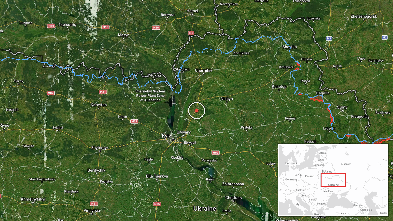
The coordinates correspond to the settlement of Kozelets, a town in Chernihiv Oblast, Ukraine, and the geographic precision is recorded as settlement level with high location confidence. The town lies on the Desna River in the northeast of the oblast, a flat, wooded and river-valley landscape near the border with Russia. The nearby settlement of Oster, also named in the report, lies a short distance to the south-east along the same river corridor.
Related events nearby
- Ukrainian air monitoring: 1 Russian jet-powered Shahed (Geran-3) drone heading toward Oster.2026-10-20 05:35 UTC · Drone Transit · Oster, Ukraine
- Ukrainian air monitoring: Russian jet-powered Shahed (Geran-3) drone tracked toward Velyka Dymerka/Brovary, Ky2026-10-20 03:29 UTC · Drone Transit · Velyka Dymerka, Brovary, Ukraine
- Ukrainian air monitoring: 2+ Russian jet-powered Shahed (Geran-3) drones passing northern Kyiv Oblast, heading2026-10-20 07:04 UTC · Drone Transit · northern Kyiv Oblast, Ukraine
- Ukrainian air monitoring: 1 Russian jet-powered Shahed (Geran-3) drone from northern Chernihiv Oblast toward n2026-10-20 03:25 UTC · Drone Transit · northern Kyiv Oblast, Ukraine
- Ukrainian air monitoring: 2+ Russian jet-powered Shahed (Geran-3) drones from northern Chernihiv Oblast toward2026-10-20 02:38 UTC · Drone Transit · northern Kyiv Oblast, Ukraine
▶ View this event on the live map

Intel Mapper aggregates open-source reports from monitored Telegram and X channels, geolocates them, cross-checks duplicates across sources and assigns a confidence score. Entries are updated as new confirmations arrive. Read how we verify events.