Ukrainian monitors report 2+ jet-powered Shahed drones crossing northern Kyiv Oblast southward
What happened
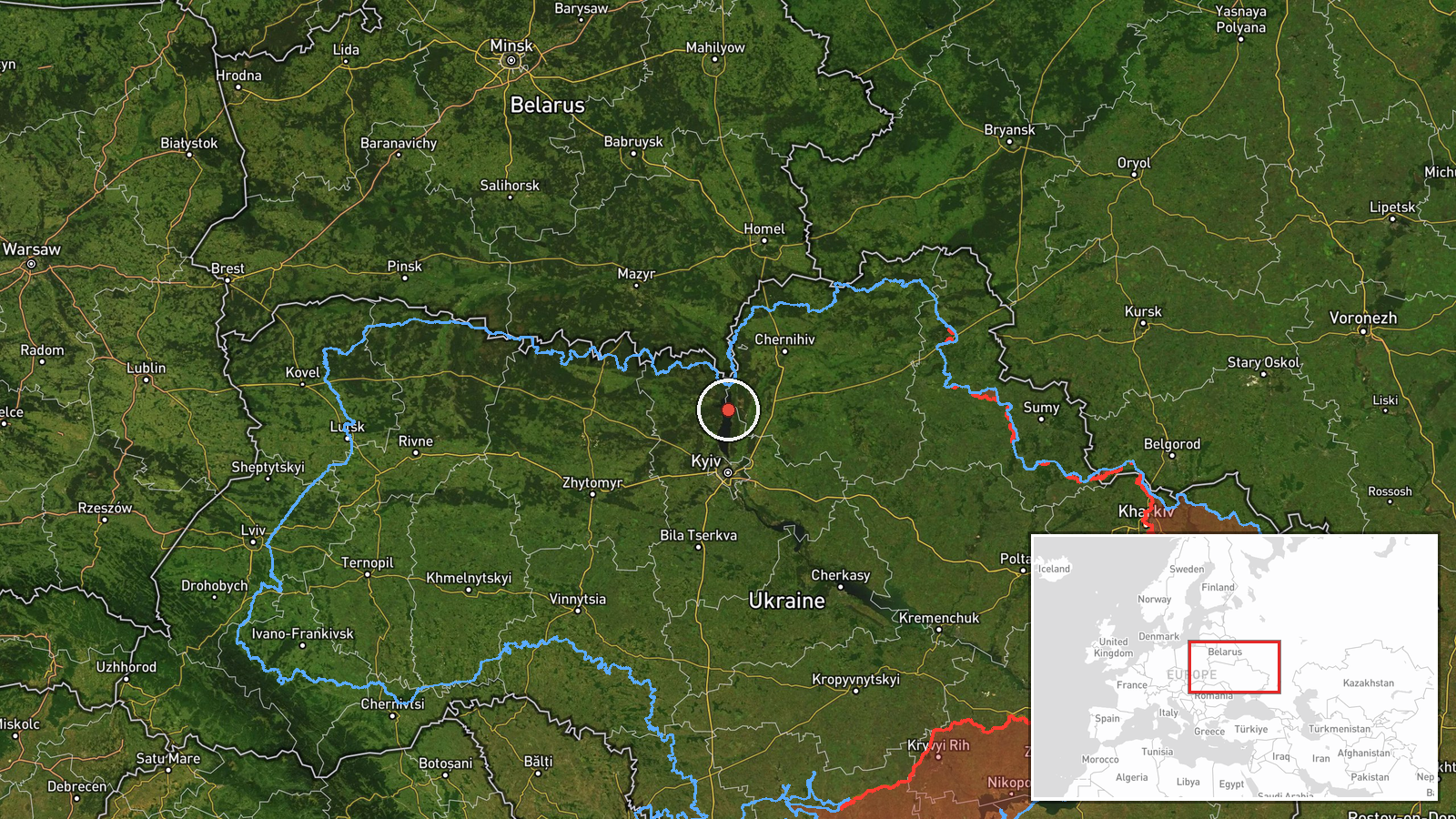
Ukrainian air monitoring posts on the Telegram channel @kpszsu reported on 20 October 2026 at 07:04 UTC that at least two Russian jet-powered Shahed (Geran-3) drones were moving through western Chernihiv Oblast and northern Kyiv Oblast on a southerly heading. The original Ukrainian-language post uses the phrase 'Реактивні БпЛА' (jet-powered unmanned aerial vehicles) and describes a transit rather than a strike. The post does not report impacts, damage, or casualties. The report gives a count of '2+', so the figure is a minimum and the true number may be higher. The event is logged as a single-source report. Earlier monitoring posts in the same series describe individual and small-group drones moving from northern Chernihiv Oblast toward northern Kyiv Oblast and the Kyiv Reservoir over the preceding day, with the most recent entry logged at 05:35 UTC near Oster.
Context and assessment
Northern Kyiv Oblast sits on the main approach to the Ukrainian capital from the north, and the Kyiv Reservoir and the Desna and Dnipro river corridors give drones natural navigational reference points. The related events show a run of Geran-3 transits crossing from Chernihiv Oblast into northern Kyiv Oblast over roughly 24 hours, with several entries naming the same reservoir and the Oster area. This repetition suggests a sustained flight path rather than a single stray track. Geran-3 is the jet-powered variant of the Shahed family, which generally flies faster and at higher altitude than the piston-engined Geran-2, making interception more demanding. Transit reports of this kind are often read as reconnaissance of air-defence coverage, route testing, or drones moving toward targets further south, though the post itself does not state any intent. Because the data shows only observation of movement, the purpose of this specific group cannot be established from the report alone.
Sources and confidence
All information comes from one Telegram channel, @kpszsu, which is the single listed source, with no independent corroboration in the event data. The confidence score of 8.0 reflects a credible official-style monitoring feed with a consistent pattern across related posts, but it is not higher because no second outlet, wreckage report, or Ukrainian Air Force statement is attached. Confidence would rise with independent confirmation of the track or with reports from local authorities or other monitoring sources. It would fall if later updates revised the drone count or the direction of travel, or if the posts were found to be inconsistent with other reporting.
Location
The location is recorded at regional level as northern Kyiv Oblast, and the coordinates are an approximate central point for that area rather than a specific settlement or facility. The location confidence is low for this reason, and the point should not be read as an exact position of the drones. The area lies on the flat, wooded transition between the Dnipro lowlands and the Polissia region, with the Kyiv Reservoir, the Desna river, and the Chernihiv border zone nearby, which are the features most often used to describe such tracks.
Related events nearby
- Ukrainian air monitoring: 1 Russian jet-powered Shahed (Geran-3) drone from northern Chernihiv Oblast toward n2026-10-20 03:25 UTC · Drone Transit · northern Kyiv Oblast, Ukraine
- Ukrainian air monitoring: 2+ Russian jet-powered Shahed (Geran-3) drones from northern Chernihiv Oblast toward2026-10-20 02:38 UTC · Drone Transit · northern Kyiv Oblast, Ukraine
- Ukrainian air monitoring: 1 Russian jet-powered Shahed (Geran-3) drone from northern Chernihiv Oblast toward n2026-10-19 16:02 UTC · Drone Transit · northern Kyiv Oblast, Ukraine
- Ukrainian air monitoring: 1 Russian jet-powered Shahed (Geran-3) drone from Chernihiv Oblast toward Kyiv Reser2026-10-19 14:02 UTC · Drone Transit · Kyiv Reservoir, Ukraine
- Ukrainian air monitoring: 1 Russian jet-powered Shahed (Geran-3) drone heading toward Oster.2026-10-20 05:35 UTC · Drone Transit · Oster, Ukraine
▶ View this event on the live map

Intel Mapper aggregates open-source reports from monitored Telegram and X channels, geolocates them, cross-checks duplicates across sources and assigns a confidence score. Entries are updated as new confirmations arrive. Read how we verify events.