Single jet-powered Shahed drone reported heading toward Oster from the north, Chernihiv Oblast
What happened
Ukraine's air monitoring channel on Telegram, @kpszsu, reported at about 05:35 UTC on 20 October 2026 that one Russian jet-powered Shahed, identified as a Geran-3, was heading toward Oster from the north. The original Ukrainian-language post describes a jet-type unmanned aerial vehicle moving toward Oster from the north. The report does not say whether the drone was shot down, lost, or struck anything, and no impacts or casualties are described in the event data. Oster is a town in northern Chernihiv Oblast, and this is a transit-type alert, meaning it tracks a drone's movement rather than recording a strike. Because the post comes from a single channel, the detail rests on that one feed.
Context and assessment
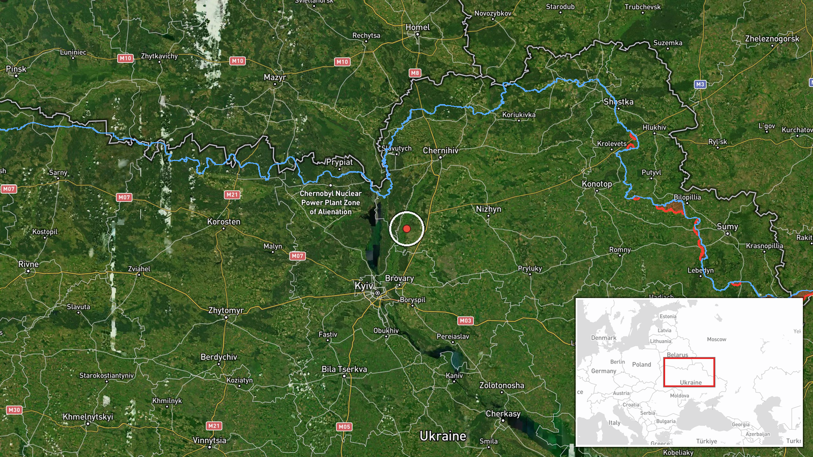
Oster sits on the Desna River in northern Chernihiv Oblast, a short distance from the Kyiv Oblast boundary, so a drone approaching from the north is on a path that could lead toward Kyiv's northern approaches or the Desna corridor. The five related reports from 19 and 20 October show a consistent pattern: single or small groups of Geran-3 jet-powered Shaheds coming from northern Chernihiv Oblast and tracked toward northern Kyiv Oblast, the Kyiv Reservoir, and the Brovary area. The Oster alert adds a further northern point to that cluster, suggesting the transit route runs across the Chernihiv and Kyiv border zone rather than toward one fixed target. Jet-powered Geran-3 variants are generally understood to be faster than the older piston-engine Shahed type, which can shorten warning times and complicate interception. Operationally, the sequence may reflect routing, decoy or saturation tactics, or reconnaissance along a corridor, but the data alone does not establish intent, and a single transit alert does not confirm a target.
Sources and confidence
The alert comes from one Telegram channel, @kpszsu, and no second outlet appears in the event record, so cross-confirmation is absent. The confidence score of 8.0 is high for a single source because the feed is a dedicated air monitoring channel, its wording names the drone type and direction, and the timing matches the surrounding sequence of reports. It is not higher because transit tracks are revised as they move and no independent confirmation exists. Confidence would rise with a second monitoring source, an official statement, or an impact report, and would fall if the track is revised or cancelled.
Location
The location is a settlement-level match to Oster, Chernihiv Oblast, at approximately 50.95 north and 30.88 east, with high location confidence. The point marks the town rather than a facility or exact track position, since the report names only the direction of approach from the north. Oster lies on the Desna River, which runs through a broad, wooded floodplain in this part of northern Ukraine, and the town is near the regional boundary with Kyiv Oblast.
Related events nearby
- Ukrainian air monitoring: 1 Russian jet-powered Shahed (Geran-3) drone from northern Chernihiv Oblast toward n2026-10-20 03:25 UTC · Drone Transit · northern Kyiv Oblast, Ukraine
- Ukrainian air monitoring: 2+ Russian jet-powered Shahed (Geran-3) drones from northern Chernihiv Oblast toward2026-10-20 02:38 UTC · Drone Transit · northern Kyiv Oblast, Ukraine
- Ukrainian air monitoring: 1 Russian jet-powered Shahed (Geran-3) drone from northern Chernihiv Oblast toward n2026-10-19 16:02 UTC · Drone Transit · northern Kyiv Oblast, Ukraine
- Ukrainian air monitoring: 1 Russian jet-powered Shahed (Geran-3) drone from Chernihiv Oblast toward Kyiv Reser2026-10-19 14:02 UTC · Drone Transit · Kyiv Reservoir, Ukraine
- Ukrainian air monitoring: Russian jet-powered Shahed (Geran-3) drone tracked toward Velyka Dymerka/Brovary, Ky2026-10-20 03:29 UTC · Drone Transit · Velyka Dymerka, Brovary, Ukraine
▶ View this event on the live map

Intel Mapper aggregates open-source reports from monitored Telegram and X channels, geolocates them, cross-checks duplicates across sources and assigns a confidence score. Entries are updated as new confirmations arrive. Read how we verify events.