Ukrainian air monitoring reports one Russian Geran-3 jet drone heading toward Dymer, Kyiv Oblast
What happened
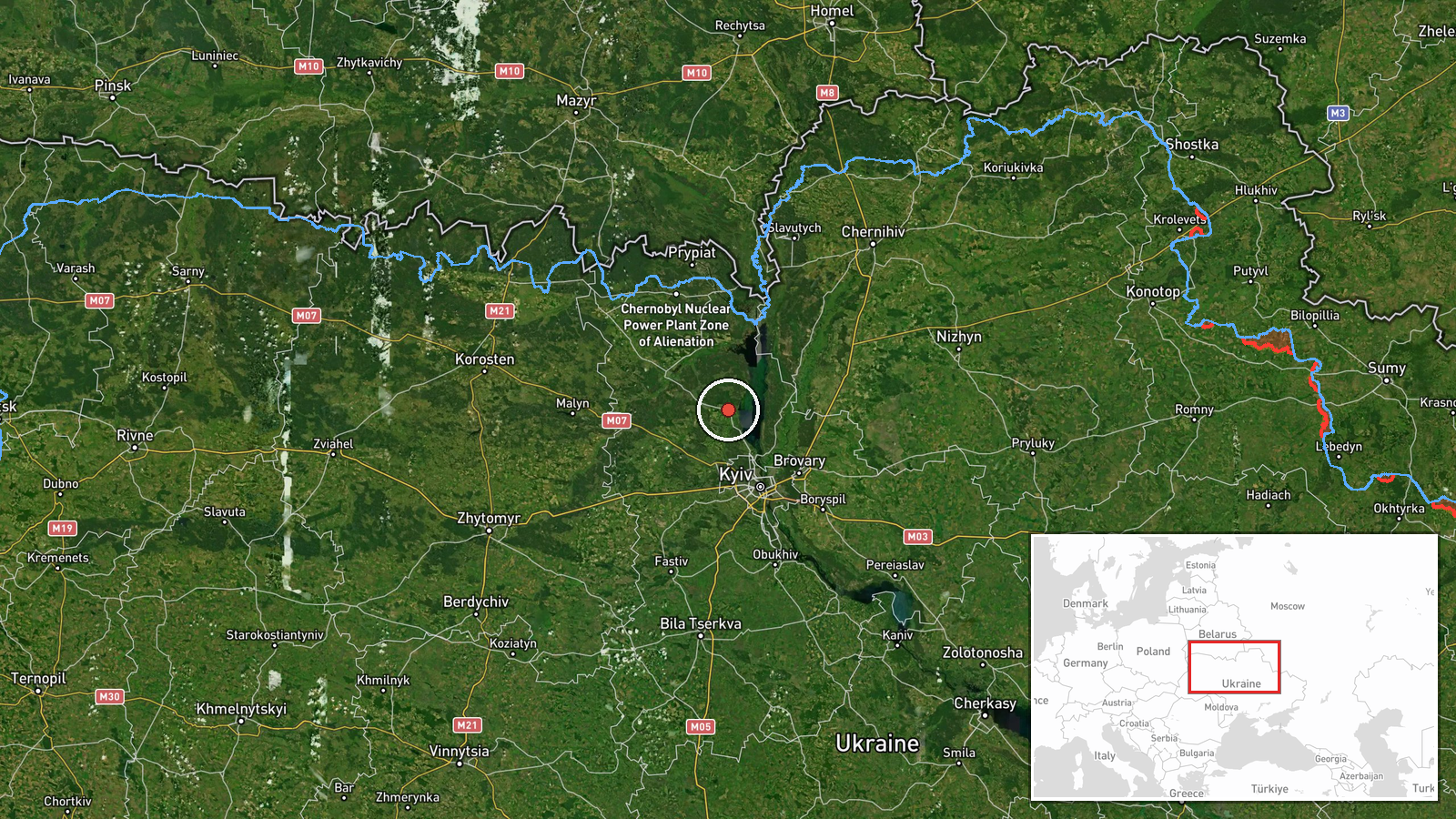
Ukrainian air monitoring reported on Telegram, through the channel @kpszsu, that a single Russian jet-powered Shahed, identified as a Geran-3, was on a course toward Dymer, a settlement in Kyiv Oblast, at about 05:26 UTC on 21 October 2026. The original Ukrainian wording was brief. It described a jet-type UAV heading for Dymer, with Ivankiv and Borodianka also named in the course line. The message is a transit warning. It does not describe an impact, damage, or casualties, and no such outcome is reported in the source. The report comes from a single channel and no later update is attached to it.
Context and assessment
Dymer lies in the belt of settlements northwest of Kyiv, an area that has repeatedly come under Shahed-type transit reporting during the autumn of 2026. The related events form a clear sequence. On 20 October, single Geran-3 drones were reported passing the Kyiv Reservoir heading west, and reports followed for Vyshhorod, where two or more drones were noted, and for Hostomel. Another Hostomel report came early on 21 October, shortly before the Dymer warning. The pattern of named settlements shifting along a northwest axis suggests the drones were being tracked along a route rather than aimed at one fixed point. Operationally, this kind of sequence may indicate route reconnaissance, attempts to stretch air defence attention across several districts, or deliberate probing of approaches to the capital. The Geran-3 is a jet-powered variant, faster than the older piston-engined Geran-2, and its use in repeated transits may reflect efforts to test interception timing. These readings are inferences from the reporting pattern and are not confirmed by the sources.
Sources and confidence
Only one source is listed, the Telegram channel @kpszsu, and the event has a source count of 1. The channel's wording matches the summary, but the report has not been cross-checked against a second monitoring channel, an official Air Force statement, or regional authorities. The confidence score of 8.0 reflects a clear, specific and consistent warning from a channel that is part of the Ukrainian military information ecosystem, offset by the lack of independent confirmation. Confidence would rise with a matching report from a second monitoring source, an Air Force or regional update, or radar-based tracking. It would fall if the drone's track was later reported as diverted, shot down outside the area, or never entering Kyiv Oblast.
Location
The location is a settlement-level match for Dymer, Ukraine, with high location confidence. The coordinates given are approximately 50.786 N, 30.304 E, placing the point in Kyiv Oblast northwest of the capital. The geographic setting is the Dnipro river valley and its surrounding lowland, which carries roads and rail lines north of Kyiv. The Kyiv Reservoir, mentioned in nearby related events, lies to the west and upstream of the area. The position is taken from the settlement name rather than a specific facility or impact site.
Related events nearby
- Ukrainian air monitoring: 1 Russian jet-powered Shahed (Geran-3) drone passing Kyiv Reservoir, heading west.2026-10-20 18:44 UTC · Drone Transit · Kyiv Reservoir, Ukraine
- Ukrainian air monitoring: 1 Russian jet-powered Shahed (Geran-3) drone heading toward Hostomel.2026-10-21 04:46 UTC · Drone Transit · Hostomel, Ukraine
- Ukrainian air monitoring: 1 Russian jet-powered Shahed (Geran-3) drone heading toward Hostomel.2026-10-20 13:34 UTC · Drone Transit · Hostomel, Ukraine
- Ukrainian air monitoring: 2+ Russian jet-powered Shahed (Geran-3) drones heading toward Vyshhorod.2026-10-20 11:42 UTC · Drone Transit · Vyshhorod, Ukraine
- Ukrainian air monitoring: 1 Russian jet-powered Shahed (Geran-3) drone passing Kyiv Reservoir, heading toward 2026-10-20 11:07 UTC · Drone Transit · Vyshhorod, Ukraine
▶ View this event on the live map

Intel Mapper aggregates open-source reports from monitored Telegram and X channels, geolocates them, cross-checks duplicates across sources and assigns a confidence score. Entries are updated as new confirmations arrive. Read how we verify events.