Jet-powered Geran-3 drone reported passing Kyiv Reservoir, heading west
What happened
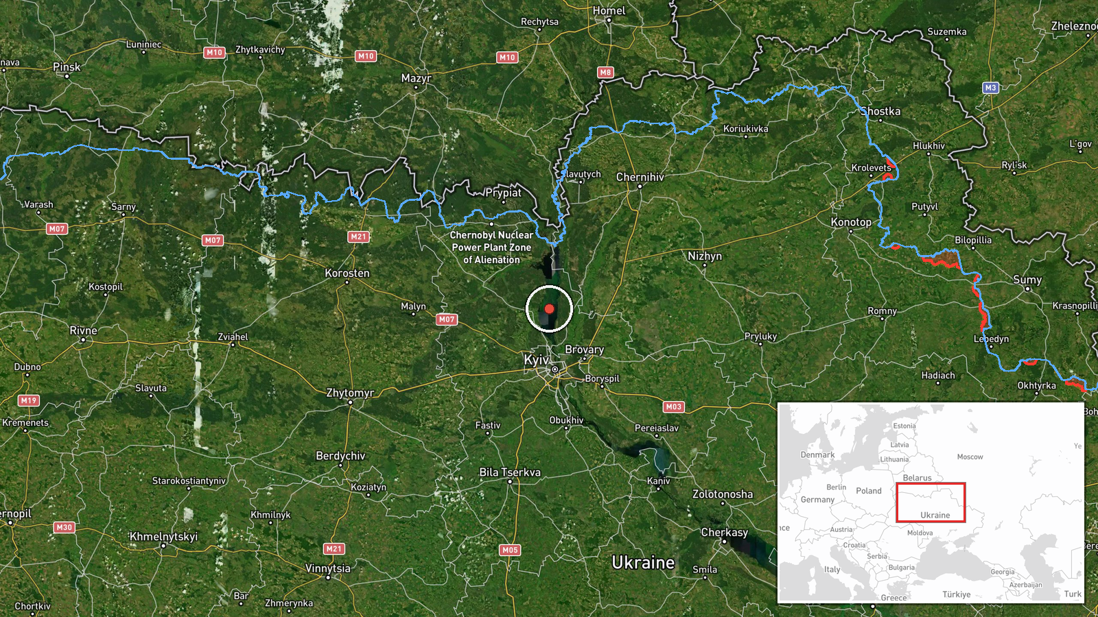
Ukrainian air monitoring reported on Telegram that one Russian jet-powered Shahed, designated Geran-3 in the report, was passing the Kyiv Reservoir on a westward heading. The alert was posted on the @kpszsu channel at 18:44 UTC on 20 October 2026. The event is recorded at settlement level for the reservoir itself rather than a precise point. The original Ukrainian wording describes a jet-powered unmanned aerial vehicle moving west past the water body, with no mention of impact, damage, casualties, or an intended target. The report is a transit notice, so it tracks the object's movement rather than confirming where it landed or detonated. It was posted by a single channel, so the account rests on that monitoring feed alone at the time of recording.
Context and assessment
The Kyiv Reservoir sits on the Dnipro north of the capital, and any object crossing its airspace is on a path that runs close to the approaches to Kyiv. This report fits a dense sequence of transit notices logged the same day. Between 02:38 and 07:04 UTC, reports described multiple Geran-3 drones moving from northern Chernihiv Oblast toward northern Kyiv Oblast and then turning south. Later, at 11:07 and 11:42, drones were reported passing the reservoir and heading toward Vyshhorod, a town just north of Kyiv on the Dnipro. Taken together, the pattern suggests drones entering from the north and moving through the Kyiv corridor over several hours rather than a single isolated flight. The shift from southbound tracks to a westward track past the reservoir may reflect rerouting, dispersal, or decoy movement, though these reports cannot establish intent. A westward heading indicates movement away from the city toward other areas, but one transit notice does not reveal a destination. The jet-powered variant is generally understood as a faster, more recent member of the Shahed family, which may make tracking windows shorter for air defence crews.
Sources and confidence
The event is drawn from one Telegram channel, @kpszsu, which is widely associated with Ukraine's Air Force monitoring output. No other outlet, official statement, or independent observer in the provided data corroborates this specific transit. The confidence score of 8.0 reflects a precise timestamp, an official-style origin, and consistency with the same-day sequence of related reports, but it is held below the top range because the claim is single-sourced and describes a transit rather than a confirmed outcome. Confidence would rise with corroboration from additional monitoring channels, regional air alerts, or later official summaries. It would fall if subsequent reporting contradicts the heading, the object type, or the timing.
Location
The location is recorded at settlement level, with coordinates near 50.8 N and 30.47 E, and location confidence is rated high. The point refers to the Kyiv Reservoir, a large artificial lake formed by a dam on the Dnipro north of Kyiv. Its shorelines are a mix of forest, villages, and recreation areas. Vyshhorod lies to the south-west of the reservoir's northern reaches, and the reservoir itself is a broad, elongated water body that is easy to identify on maps. The coordinates therefore describe a general area rather than a specific facility or point of impact.
Related events nearby
- Ukrainian air monitoring: 2+ Russian jet-powered Shahed (Geran-3) drones passing northern Kyiv Oblast, heading2026-10-20 07:04 UTC · Drone Transit · northern Kyiv Oblast, Ukraine
- Ukrainian air monitoring: 1 Russian jet-powered Shahed (Geran-3) drone from northern Chernihiv Oblast toward n2026-10-20 03:25 UTC · Drone Transit · northern Kyiv Oblast, Ukraine
- Ukrainian air monitoring: 2+ Russian jet-powered Shahed (Geran-3) drones from northern Chernihiv Oblast toward2026-10-20 02:38 UTC · Drone Transit · northern Kyiv Oblast, Ukraine
- Ukrainian air monitoring: 2+ Russian jet-powered Shahed (Geran-3) drones heading toward Vyshhorod.2026-10-20 11:42 UTC · Drone Transit · Vyshhorod, Ukraine
- Ukrainian air monitoring: 1 Russian jet-powered Shahed (Geran-3) drone passing Kyiv Reservoir, heading toward 2026-10-20 11:07 UTC · Drone Transit · Vyshhorod, Ukraine
▶ View this event on the live map

Intel Mapper aggregates open-source reports from monitored Telegram and X channels, geolocates them, cross-checks duplicates across sources and assigns a confidence score. Entries are updated as new confirmations arrive. Read how we verify events.