Jet-powered Shahed drone reported passing Vilnyansk, Zaporizhzhia Oblast, heading northwest
What happened
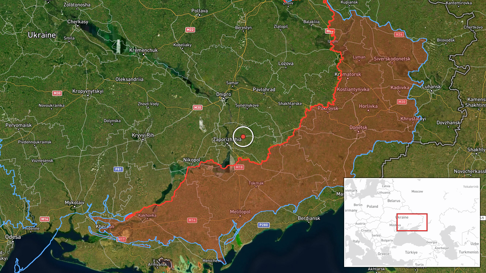
Ukrainian air monitoring channel @kpszsu reported on 21 October 2026 at 10:31 UTC that one Russian jet-powered Shahed-type drone, identified in the post as a Geran-3, was passing Vilnyansk in Zaporizhzhia Oblast and heading northwest. The original Ukrainian wording describes a jet-type unmanned aerial vehicle moving in that direction, but gives no altitude, speed, or indication of intended target. The report describes a transit rather than a strike, and the data records no damage or casualties. Attribution to Russia comes from the channel's framing of the drone. The event rests on a single-source report and carries a confidence score of 8.0.
Context and assessment
Vilnyansk sits in the Zaporizhzhia axis, where Russian long-range drones, glide bombs and tactical aviation have been active in the same window. Related entries show a Shahed-type drone passing Vilnyansk heading west on 20 October at 14:08, and a Geran-3 heading toward Zaporizhzhia city at 14:51 that day. Overnight, a guided glide bomb was logged heading toward Zaporizhzhia at 02:18 on 21 October, followed by tactical aircraft at 07:13. The General Staff also reported 20 Russian attacks on Ukrainian positions in the Huliaipole direction at 05:06. A drone that crosses the same settlement twice within about 21 hours, first westbound and then northwestbound, may indicate routing across the oblast rather than a single fixed target. Such transits can serve reconnaissance, saturation, or decoy purposes, but one transit report cannot establish intent. Read alongside the glide bomb and aircraft entries, the sequence fits a broader pattern of sustained aerial pressure on the Zaporizhzhia area.
Sources and confidence
All information comes from one Telegram channel, @kpszsu, which publishes Ukrainian air-monitoring alerts. No second outlet, official statement, or independent observer in the dataset confirms the sighting. The confidence score of 8.0 reflects the channel's specific wording, precise timestamp, and the routine nature of this type of alert, but it is not higher because no corroboration exists and the post does not report impacts. Confidence would rise with confirmation from an air force or regional military administration, radar-based reporting, or local official accounts of debris or sightings. It would fall if the channel corrected or withdrew the post, or if later reporting placed the drone elsewhere.
Location
The location is settlement-level. The coordinates place the marker at the centre of Vilnyansk, a town in Zaporizhzhia Oblast, and location confidence is recorded as high. Vilnyansk lies north-northwest of Zaporizhzhia city in open, largely agricultural steppe. The Dnipro river valley and its reservoir system lie to the west and south of the wider oblast. The terrain is flat, so low-altitude drone movement is hard to conceal from ground observers.
Related events nearby
- Ukrainian air monitoring: Russian tactical aircraft (tac. aviation) heading toward Zaporizhzhia.2026-10-21 07:13 UTC · Combat Aircraft · Zaporizhzhia, Ukraine
- Ukrainian air monitoring: 1 Russian guided glide bomb (KAB) heading toward Zaporizhzhia.2026-10-21 02:18 UTC · Airstrike · Zaporizhzhia, Ukraine
- Ukrainian air monitoring: 1 Russian jet-powered Shahed (Geran-3) drone heading toward Zaporizhzhia.2026-10-20 14:51 UTC · Drone Transit · Zaporizhzhia, Ukraine
- Ukrainian air monitoring: 1 Russian Shahed-type drone passing Komyshuvakha, heading west; 1 Russian Shahed-typ2026-10-20 14:08 UTC · Drone Transit · Komyshuvakha, Ukraine
- Ukrainian air monitoring: 2+ Russian jet-powered Shahed (Geran-3) drones over Solone.2026-10-21 11:41 UTC · Drone Transit · Solone, Ukraine
▶ View this event on the live map

Intel Mapper aggregates open-source reports from monitored Telegram and X channels, geolocates them, cross-checks duplicates across sources and assigns a confidence score. Entries are updated as new confirmations arrive. Read how we verify events.