Jet-powered Shahed drones tracked over Solone in Dnipropetrovsk Oblast amid missile activity
What happened
Ukraine's Air Force, posting on its Telegram channel (@kpszsu), reported at 11:41 UTC on 21 October 2026 that two or more Russian jet-powered Shahed (Geran-3) drones were operating over the Synelnykove and Solone area of Dnipropetrovsk Oblast. The original Ukrainian wording describes the drones as "реактивні БпЛА" (jet-powered UAVs) whose course "постійно змінюється", meaning it is constantly changing. The report is a short air-monitoring alert. It does not describe impacts, damage, or casualties, and it gives no confirmed final target. The drones were tracked in the same hours as several cruise missile warnings aimed at Dnipro.
Context and assessment
Solone sits in the Dnipropetrovsk countryside, roughly 30 km southwest of Dnipro, a major industrial and logistics city that has been a recurring target. The alert belongs to a dense sequence on 20 and 21 October. At 17:58 on 20 October a guided glide bomb was reported heading toward the oblast. At 05:59 on 21 October, two or more jet-powered Geran-3 drones were reported passing the oblast heading northwest. Between 06:08 and 10:18, multiple Banderol mini cruise missiles were reported passing Solone or heading toward Dnipro, one of them from northern Dnipropetrovsk Oblast. Taken together, the pattern suggests a coordinated mix of drone and missile routes, with Solone lying on a corridor used by several strike types. Jet-powered Shaheds are generally faster and harder to intercept than piston-engine variants, and their shifting courses may be intended to complicate air defence tracking. These are inferences from the pattern, not confirmed intent.
Sources and confidence
The event rests on one source, the Ukrainian Air Force's Telegram channel (@kpszsu), which is the official national air-monitoring feed and typically carries real-time track warnings. No second outlet, Ukrainian regional authority, or independent monitor in the provided data reports this specific drone track. The confidence score of 8.0 reflects the official origin and specific system identification, offset by the single-channel basis and the absence of impact reporting. Confidence would rise with independent corroboration such as regional military administration statements, radar-based open-source tracking, or geolocated imagery. It would fall if the Air Force later revised or withdrew the track, or if the drones were identified as a different type.
Location
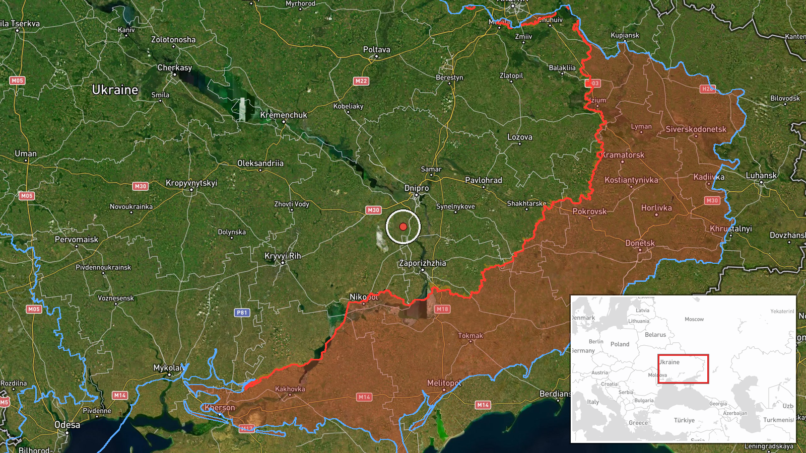
The location is a settlement-level match. The coordinates correspond to Solone, a village-scale settlement in Dnipropetrovsk Oblast, so the point is not a precise facility. The track is reported as passing over an area around Synelnykove and Solone, so the exact flight path is approximate. The area is open steppe farmland, with the Dnipro urban area to the northeast and fewer settlements to the southwest. Solone is part of the wider Synelnykove district and is reported in the data as a waypoint, not as the destination.
Related events nearby
- Ukrainian air monitoring: 2+ Russian Banderol mini cruise missiles heading toward Dnipro.2026-10-21 10:18 UTC · Cruise Missile · Dnipro, Ukraine
- Ukrainian air monitoring: 1 Russian Banderol mini cruise missile from northern Dnipropetrovsk Oblast toward Dn2026-10-21 10:13 UTC · Cruise Missile · Dnipro, Ukraine
- Ukrainian air monitoring: 2+ Russian Banderol mini cruise missiles passing Solone, heading toward Dnipro.2026-10-21 06:08 UTC · Cruise Missile · Dnipro, Ukraine
- Ukrainian air monitoring: 2+ Russian jet-powered Shahed (Geran-3) drones passing Dnipropetrovsk Oblast, headin2026-10-21 05:59 UTC · Drone Transit · Dnipropetrovsk Oblast, Ukraine
- Ukrainian air monitoring: 1 Russian guided glide bomb (KAB) heading toward Dnipropetrovsk Oblast.2026-10-20 17:58 UTC · Airstrike · Dnipropetrovsk Oblast, Ukraine
▶ View this event on the live map

Intel Mapper aggregates open-source reports from monitored Telegram and X channels, geolocates them, cross-checks duplicates across sources and assigns a confidence score. Entries are updated as new confirmations arrive. Read how we verify events.