Ukrainian air monitoring reports one drone heading toward Zaporizhzhia from the south
What happened
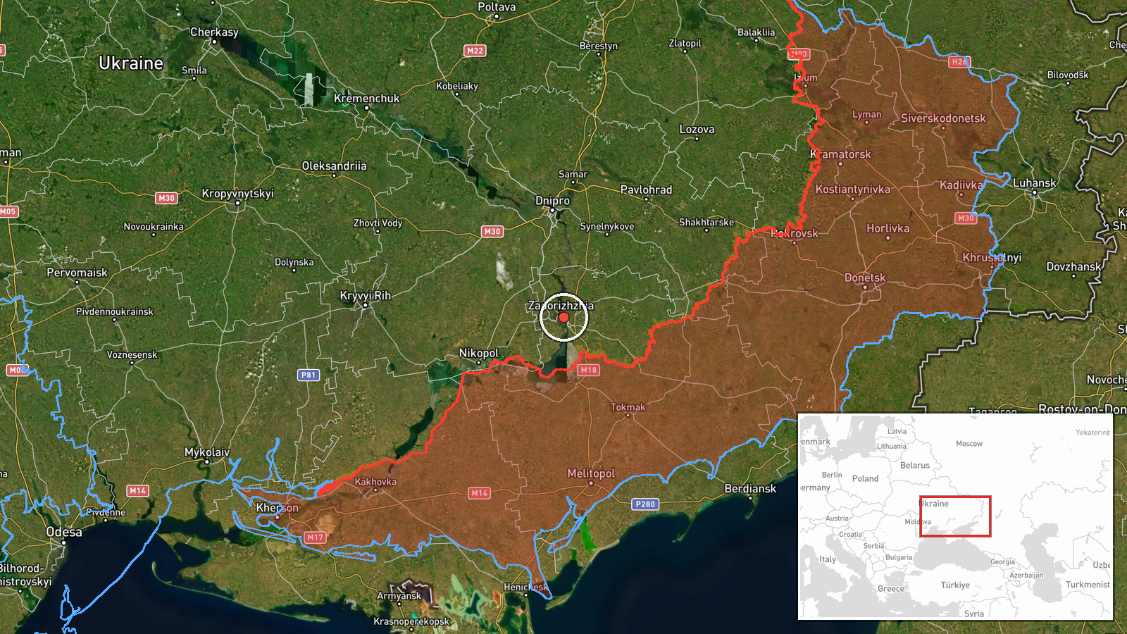
Ukrainian air monitoring reporting on the Telegram channel @kpszsu logged an alert at 13:07 UTC on 21 October 2026 stating that one unmanned aerial vehicle was heading toward Zaporizhzhia from the south. The original Ukrainian text, which translates roughly as 'UAV toward Zaporizhzhia from the south', carries a scooter emoji that the channel uses as a drone marker. The event summary classifies the object as a Russian Shahed-type drone, but the original wording names neither the model nor the operator, so that attribution rests on the channel's standard alert format and the event tagging. The record describes a transit warning rather than a confirmed strike, and no impact, damage, or casualties appear in the data provided.
Context and assessment
Zaporizhzhia has been a recurring target of air alerts in the surrounding hours. Earlier on 20 October, a Geran-3 jet-powered drone was reported heading toward the city at 14:51 UTC, and a group of two or more of the same drone type was logged the same afternoon heading toward Tomakivka, a settlement to the west. On 21 October the pattern continued with a guided glide bomb (KAB) reported heading toward Zaporizhzhia at 02:18 UTC, a Russian tactical aircraft flagged at 07:13 UTC, and a jet-powered Shahed passing Vilnyansk to the northwest at 10:31 UTC. Taken together, these reports suggest a sustained series of separate air threats moving through the Zaporizhzhia area over roughly a day, rather than a single isolated launch. Because the sequence is made up of monitoring alerts, it is more plausible to read it as evidence of persistent pressure on the city and its approaches than as a confirmed campaign with a defined target set. Monitoring alerts of this kind are also used to coordinate air-defence response, so the reports may reflect the defensive posture as much as the attacker's intent. The data does not show which of these objects, if any, reached the city.
Sources and confidence
The event rests on a single Telegram channel, @kpszsu, which is the official Ukrainian air monitoring feed, and no independent outlet has been recorded as cross-confirming it. The confidence score of 8.0 reflects the channel's institutional role and its consistent alert format, but it is held below the top of the scale because the report is single-source and does not describe the object's model or impact. Confidence would rise with corroboration from regional military administration statements, air defence reports, or verified photos or video of the object or its effects. It would fall if the alert were updated, withdrawn, or found to refer to a different track.
Location
The location is assigned at settlement level, placing the event at the centre of Zaporizhzhia city at approximately 47.84 N, 35.14 E, with high location confidence. Zaporizhzhia is a large industrial city on the left bank of the Dnipro River, with the Dnipro reservoir upstream and open steppe to the south and west. The Zaporizhzhia Nuclear Power Plant lies across the river to the south-west, near Enerhodar, roughly 50 km away. The alert gives only a direction of approach, not a precise track, so the exact target area inside the city is not specified.
Related events nearby
- Ukrainian air monitoring warns of incoming Russian strike drones threatening Zaporizhzhia city.2026-10-21 13:35 UTC · Drone Transit · Zaporizhzhia, Zaporizhzhia Oblast, Ukraine
- Ukrainian air monitoring: Russian tactical aircraft (tac. aviation) heading toward Zaporizhzhia.2026-10-21 07:13 UTC · Combat Aircraft · Zaporizhzhia, Ukraine
- Ukrainian air monitoring: 1 Russian guided glide bomb (KAB) heading toward Zaporizhzhia.2026-10-21 02:18 UTC · Airstrike · Zaporizhzhia, Ukraine
- Ukrainian air monitoring: 1 Russian jet-powered Shahed (Geran-3) drone heading toward Zaporizhzhia.2026-10-20 14:51 UTC · Drone Transit · Zaporizhzhia, Ukraine
- Ukrainian air monitoring: 1 Russian jet-powered Shahed (Geran-3) drone passing Vilnyansk, heading northwest.2026-10-21 10:31 UTC · Drone Transit · Vilnyansk, Ukraine
▶ View this event on the live map

Intel Mapper aggregates open-source reports from monitored Telegram and X channels, geolocates them, cross-checks duplicates across sources and assigns a confidence score. Entries are updated as new confirmations arrive. Read how we verify events.