Ukrainian monitoring reports jet-powered Shahed drone heading toward Dnipro
What happened
Ukrainian air monitoring reported on 21 October 2026 at 13:45 UTC that a single Russian jet-powered Shahed drone, identified as a Geran-3 type, was heading toward the city of Dnipro. The report, posted on the Telegram channel @kpszsu, described the aircraft as approaching from the south. The original Ukrainian wording reads roughly as 'Jet-powered UAV toward Dnipro from the south.' The message did not report impacts, damage, or casualties, and it did not say whether the drone was later intercepted or lost track of. The event is classified as a drone transit, meaning an aircraft seen in flight, not a confirmed strike. Attribution to Russia rests on the drone type and the channel's standard framing of such alerts.
Context and assessment
Dnipro is a large industrial and transport hub on the Dnipro River in central Ukraine, and it has been a recurring target of Russian long-range strikes. The event sits within a dense sequence of air alerts on the same day. At 05:59 UTC, two or more Geran-3 drones were reported passing Dnipropetrovsk Oblast heading northwest. At 06:08, two or more Banderol mini cruise missiles were reported passing Solone, heading toward Dnipro. A further single Banderol was reported at 10:13 from northern Dnipropetrovsk Oblast, followed at 10:18 by two or more Banderol missiles heading toward the city. The previous evening, at 17:58, a guided glide bomb was reported heading toward the oblast. Taken together, the sequence suggests a sustained, multi-axis effort against the Dnipro area using mixed aerial weapons. Jet-powered drones are generally faster than the older piston-engined Shahed variants, which can shorten warning windows for local air defence. Heading reports indicate direction of travel, not the intended aim point, so this single alert should not be read as confirmation of a specific target.
Sources and confidence
The only source is the Telegram channel @kpszsu, which is associated with the Ukrainian Air Force's air monitoring messages. No second outlet, official statement, or independent observer has reported this specific sighting in the materials provided. The confidence score of 8.0 reflects a high-reliability official channel with an established alert format, offset by the single-source status and the absence of any follow-up. Confidence would rise if a second Ukrainian authority, a regional administration, or a credible open-source tracker confirmed the track or reported an interception or impact. It would fall if later updates contradicted the heading or the drone type.
Location
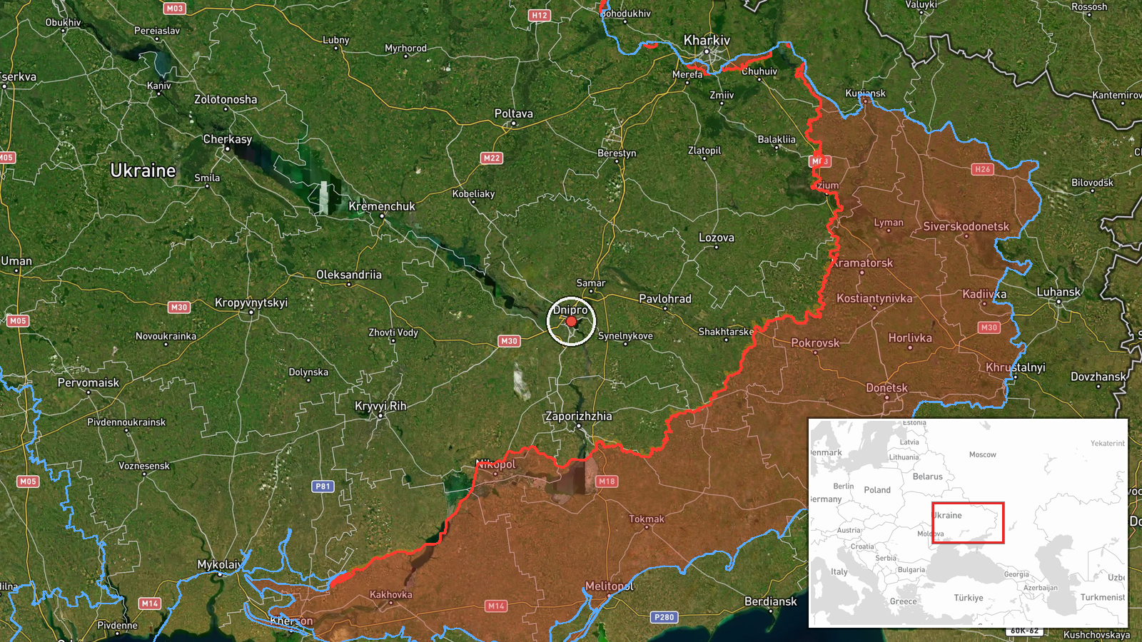
The location is recorded at settlement level for Dnipro city at approximately 48.46 N, 35.05 E, with high location confidence. This reflects the report naming the city rather than a specific facility or district. Dnipro lies in central-eastern Ukraine within Dnipropetrovsk Oblast, straddling the Dnipro River, which divides the city into left and right banks. The river and its islands are prominent features, as are the wide floodplains and the rail and road corridors that run through the urban area.
Related events nearby
- Ukrainian air monitoring: 2+ Russian Banderol mini cruise missiles heading toward Dnipro.2026-10-21 10:18 UTC · Cruise Missile · Dnipro, Ukraine
- Ukrainian air monitoring: 1 Russian Banderol mini cruise missile from northern Dnipropetrovsk Oblast toward Dn2026-10-21 10:13 UTC · Cruise Missile · Dnipro, Ukraine
- Ukrainian air monitoring: 2+ Russian Banderol mini cruise missiles passing Solone, heading toward Dnipro.2026-10-21 06:08 UTC · Cruise Missile · Dnipro, Ukraine
- Ukrainian air monitoring: 2+ Russian jet-powered Shahed (Geran-3) drones passing Dnipropetrovsk Oblast, headin2026-10-21 05:59 UTC · Drone Transit · Dnipropetrovsk Oblast, Ukraine
- Ukrainian air monitoring: 1 Russian guided glide bomb (KAB) heading toward Dnipropetrovsk Oblast.2026-10-20 17:58 UTC · Airstrike · Dnipropetrovsk Oblast, Ukraine
▶ View this event on the live map

Intel Mapper aggregates open-source reports from monitored Telegram and X channels, geolocates them, cross-checks duplicates across sources and assigns a confidence score. Entries are updated as new confirmations arrive. Read how we verify events.