Single jet-powered Geran-3 drone reported heading toward Rivne, Ukraine, per air monitoring channel
What happened
A Ukrainian air monitoring post reported on Telegram that one Russian jet-powered Shahed, designated Geran-3, was moving toward Rivne, approaching from the east. The alert was posted at 16:02 UTC on 21 October 2026. The original Ukrainian-language wording describes a jet-type unmanned aerial vehicle on a course toward Rivne from the east, a phrasing typical of routine air-alert updates rather than a confirmed impact report. The post does not state whether the drone was shot down, lost, or reached its target, and no damage, casualties, or intercept details appear in the data. The report comes from a single channel, so the detail is best read as the monitoring service's own assessment at that moment.
Context and assessment
Rivne sits in the northwest of Ukraine, a regional administrative center and a hub for road and rail links toward the Polish and Belarusian borders, which makes it a recurring point of interest in air-alert reporting. The alert is one of five Drone Transit entries for Rivne or Rivne Oblast logged on 21 October 2026, beginning at 04:58 UTC. Earlier reports described a group of at least two drones passing Zakhod, near the western border area, at 09:22, and a single drone moving from Zhytomyr Oblast toward Rivne at 12:11. The repetition suggests sustained or successive drone movement across northwestern Ukraine during the day rather than a single isolated sortie. Such patterns are commonly associated with long-range strike waves or with drones being routed through the region toward other targets. Because the data records transit alerts rather than strikes, the operational purpose of each track cannot be established from this material alone, and the sequence should be read as an indication of activity, not of intent against a specific facility.
Sources and confidence
The event rests on one Telegram channel, @kpszsu, which is the official Ukrainian air force channel and is generally treated as a primary source for air-alert information. No second independent channel is recorded for this specific entry, so cross-confirmation is absent. The confidence score of 8.0 reflects the authority of the publisher and the specificity of the report, offset by the single-source status and the lack of follow-up on outcome. Confidence would rise with corroboration from regional military administrations, local authorities in Rivne Oblast, or independent monitoring accounts, and with any later report confirming interception or impact. It would fall if subsequent official updates revised the track or if the drone type were disputed.
Location
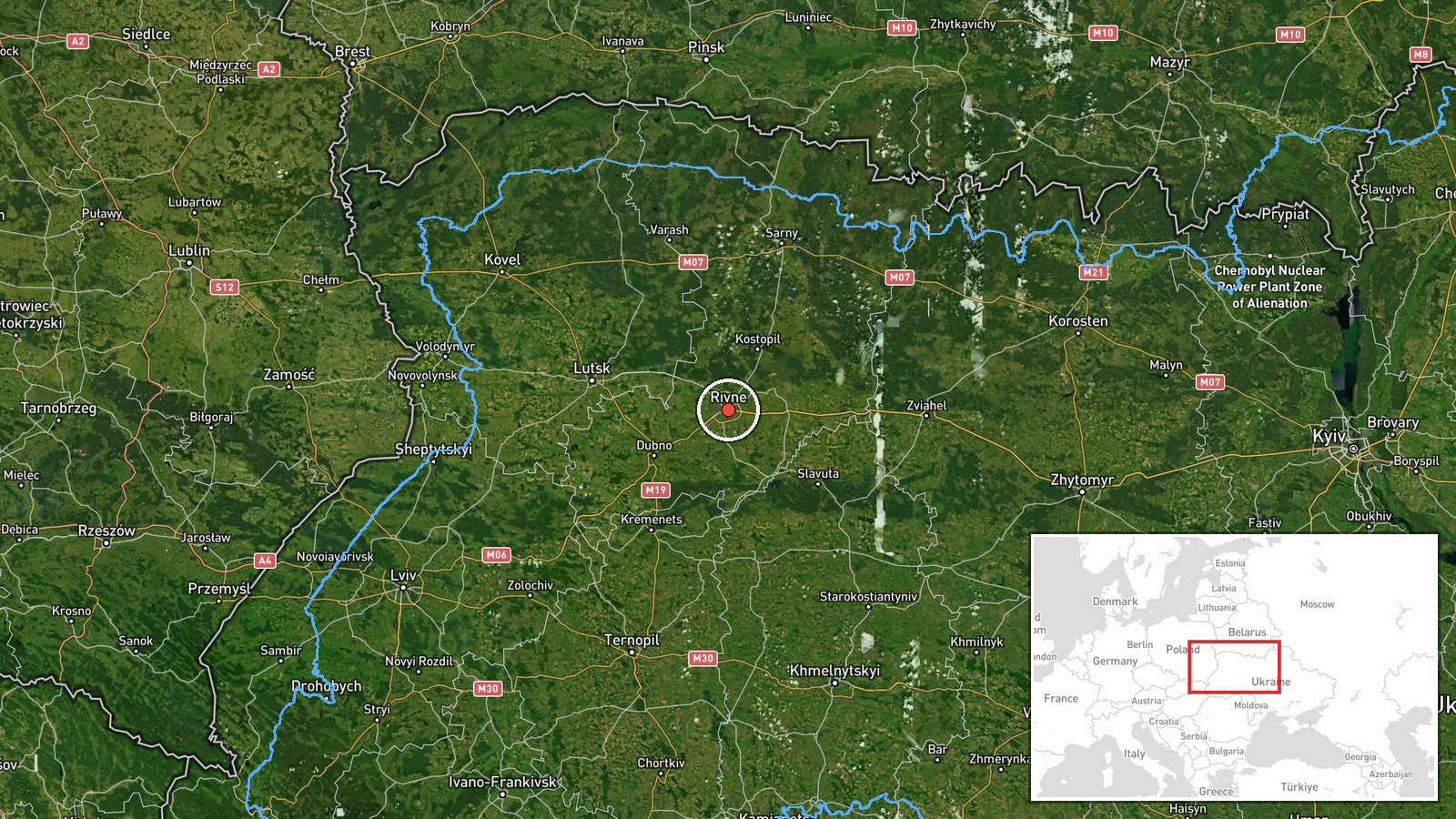
The coordinates correspond to Rivne city at settlement precision, with high location confidence, since the alert names the city directly. The point marks the urban center rather than any particular facility, so the map shows the general target area of the track. Rivne lies on relatively flat terrain in the Polissia and Volhynia region, with wetlands, forests, and river valleys to the north and west. The Horyn and Ustia river systems and the surrounding agricultural land are features of the wider area. Earlier entries on the same day place the track near Zakhod and within Rivne Oblast, so the exact approach path is less certain than the final named city.
Related events nearby
- Ukrainian air monitoring: 1 Russian jet-powered Shahed (Geran-3) drone heading toward Rivne Oblast.2026-10-21 16:36 UTC · Drone Transit · Rivne Oblast, Ukraine
- Ukrainian air monitoring: 1 Russian jet-powered Shahed (Geran-3) drone heading toward Rivne.2026-10-21 15:57 UTC · Drone Transit · Rivne, Ukraine
- Ukrainian air monitoring: 1 Russian jet-powered Shahed (Geran-3) drone heading toward Rivne.2026-10-21 15:06 UTC · Drone Transit · Rivne, Ukraine
- Ukrainian air monitoring: 1 Russian jet-powered Shahed (Geran-3) drone from Zhytomyr Oblast toward Rivne.2026-10-21 12:11 UTC · Drone Transit · Rivne, Ukraine
- Ukrainian air monitoring: 2+ Russian jet-powered Shahed (Geran-3) drones passing Zakhod, heading toward Rivne 2026-10-21 09:22 UTC · Drone Transit · Rivne Oblast, Ukraine
▶ View this event on the live map

Intel Mapper aggregates open-source reports from monitored Telegram and X channels, geolocates them, cross-checks duplicates across sources and assigns a confidence score. Entries are updated as new confirmations arrive. Read how we verify events.