Russian jet-powered Shahed reported heading toward Klembivka, southern Vinnytsia Oblast
What happened
Ukraine's Air Force air-monitoring channel on Telegram (@kpszsu) reported at 16:17 UTC on 21 October 2026 that one jet-powered Shahed, designated Geran-3 in the report, was flying from southern Vinnytsia Oblast toward the settlement of Klembivka. The original Ukrainian wording, «Реактивний БпЛА на Клембівку на півдні Вінниччини, курс на захід», describes a jet-propelled unmanned aerial vehicle heading to Klembivka in the south of Vinnytsia region on a westward course. The post does not describe any impact, casualties, or damage, and no other channel has been identified as confirming it. The alert is a transit notice, meaning it tracks a drone's movement rather than recording a strike. Attribution to Russia rests on the monitoring post's framing of Shahed-type drones, which Ukraine has long linked to Russian forces.
Context and assessment
Klembivka is a small settlement, so its significance lies less in the village itself than in the corridor it sits within. Earlier on the same day, the same channel logged at least five other Geran-3 transits across southern Vinnytsia: near Sharhorod at 02:55 UTC, toward Berezivka at 05:08, near Rudnytsia heading northwest at 07:20, toward Ladyzhyn at 13:30 and again at 15:23, before the Klembivka alert. The sequence shows repeated drone movement through the same southern belt over roughly fourteen hours, with headings shifting between northwest and west. That pattern may suggest drones being routed around air defense, following multiple axes, or simply transiting a wide area rather than heading for one target. The jet-powered variant is faster than older piston-engined Shaheds and harder to intercept, so frequent alerts of this kind may reflect both a sustained long-range campaign and the difficulty of tracking these systems. Vinnytsia lies well behind the front line, so these transits likely represent flights toward targets further west or northwest, though the data does not identify them. Operationally, the pattern is consistent with saturation or probing, but monitoring posts do not confirm intent, and transit notices do not establish where drones were aimed or whether they were intercepted.
Sources and confidence
The report comes from a single Telegram channel, @kpszsu, which carries Ukrainian Air Force air-monitoring alerts and is the only source listed for this event. The confidence score of 8.0 reflects a credible, time-stamped official-style feed, offset by the absence of cross-confirmation from a second outlet or a regional military administration. The five related transit alerts on the same day come from the same type of source, which supports the feed's reliability as a stream but does not independently verify this specific track. Confidence would rise with corroboration from regional authorities, a national Air Force statement, or reports of debris or impacts. It would fall if the channel corrected or retracted the alert or later updates contradicted the heading.
Location
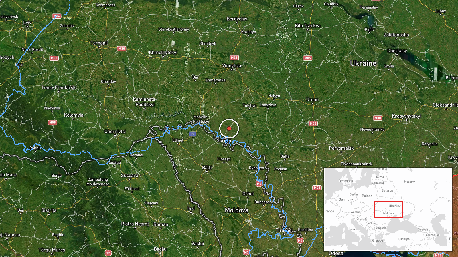
The location is a settlement-level match. The coordinates, 48.387 N and 28.410 E, correspond to Klembivka as named in the alert, and location confidence is rated high. No facility or precise track point is given. Klembivka sits in the southern part of Vinnytsia Oblast, a largely agricultural landscape of rolling Podolia upland drained by the Southern Bug and its tributaries.
Related events nearby
- Ukrainian air monitoring: one Russian jet-powered Shahed (Geran-3) drone near Rudnytsia, Vinnytsia Oblast, hea2026-10-21 07:20 UTC · Drone Transit · Rudnytsia, Ukraine
- Ukrainian air monitoring: 1 Russian jet-powered Shahed (Geran-3) drone heading toward Sharhorod.2026-10-21 02:55 UTC · Drone Transit · Sharhorod, Ukraine
- Ukrainian air monitoring: 1 Russian jet-powered Shahed (Geran-3) drone heading toward Ladyzhyn.2026-10-21 15:23 UTC · Drone Transit · Ladyzhyn, Ukraine
- Ukrainian air monitoring: 1 Russian jet-powered Shahed (Geran-3) drone heading toward Ladyzhyn.2026-10-21 13:30 UTC · Drone Transit · Ladyzhyn, Ukraine
- Ukrainian air monitoring: 1 Russian jet-powered Shahed (Geran-3) drone from Vinnytsia Oblast toward Berezivka.2026-10-21 05:08 UTC · Drone Transit · Berezivka, Ukraine
▶ View this event on the live map

Intel Mapper aggregates open-source reports from monitored Telegram and X channels, geolocates them, cross-checks duplicates across sources and assigns a confidence score. Entries are updated as new confirmations arrive. Read how we verify events.